Tuesday, November 28, 2006

Night Flight Home

After enjoying a very nice dinner at McCarthy's in Tequesta, it was time for us to fly home. I signed on to the computer, got a weather briefing and filed my instrument flight plan for an 8:30pm departure from F45 to CRG at 7000'. Knowing that my heading would be slightly West of North, the normal procedure would be to file for an even altitude as per the AIM, but having flown this route many times, I knew that ATC would assign odd altitudes to northerly flowing traffic. I didn't want to get stuck down at 5000', so rather than filing for 6000', I filed for 7000.

We loaded up and were ready to go very close to our departure time. I taxied to the runup area and contacted Palm Beach Clearance Delivery.

"Palm Beach Clearance Delivery, Skyhawk 1-4-6-3-Foxtrot, ready to copy IFR to Charlie-Romeo-Golf, holding short of runway 3-1.", I announced.

Nothing.

Oops, wrong frequency. I corrected the frequency and called again.

This time, the response came, "Who's calling clearance delivery?"

I repeated myself and was told that he didn't have anything for me. It seemed strange that he didn't have to spend too much time looking for my plan, so I told him I had filed about 45 minutes ago on line.

"Well, I can give you VFR flight following and you can contact the Miami Flight Service Station at 122.4 or 122.2 and refile with them."

I was sitting with my engine running and I'd have to file over the radio...lovely.

I changed the radio frequency to 122.4 and called, "Miami Radio, Skyhawk 1-4-6-3-Foxtrot."

A garbled crackle was my only response, so I called again. A near perfect duplicate of the original garbled crackle came through my headset.

"Great.", I thought to myself, "I've got an overcast ceiling and I can't file an IFR plan on the ground without shutting down and getting on the phone."

I tuned Palm Beach clearance again and called them up. The controller said he would call when my clearance comes up. This posed a dilemna for me since the only way it would come up would be if my original clearance magically appeared. I decided to avoid clearance delivery and file in the air with the FSS.

I verified that the Vero Beach VOR was my direct to in my GPS and I announced my departure on runway 31. At 500', I began my turn towards VRB and continued my climb towards 2000'. As I climbed, I heard a multi-engine aircraft announce their position to the north of F45 southbound descending for a full stop. I could see his lights in the distance.

I announced my departure to the north on the CTAF and the twin pilot called me, "Traffic departing North County, what's your position? Do you have your landing lights on?".

I responded, "I'm direct Vero out of 1,500 for 2,000. I think I've got your lights in sight. I'll flash mine for you." And I flashed the landing lights.

"Ok, I've got you in sight. I'll turn a little eastward and I'll pass you to the East.", the twin advised.

"Thanks. I see you passing. Have a nice evening", I said.

After this encounter, I called the Miami FSS saying "Miami Center, Skyhawk 1-4-6-3-Foxtrot".

As soon as the words were out of my mouth, I knew I called the target by the wrong name.

"This is the Miami Flight Service Station, can I help you?", announced the FSS contact.

"Sorry. That's what I meant to say. I filed an IFR plan that seems to have been lost. Can I file with you?", I humbly begged.

"Sure. What's your type of aircraft and equipment?", he asked.

We then went back and forth through the full flight plan procedure ultimately culminating with a "You're on file. If you feel like giving a PIREP, please call Flight Watch at 122.0".

I thanked the very patient controller and contacted Palm Beach Approach, "Palm Beach Approach, Skyhawk 1-4-6-3-Foxtrot, with request".

Immediately a very nice sounding lady told me that I was cleared to CRG, squawk 3734 and to climb to 7000'.

I began my climb through the overcast layer. It got a bit bumpy on the climb, but I maintained level flight throughout the climb. We broke out of the clouds around 6600' and there was a very stable layer of clouds only 400' beneath us.

A few minutes later, I was handed off to Miami Center. The center controller told me he had my clearance and I should advise when ready to copy. This seemed odd since I had received clearance from the PB controller, but considering the problems so far, I was not about to argue.

"Cleared direct MLB then Victor 3 to OMN, then V51 to CRG", he announced.

I was already direct VRB, so getting cleared beyond that made life a bit simpler. I repeated my clearance and settled in for a smooth flight.

There was almost no moon to illuminate the cloud layer that undulated below me. At times, towering cumulous clouds jutted into our path tossing the plane with surprising force. At other times, the cloud layer slowly rose in unison above our cruising altitude ever so briefly before retreating to a stable distance about 500' below us. The traffic system was alive now pointing out all traffic within 3500 feet vertically and about 10 miles horizontally. It is always fun when a controller points out traffic and I can reply, I've got him on my scope and in sight.

I tried to take a few pictures of the clouds below, but low light made them very grainy. I'll post one just to show the view...


We cruised along making about 110 knots of groundspeed with a decent headwind. True Airspeed was around 118 knots. The traffic system showed a plane 2000' below us heading in roughly the same direction at close to the same speed. He was actually several miles to the West of the airway and weaved left and right quite a bit. At one point, his altitude reported within 1500' of us. Thinking that another aircraft flying at our altitude towards the same destination might cause me some delay getting down, I decided to up the power a bit. I pushed the throttle until the engine was making 2600 RPM and readjusted the mixture. We trimmed out at 122 knots TAS and started making about 116 knots of groundspeed - give or take a knot. Through periodic gaps in the clouds I could see the aircraft below me just to the left of my course. Slowly we passed him until he disappeared from the scope altogether.

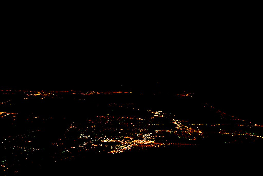
During this time, I managed to snap a photo of the lights of Orlando. There's really not much to see. The lights kind of look like lava flows to me.


With a solid layer of overcast below us, we passed over OMN. Shortly afterwards, the Daytona Approach Controller called, "November 6-3-Foxtrot, it is now clear down to 5000, you'll need to be down in about 40 miles, would you like to descend?"

I responded, "6-3-foxtrot, If it isn't a problem, I'd prefer to remain at 7000. We are in smooth air above the clouds and we still have about 65 miles to go."

"November 6-3-Foxtrot, remain at 7000 as requested", he replied.

So on we cruised in smooth air as the cloud layer below us diminished. We were almost clear of clouds when we approached St. Augustine.

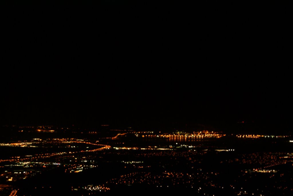
Lights of St. Augustine descending from 7000' northbound.

I called Jacksonville Approach and requested lower. The controller cleared me down to 3000' and I began my descent. During the descent, I shot a few photos of St. Augustine - It's amazing what you have time to do when you establish a nice, stable descent. Most of the shots are a bit blurry. The shutter speed had to be fairly slow to get the light, so even the slightest motion resulted in blurred images. Nevertheless, I managed to get one that wasn't totally blurry.

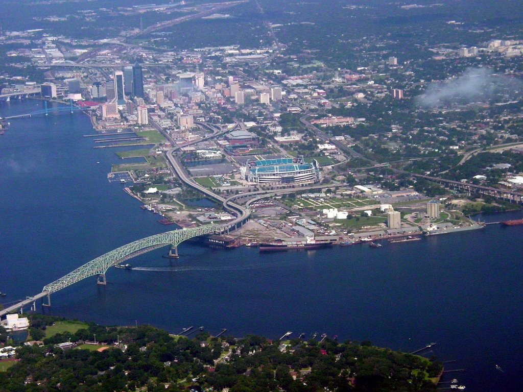
As we approached CRG, I also shot the following picture. You can see the Blount Island lights in the center of the shot as they reflect off of the St. Johns River. The curving line that comes from the bottom left then curls back again to the left is highway 9A. The line with the hump is the Dames Point Bridge.


Craig was landing VFR on runway 5 and when we were about 12 miles out, I advised ATC that I had CRG in sight. I had listened to the ATIS on the second radio and contacted the tower when Jax Approach handed me off. I was advised to make a right base for runway 5 and I set up a steady, slow descent.

Runway 5 is the closest runway to Sterling and if I could stop by the Bravo-2 taxiway, I would cut off a significant part of my taxi time. Therefore, I set up for a short field landing. Winds were calm, so I maintained 65 knots on approach with my hand on the throttle so I could gas it should a gust cause my airspeed to drop. I aimed at the numbers and pulled the power to idle. I flared above the numbers and landed just beyond them. I maintained full backpressure on the yoke and retracted the flaps as soon as I touched down. Confident that we weren't going to bounce, I applied the brakes and we slowed to a crawl in time to make the Bravo-2 cutoff.

Upon seeing me turn off, the tower advised me to taxi to the ramp and monitor ground on "point 8", which means monitor the ground control frequency on 121.8.

I acknowledged and said good night as we taxied to our parking spot. Just before shutting down, the radio announced that the tower was closed and would reopen in the morning....It was now 11PM. Our flight had taken a little over 2 hours due to the extra time on the ground monkeying around with the flight plan. I got a fair amount of instrument time in at the beginning as most of our climbout was spent in the clouds and we popped in and out for the first hour of the ride. Overall the flight was very smooth and enjoyable.

Seven years ago, we made the same trip by car...maybe for Christmas, I don't recall exactly. We had a nearly 4 hour ride to Tampa followed by a similar ride to Palm Beach Gardens and capped off by a nearly 4 hour ride from PBG to Jacksonville. At the end of that trip I remember saying I would never spend that much time on a holiday weekend fighting traffic. Having a pilot's certificate makes a huge difference. We spent much less time in transit. Our time was spent free of traffic relaxing in the air thanks to a terrific autopilot and a wonderful aircraft. Maureen even watched TV on my IPOD during the flight - something she would never dream of doing in a car.

Life is Good!

David West

Tampa North to North Palm Beach County

I had never flown this route before although I had flown out of both Tampa North and North Palm Beach County many times in the past. I have also flown to Lakeland Linder for Sun-n-Fun twice before and this airport is along the route. There is a large MOA and Lake Okeechobee to contend with, otherwise, there are many small airports on the route in case of an emergency.

I had filed an instrument flight plan the night before. After making a quick check of the weather on the route and the updated forecast, we were ready to head out. As expected, the engine started easily. I set the altimeter so that the airport's elevation appeared. With a traditional altimeter, the barometer setting is dialed in the "Kohlsman" window. I wonder what they would call the window on this new glass panel aircraft...it's just a box on a computer screen.

Anyway, the winds were light but favored runway 32, so I didn't have far to taxi. There was a skyhawk just ahead of me who announced on the CTAF that he would taxi across the runway for runup. I taxied short of the runway on the near side and angled the prop wash away from the parked aircraft. I set the radios and entered the Lakeland VOR in the GPS as a direct-to. This was my first point on my flight plan and I did not expect any problem getting a clearance once I was airborn. I quickly ran through the checklist and satisfied that all was well, I announced that I would be taking runway 32. The other Skyhawk was still completing his runup while a third airplane had just pulled from his parking spot. Looked like the morning was going to be busy.

Holding the brakes, I ran the engine to full power noting that the RPM had reached 2,400. I released the brakes and we were rolling. The speed came up quickly and I nosed her into the air adjusting my attitude to maintain 74 knots. Since there is a neighborhood in the flight path, I maintained a straight-ahead path until I reached 1000' then I made my left turns which put me on an almost direct path to LAL. I leveled off at 2000' and established a heading of 130 - direct to LAL. After engaging the autopilot and setting it to follow the NAV and maintain altitude, I contacted Tampa Approach and requested my instrument clearance to F45. Approach was busy, so he gave me a transponder code and told me to stand by while he retrieved my clearance.

The controller told me that he had my clearance and asked that I tell him when I was ready to copy. I immediately replied that I was ready.


"Cleared via radar vectors to HALLR, Hotel, alpha, lima, lima, romeo; then direct ULLMN, uniform-lima-lima-mike-november; then direct Palm Beach; then direct Foxtrot-4-5." came the clearance.

I repeated the clearance and was told to fly heading 130 and climb to 5000. I switched the autopilot to heading mode and began my climb to 5000. I also entered HALLR as a direct-to in the GPS and began to enter the rest of the plan.

We passed by the Lakeland Linder airport where I shot these photos out the window.

Prior to reaching HALLR, the controller handed me off to Miami and told me I would receive my on course clearance from the Miami controller. About 10 minutes after contacting Miami center, I asked the controller if I could get my on course clearance. The controller said that he thought the prior controller cleared me and apologized. He cleared me direct to ULLMN. I tried hard to find ULLMN on my instrument chart, but it simply wasn't there. It turns out that it REALLY isn't on the L19 chart. I don't know why. Fortunately, the GPS showed me exactly where it was - in the middle of lake Okeechobee.


I updated the GPS and adjusted my course slightly to head straight for ULLMN. I was a bit nervous about flying over the big lake. If the engine died, we would be stretching our glide distance to the limit in order to make it to shore. A forced landing in the middle of the lake would satisfy a few alligators' hunger, and surviving would be a challenge if the water was deep enough for the plane to sink. Therefore, I monitored every instrument very carefully to ensure that nothing was about to go wrong. We had clear skies ahead, so weather would not be a problem. I kept a close eye on the GPS which provided an indication of the relative wind. We were getting between 9 and 11 knots of wind from our front left quarter. Knowing this, I reasoned if we were less than 2/3rds of the way across the lake, an engine problem would result in my banking to the right immediately while pitching for 69 knots to make a 120 degree turn to put the wind behind me. This would maximize our distance covered while in best glide configuration. Fortunately, we didn't need to make use of these plans as we made it across the lake safely. I took a couple of shots of the lake, but it just looks like a bunch of blue from the middle. The shots I took as we crossed the west boundary are much more interesting - here's one:

The dark spot near the bottom of the shot is a mote on my camera lens.

Near the eastern end of the lake, ATC instructed me to descend to 3000' and cleared me direct F45. With the airport in sight, I canceled IFR and made a VFR approach to runway 31 which was being used by several other planes. I came in a bit hot and landed longer than I like to, but there would have been little point in landing short as there were no turnoffs near by.

This was a great day for flying and for seeing parts of Florida that I had not seen from the air in the past. I even got a shot of the Sebring airport where they have the 12 hour endurance race every year. Here it is:


So, that gives me another 1.6 hours of cross-country flying with a measly 0.2 hours of actual instrument time. All in all, an outstanding flight.

David West

Sunday, November 26, 2006

Thanksgiving Flying with my Nephew

Tony is my 16 year old nephew who lives in Odessa, Florida. He's an intelligent and artistic young man with great potential. He is an outstanding guitarist and a wonderful big brother to his three younger siblings.

He's flown with me before and has shown himself to be a very calm flyer.

This would be his first flight in a plane with the G1000 cockpit, so I was interested in seeing how he would interface with the new instrumentation. We started the engine and I explained a few things to him. As we were completing our pre-taxi checklist, another aircraft landed and they wanted our parking spot - it was the last one with tiedowns.

"Cessna 63-Foxtrot, are you listening?" came the call from the plane that had taxied up to the small parking area.

"Affirmative. What can I do for you?", I replied.

"If you're getting ready to leave, we'll just park back in that spot", said the local.

Apparently, I had taken his spot. I replied, "We'll get out of your way. Any advice as to where we should park when we return?"

Since the FBO was closed, parking was a free-for-all. The parking areas on the grass were all taken and all of the paved areas appeared to be taken, too. The airport is building numerous new hangars, but they had to tear down some to make room for the new - consequently, parking is at a premium, especially on Thanksgiving.

The other pilot said there was a spot beyond the fuel depot or I could park on the grass anywhere.

Tony and I took off down runway 32 and headed north out from under the Class B airspace at Tampa. I handed over the controls to Tony after explaining the HSI and the altitude read outs. I had toyed with using the reversion mode on the PFD/MFD so he would have the full instrumentation directly in front of him, but this would precluded the traffic display. There were many aircraft in the area and TPA is a busy airport, so I didn't want to take unnecessary chances.

Tony did a remarkable job of flying the plane. He maintained altitude very close to the PTS standard. He was able to turn to specific headings and to maintain level flight very well once I explained the attitude indicator.

I had him turn left to 270 and we flew until we crossed the Veteran's expressway. We were at 2300 feet, well below the Class B shelf which begins at 3000 feet. Crossing the Veteran's, we flew South until we spotted landmarks that identified his neighborhood. We then circled his home and then flew straight back to Tampa North.

As we approached Tampa North, a Comanche radioed his position and intentions and I did the same. I had him on our traffic scope and I was closer to the airport. I descended to pattern altitude and advised that I was entering the left downwind for 32, full stop. The Comanche advised that he would take position behind me...but he was coming from the southeast and I was coming from the west. I could see him coming straight at me as I was on downwind. I called out to him, "Comanche, I've got you in sight. You'll pass directly overhead." It's a good thing that I had already descended below pattern altitude or we would have been on a collision course. I'm not sure why he chose this entry - he could have made a straight-in approach and we would have been safer. Instead, he entered by flying the opposite direction in the downwind - which would have been the Right Downwind for 14, but he was landing on 32.

I suppose that I could have declared that I was going to fly a straight-in for 14 which would have saved taxi time, but with other planes in the pattern, I figured standard approaches would be best. Also, other planes had been using 32 earlier and although there was little wind, what wind there was favored 32.

After touching down, I advised the Comanche that I would taxi to the end of the runway to make room for him to land - he was right behind me in the pattern and taxiing back while he was on final would have forced him to go around. He landed and then taxiied all the way to the end, too. He could have turned around mid way down the runway, but maybe his plane couldn't turn so tightly.

With collisions and crashes averted, we taxiied very rapidly to the other end of the airport and parked in the grass beyond the gas pumps.

Tony did a great job flying - maybe one day, he'll get his certificate.

0.8 hours of sightseeing with my nephew.

David West

Thanksgiving Flying

The second flight of the long weekend took me from Jacksonville's Craig Municipal Airport (KCRG) to the Tampa North Aeropark (X39). Mom was picking us up in Tampa and I had offered flights to my neices and nephews. I told her the night before that we would be there by 10:30 am, so a 9AM wheels up time would be the order of the day.

There were three or four other planes who were leaving on instrument plans at 9AM, so clearance delivery told me that my clearance was on request and he'd give it to me in the run-up area at runway 23. He also cleared me to taxi to 23.

I ran through the checklist as I taxied. Reaching the run-up area, I found another skyhawk already there, another single coming up behind me and a Mooney coming from the opposite side of the airport. I parked as close as I could to the Cessna. The controller advised me to tell him when I was ready to copy - I immediately told him I was ready.

I was cleared via radar vectors to OCF then direct DADES then X39--Climb 2000, expect 5000 in 10 given a squawk and the departure frequency. It might come as a surprise that I had filed 5000 as my altitude since this flight was to the West, but in Florida, ATC does things a little differently when dealing with altitudes. If you are in the system - whether flying IFR or using flight following on a VFR flight, ATC looks at things from a NORTH/SOUTH perspective rather than an EAST/WEST perspective in the Florida peninsula. Since we have a long, narrow state, more flying is done north/south than east/west. Traffic separation is more easily accomplished when adjustments are made with this in mind. I've seen this quite a bit on flights down the East coast - When I flew home from North Palm Beach County, I was given 7000' and oncoming Southbound traffic was generally at 6000' or 8000' - even though my heading was North by northwest which according to the AIM should receive an even altitude.

Anyway, my takeoff clearance had me turning to 280 and I was immediately handed off to Jacksonville departure control. The controller advised me to climb to 4000' and to expect on course after 3000'. Usually, I get an on course vector after 2600 - just high enough to clear the NAS JAX airspace. This time, however, the controller was very busy and I received an on course vector when I was passing 3400'. At the same time, I was told to climb to 5000'.

Shortly after that, I was cleared direct to DADES - which was great. This shortened the distance to X39 by taking the bend out of the flight that would have taken me over OCF. It also gave me some practice with the GPS making it skip entries in the flight plan.

It was a beautiful day for flying with only occasional clouds in the distance. Every once in a while, the traffic display reported another aircraft in the vicinity, but we never had a problem. Tailwinds were in abundance with the GPS showing as high as 34 knots of a right rear quartering wind. This was giving us a ground speed in excess of 140 knots and nearly 165 knots on our descent. I was babying the plane to save fuel so I was only getting 114 knots of true airspeed and burning only 7.5 gallons per hour!

There was other traffic in the pattern at Tampa North that I discovered by monitoring the CTAF on the second radio. About 25 miles out, ATC descended me to 2000'. At 12 miles, the told me the airport was 12 o'clock, which I already knew thanks to the incredible technology I had on board...as well as the numerous prior flights I had made to this airport. ATC said I could cancel with them or with the FSS on the ground, so seeing no clouds in the area, I canceled IFR and completed the flight VFR. I overflew the airport at 1,500' and heard other aircraft landing on runway 31. This meant that I would have to land and taxi back. I made a teardrop entry and flew a tight pattern. We touched down near the numbers and I turned the plane around in the width of the narrow runway.

Parking was going to be another story. There must have been quite a few visitors in town for the holiday as I only saw one parking spot available. I pulled in front of it and then pushed back. Mom wasn't there yet, so I called and learned that she was 20 minutes away. She was bringing my 16 year old nephew, Tony, with her so he could take a flight with me.

This flight was 1.5 hours of cross-country, a very small amount of instrument time, and was about as uneventful as they come.

Tony's flight is next.

David West

Around Florida in Under 6 Hours

or...How I spent my Thanksgiving Vacation

Between Wednesday evening and Friday night, I accumulated 7.3 hours of flying time - 5.5 of that was cross-country. I encountered at least one situation that I had not encountered before and I flew in areas that I had not flown in before.

It all began Wednesday evening when I took N1463F up for a little night flying. I had previously reserved the plane from 5pm Wed through midnight Friday to give me plenty of flexibility to go to my sister's for Thanksgiving. Our plans had changed, so we decided to leave on Thursday morning. I felt bad that someone else wouldn't be using the plane, but I didn't want to take a chance on there not being adequate fuel for my flights from CRG to X39 and then to F45. Refueling would be an issue on Thanksgiving day as most places are closed and we were planning to fly from X39 to F45 first thing on Friday morning.

I filed an instrument plan for a round trip to CRG with a SGJ (St. Augustine) as a stop. The plane was not quite full of fuel, but there would be someone at Sterling to refuel until 7pm, so I should have no problems.

The weather all day at CRG was overcast with a very close temp/dewpoint spread. The engine started easily and I taxied to the departure runway after getting the ATIS and my clearance. The climb out was uneventful. I requested vectors for the ILS31 approach at St. Augustine. I listened to the ATIS at SGJ and learned that the glideslope was out of service and the ILS was unmonitored. The NOTAMs mentioned the unmonitored situation, but not the glideslope - this would have to be a localizer approach. ATC gave me vectors and cleared me for the approach - and told me about the glideslope.

I was handed off to St. Augustine tower and a very nice lady controller cleared me for the option. I had initially planned to make a low approach, but there was no traffic around and since this was night, I opted to make this one a stop and go. I flew the localizer and descended to decision height. When I was a mile out I looked up and saw the runway looming ahead of me. I touched down smoothly and braked to a halt. I then pulled the flaps, pushed the power and I was rolling again.

ATC had previously told me to fly 360 and climb to 2000 following my approach, so at 700 feet I started to make my right turn. The tower handed me back to ATC who asked my intentions at CRG. I requested the ILS32 and was told to expect the ILS 32 circle to 23.

I briefed the approach and tuned the appropriate radios, listened to the ATIS, adjusted the barometer. Since this is a G1000 panel plane, there is no turning the heading indicator to the magnetic compass which is nice - although I suspect it will create some bad habits when I fly aircraft with steam gauges.

I was cleared and handed off to Craig tower. The tower advised me to circle northeast to runway 23 and to advise of the circle. MDA for a circling is 500', so I decided that I would begin my circle at 500. I would imagine that the homes in the area don't care for that so much...but they bought houses next to a very old airport, didn't they!?

I touched down a little long and the controller told me to go all the way to Bravo-2 then taxi to the ramp - this actually saved me a bit of time as I could make an almost straight in taxi to Sterling.

This flight took exactly 1.0 hours with just a little actual instrument time at the beginning of the flight...the skies had cleared pretty quickly.

Flight #2 comes in the next post.

Saturday, November 04, 2006

Alltel Stadium


From time to time I bring my camera with me to snap aerial photos. I took this shot of Alltel Stadium on September 2, 2006. The Hart bridge is in the left foreground with Alltel Stadium in the center. Downtown Jacksonville's northbank is in the upper left. We are looking west north west from about 2000'. That's the St. Johns River.