Tuesday, November 28, 2006

Night Flight Home

After enjoying a very nice dinner at McCarthy's in Tequesta, it was time for us to fly home. I signed on to the computer, got a weather briefing and filed my instrument flight plan for an 8:30pm departure from F45 to CRG at 7000'. Knowing that my heading would be slightly West of North, the normal procedure would be to file for an even altitude as per the AIM, but having flown this route many times, I knew that ATC would assign odd altitudes to northerly flowing traffic. I didn't want to get stuck down at 5000', so rather than filing for 6000', I filed for 7000.

We loaded up and were ready to go very close to our departure time. I taxied to the runup area and contacted Palm Beach Clearance Delivery.

"Palm Beach Clearance Delivery, Skyhawk 1-4-6-3-Foxtrot, ready to copy IFR to Charlie-Romeo-Golf, holding short of runway 3-1.", I announced.

Nothing.

Oops, wrong frequency. I corrected the frequency and called again.

This time, the response came, "Who's calling clearance delivery?"

I repeated myself and was told that he didn't have anything for me. It seemed strange that he didn't have to spend too much time looking for my plan, so I told him I had filed about 45 minutes ago on line.

"Well, I can give you VFR flight following and you can contact the Miami Flight Service Station at 122.4 or 122.2 and refile with them."

I was sitting with my engine running and I'd have to file over the radio...lovely.

I changed the radio frequency to 122.4 and called, "Miami Radio, Skyhawk 1-4-6-3-Foxtrot."

A garbled crackle was my only response, so I called again. A near perfect duplicate of the original garbled crackle came through my headset.

"Great.", I thought to myself, "I've got an overcast ceiling and I can't file an IFR plan on the ground without shutting down and getting on the phone."

I tuned Palm Beach clearance again and called them up. The controller said he would call when my clearance comes up. This posed a dilemna for me since the only way it would come up would be if my original clearance magically appeared. I decided to avoid clearance delivery and file in the air with the FSS.

I verified that the Vero Beach VOR was my direct to in my GPS and I announced my departure on runway 31. At 500', I began my turn towards VRB and continued my climb towards 2000'. As I climbed, I heard a multi-engine aircraft announce their position to the north of F45 southbound descending for a full stop. I could see his lights in the distance.

I announced my departure to the north on the CTAF and the twin pilot called me, "Traffic departing North County, what's your position? Do you have your landing lights on?".

I responded, "I'm direct Vero out of 1,500 for 2,000. I think I've got your lights in sight. I'll flash mine for you." And I flashed the landing lights.

"Ok, I've got you in sight. I'll turn a little eastward and I'll pass you to the East.", the twin advised.

"Thanks. I see you passing. Have a nice evening", I said.

After this encounter, I called the Miami FSS saying "Miami Center, Skyhawk 1-4-6-3-Foxtrot".

As soon as the words were out of my mouth, I knew I called the target by the wrong name.

"This is the Miami Flight Service Station, can I help you?", announced the FSS contact.

"Sorry. That's what I meant to say. I filed an IFR plan that seems to have been lost. Can I file with you?", I humbly begged.

"Sure. What's your type of aircraft and equipment?", he asked.

We then went back and forth through the full flight plan procedure ultimately culminating with a "You're on file. If you feel like giving a PIREP, please call Flight Watch at 122.0".

I thanked the very patient controller and contacted Palm Beach Approach, "Palm Beach Approach, Skyhawk 1-4-6-3-Foxtrot, with request".

Immediately a very nice sounding lady told me that I was cleared to CRG, squawk 3734 and to climb to 7000'.

I began my climb through the overcast layer. It got a bit bumpy on the climb, but I maintained level flight throughout the climb. We broke out of the clouds around 6600' and there was a very stable layer of clouds only 400' beneath us.

A few minutes later, I was handed off to Miami Center. The center controller told me he had my clearance and I should advise when ready to copy. This seemed odd since I had received clearance from the PB controller, but considering the problems so far, I was not about to argue.

"Cleared direct MLB then Victor 3 to OMN, then V51 to CRG", he announced.

I was already direct VRB, so getting cleared beyond that made life a bit simpler. I repeated my clearance and settled in for a smooth flight.

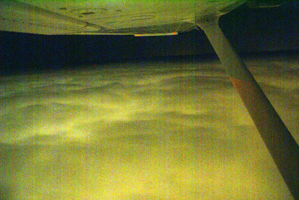
There was almost no moon to illuminate the cloud layer that undulated below me. At times, towering cumulous clouds jutted into our path tossing the plane with surprising force. At other times, the cloud layer slowly rose in unison above our cruising altitude ever so briefly before retreating to a stable distance about 500' below us. The traffic system was alive now pointing out all traffic within 3500 feet vertically and about 10 miles horizontally. It is always fun when a controller points out traffic and I can reply, I've got him on my scope and in sight.

I tried to take a few pictures of the clouds below, but low light made them very grainy. I'll post one just to show the view...

We cruised along making about 110 knots of groundspeed with a decent headwind. True Airspeed was around 118 knots. The traffic system showed a plane 2000' below us heading in roughly the same direction at close to the same speed. He was actually several miles to the West of the airway and weaved left and right quite a bit. At one point, his altitude reported within 1500' of us. Thinking that another aircraft flying at our altitude towards the same destination might cause me some delay getting down, I decided to up the power a bit. I pushed the throttle until the engine was making 2600 RPM and readjusted the mixture. We trimmed out at 122 knots TAS and started making about 116 knots of groundspeed - give or take a knot. Through periodic gaps in the clouds I could see the aircraft below me just to the left of my course. Slowly we passed him until he disappeared from the scope altogether.

During this time, I managed to snap a photo of the lights of Orlando. There's really not much to see. The lights kind of look like lava flows to me.


With a solid layer of overcast below us, we passed over OMN. Shortly afterwards, the Daytona Approach Controller called, "November 6-3-Foxtrot, it is now clear down to 5000, you'll need to be down in about 40 miles, would you like to descend?"

I responded, "6-3-foxtrot, If it isn't a problem, I'd prefer to remain at 7000. We are in smooth air above the clouds and we still have about 65 miles to go."

"November 6-3-Foxtrot, remain at 7000 as requested", he replied.

So on we cruised in smooth air as the cloud layer below us diminished. We were almost clear of clouds when we approached St. Augustine.
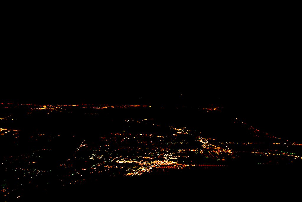
Lights of St. Augustine descending from 7000' northbound.

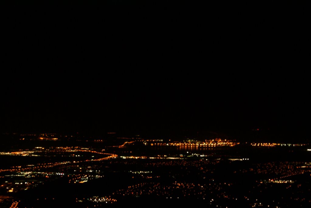
I called Jacksonville Approach and requested lower. The controller cleared me down to 3000' and I began my descent. During the descent, I shot a few photos of St. Augustine - It's amazing what you have time to do when you establish a nice, stable descent. Most of the shots are a bit blurry. The shutter speed had to be fairly slow to get the light, so even the slightest motion resulted in blurred images. Nevertheless, I managed to get one that wasn't totally blurry.

As we approached CRG, I also shot the following picture. You can see the Blount Island lights in the center of the shot as they reflect off of the St. Johns River. The curving line that comes from the bottom left then curls back again to the left is highway 9A. The line with the hump is the Dames Point Bridge.

Craig was landing VFR on runway 5 and when we were about 12 miles out, I advised ATC that I had CRG in sight. I had listened to the ATIS on the second radio and contacted the tower when Jax Approach handed me off. I was advised to make a right base for runway 5 and I set up a steady, slow descent.

Runway 5 is the closest runway to Sterling and if I could stop by the Bravo-2 taxiway, I would cut off a significant part of my taxi time. Therefore, I set up for a short field landing. Winds were calm, so I maintained 65 knots on approach with my hand on the throttle so I could gas it should a gust cause my airspeed to drop. I aimed at the numbers and pulled the power to idle. I flared above the numbers and landed just beyond them. I maintained full backpressure on the yoke and retracted the flaps as soon as I touched down. Confident that we weren't going to bounce, I applied the brakes and we slowed to a crawl in time to make the Bravo-2 cutoff.

Upon seeing me turn off, the tower advised me to taxi to the ramp and monitor ground on "point 8", which means monitor the ground control frequency on 121.8.

I acknowledged and said good night as we taxied to our parking spot. Just before shutting down, the radio announced that the tower was closed and would reopen in the morning....It was now 11PM. Our flight had taken a little over 2 hours due to the extra time on the ground monkeying around with the flight plan. I got a fair amount of instrument time in at the beginning as most of our climbout was spent in the clouds and we popped in and out for the first hour of the ride. Overall the flight was very smooth and enjoyable.

Seven years ago, we made the same trip by car...maybe for Christmas, I don't recall exactly. We had a nearly 4 hour ride to Tampa followed by a similar ride to Palm Beach Gardens and capped off by a nearly 4 hour ride from PBG to Jacksonville. At the end of that trip I remember saying I would never spend that much time on a holiday weekend fighting traffic. Having a pilot's certificate makes a huge difference. We spent much less time in transit. Our time was spent free of traffic relaxing in the air thanks to a terrific autopilot and a wonderful aircraft. Maureen even watched TV on my IPOD during the flight - something she would never dream of doing in a car.

Life is Good!

David West

Tampa North to North Palm Beach County

I had never flown this route before although I had flown out of both Tampa North and North Palm Beach County many times in the past. I have also flown to Lakeland Linder for Sun-n-Fun twice before and this airport is along the route. There is a large MOA and Lake Okeechobee to contend with, otherwise, there are many small airports on the route in case of an emergency.

I had filed an instrument flight plan the night before. After making a quick check of the weather on the route and the updated forecast, we were ready to head out. As expected, the engine started easily. I set the altimeter so that the airport's elevation appeared. With a traditional altimeter, the barometer setting is dialed in the "Kohlsman" window. I wonder what they would call the window on this new glass panel aircraft...it's just a box on a computer screen.

Anyway, the winds were light but favored runway 32, so I didn't have far to taxi. There was a skyhawk just ahead of me who announced on the CTAF that he would taxi across the runway for runup. I taxied short of the runway on the near side and angled the prop wash away from the parked aircraft. I set the radios and entered the Lakeland VOR in the GPS as a direct-to. This was my first point on my flight plan and I did not expect any problem getting a clearance once I was airborn. I quickly ran through the checklist and satisfied that all was well, I announced that I would be taking runway 32. The other Skyhawk was still completing his runup while a third airplane had just pulled from his parking spot. Looked like the morning was going to be busy.

Holding the brakes, I ran the engine to full power noting that the RPM had reached 2,400. I released the brakes and we were rolling. The speed came up quickly and I nosed her into the air adjusting my attitude to maintain 74 knots. Since there is a neighborhood in the flight path, I maintained a straight-ahead path until I reached 1000' then I made my left turns which put me on an almost direct path to LAL. I leveled off at 2000' and established a heading of 130 - direct to LAL. After engaging the autopilot and setting it to follow the NAV and maintain altitude, I contacted Tampa Approach and requested my instrument clearance to F45. Approach was busy, so he gave me a transponder code and told me to stand by while he retrieved my clearance.

The controller told me that he had my clearance and asked that I tell him when I was ready to copy. I immediately replied that I was ready.


"Cleared via radar vectors to HALLR, Hotel, alpha, lima, lima, romeo; then direct ULLMN, uniform-lima-lima-mike-november; then direct Palm Beach; then direct Foxtrot-4-5." came the clearance.

I repeated the clearance and was told to fly heading 130 and climb to 5000. I switched the autopilot to heading mode and began my climb to 5000. I also entered HALLR as a direct-to in the GPS and began to enter the rest of the plan.

We passed by the Lakeland Linder airport where I shot these photos out the window.

Prior to reaching HALLR, the controller handed me off to Miami and told me I would receive my on course clearance from the Miami controller. About 10 minutes after contacting Miami center, I asked the controller if I could get my on course clearance. The controller said that he thought the prior controller cleared me and apologized. He cleared me direct to ULLMN. I tried hard to find ULLMN on my instrument chart, but it simply wasn't there. It turns out that it REALLY isn't on the L19 chart. I don't know why. Fortunately, the GPS showed me exactly where it was - in the middle of lake Okeechobee.


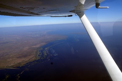
I updated the GPS and adjusted my course slightly to head straight for ULLMN. I was a bit nervous about flying over the big lake. If the engine died, we would be stretching our glide distance to the limit in order to make it to shore. A forced landing in the middle of the lake would satisfy a few alligators' hunger, and surviving would be a challenge if the water was deep enough for the plane to sink. Therefore, I monitored every instrument very carefully to ensure that nothing was about to go wrong. We had clear skies ahead, so weather would not be a problem. I kept a close eye on the GPS which provided an indication of the relative wind. We were getting between 9 and 11 knots of wind from our front left quarter. Knowing this, I reasoned if we were less than 2/3rds of the way across the lake, an engine problem would result in my banking to the right immediately while pitching for 69 knots to make a 120 degree turn to put the wind behind me. This would maximize our distance covered while in best glide configuration. Fortunately, we didn't need to make use of these plans as we made it across the lake safely. I took a couple of shots of the lake, but it just looks like a bunch of blue from the middle. The shots I took as we crossed the west boundary are much more interesting - here's one:

The dark spot near the bottom of the shot is a mote on my camera lens.

Near the eastern end of the lake, ATC instructed me to descend to 3000' and cleared me direct F45. With the airport in sight, I canceled IFR and made a VFR approach to runway 31 which was being used by several other planes. I came in a bit hot and landed longer than I like to, but there would have been little point in landing short as there were no turnoffs near by.

This was a great day for flying and for seeing parts of Florida that I had not seen from the air in the past. I even got a shot of the Sebring airport where they have the 12 hour endurance race every year. Here it is:


So, that gives me another 1.6 hours of cross-country flying with a measly 0.2 hours of actual instrument time. All in all, an outstanding flight.

David West

Sunday, November 26, 2006

Thanksgiving Flying with my Nephew

Tony is my 16 year old nephew who lives in Odessa, Florida. He's an intelligent and artistic young man with great potential. He is an outstanding guitarist and a wonderful big brother to his three younger siblings.

He's flown with me before and has shown himself to be a very calm flyer.

This would be his first flight in a plane with the G1000 cockpit, so I was interested in seeing how he would interface with the new instrumentation. We started the engine and I explained a few things to him. As we were completing our pre-taxi checklist, another aircraft landed and they wanted our parking spot - it was the last one with tiedowns.

"Cessna 63-Foxtrot, are you listening?" came the call from the plane that had taxied up to the small parking area.

"Affirmative. What can I do for you?", I replied.

"If you're getting ready to leave, we'll just park back in that spot", said the local.

Apparently, I had taken his spot. I replied, "We'll get out of your way. Any advice as to where we should park when we return?"

Since the FBO was closed, parking was a free-for-all. The parking areas on the grass were all taken and all of the paved areas appeared to be taken, too. The airport is building numerous new hangars, but they had to tear down some to make room for the new - consequently, parking is at a premium, especially on Thanksgiving.

The other pilot said there was a spot beyond the fuel depot or I could park on the grass anywhere.

Tony and I took off down runway 32 and headed north out from under the Class B airspace at Tampa. I handed over the controls to Tony after explaining the HSI and the altitude read outs. I had toyed with using the reversion mode on the PFD/MFD so he would have the full instrumentation directly in front of him, but this would precluded the traffic display. There were many aircraft in the area and TPA is a busy airport, so I didn't want to take unnecessary chances.

Tony did a remarkable job of flying the plane. He maintained altitude very close to the PTS standard. He was able to turn to specific headings and to maintain level flight very well once I explained the attitude indicator.

I had him turn left to 270 and we flew until we crossed the Veteran's expressway. We were at 2300 feet, well below the Class B shelf which begins at 3000 feet. Crossing the Veteran's, we flew South until we spotted landmarks that identified his neighborhood. We then circled his home and then flew straight back to Tampa North.

As we approached Tampa North, a Comanche radioed his position and intentions and I did the same. I had him on our traffic scope and I was closer to the airport. I descended to pattern altitude and advised that I was entering the left downwind for 32, full stop. The Comanche advised that he would take position behind me...but he was coming from the southeast and I was coming from the west. I could see him coming straight at me as I was on downwind. I called out to him, "Comanche, I've got you in sight. You'll pass directly overhead." It's a good thing that I had already descended below pattern altitude or we would have been on a collision course. I'm not sure why he chose this entry - he could have made a straight-in approach and we would have been safer. Instead, he entered by flying the opposite direction in the downwind - which would have been the Right Downwind for 14, but he was landing on 32.

I suppose that I could have declared that I was going to fly a straight-in for 14 which would have saved taxi time, but with other planes in the pattern, I figured standard approaches would be best. Also, other planes had been using 32 earlier and although there was little wind, what wind there was favored 32.

After touching down, I advised the Comanche that I would taxi to the end of the runway to make room for him to land - he was right behind me in the pattern and taxiing back while he was on final would have forced him to go around. He landed and then taxiied all the way to the end, too. He could have turned around mid way down the runway, but maybe his plane couldn't turn so tightly.

With collisions and crashes averted, we taxiied very rapidly to the other end of the airport and parked in the grass beyond the gas pumps.

Tony did a great job flying - maybe one day, he'll get his certificate.

0.8 hours of sightseeing with my nephew.

David West

Thanksgiving Flying

The second flight of the long weekend took me from Jacksonville's Craig Municipal Airport (KCRG) to the Tampa North Aeropark (X39). Mom was picking us up in Tampa and I had offered flights to my neices and nephews. I told her the night before that we would be there by 10:30 am, so a 9AM wheels up time would be the order of the day.

There were three or four other planes who were leaving on instrument plans at 9AM, so clearance delivery told me that my clearance was on request and he'd give it to me in the run-up area at runway 23. He also cleared me to taxi to 23.

I ran through the checklist as I taxied. Reaching the run-up area, I found another skyhawk already there, another single coming up behind me and a Mooney coming from the opposite side of the airport. I parked as close as I could to the Cessna. The controller advised me to tell him when I was ready to copy - I immediately told him I was ready.

I was cleared via radar vectors to OCF then direct DADES then X39--Climb 2000, expect 5000 in 10 given a squawk and the departure frequency. It might come as a surprise that I had filed 5000 as my altitude since this flight was to the West, but in Florida, ATC does things a little differently when dealing with altitudes. If you are in the system - whether flying IFR or using flight following on a VFR flight, ATC looks at things from a NORTH/SOUTH perspective rather than an EAST/WEST perspective in the Florida peninsula. Since we have a long, narrow state, more flying is done north/south than east/west. Traffic separation is more easily accomplished when adjustments are made with this in mind. I've seen this quite a bit on flights down the East coast - When I flew home from North Palm Beach County, I was given 7000' and oncoming Southbound traffic was generally at 6000' or 8000' - even though my heading was North by northwest which according to the AIM should receive an even altitude.

Anyway, my takeoff clearance had me turning to 280 and I was immediately handed off to Jacksonville departure control. The controller advised me to climb to 4000' and to expect on course after 3000'. Usually, I get an on course vector after 2600 - just high enough to clear the NAS JAX airspace. This time, however, the controller was very busy and I received an on course vector when I was passing 3400'. At the same time, I was told to climb to 5000'.

Shortly after that, I was cleared direct to DADES - which was great. This shortened the distance to X39 by taking the bend out of the flight that would have taken me over OCF. It also gave me some practice with the GPS making it skip entries in the flight plan.

It was a beautiful day for flying with only occasional clouds in the distance. Every once in a while, the traffic display reported another aircraft in the vicinity, but we never had a problem. Tailwinds were in abundance with the GPS showing as high as 34 knots of a right rear quartering wind. This was giving us a ground speed in excess of 140 knots and nearly 165 knots on our descent. I was babying the plane to save fuel so I was only getting 114 knots of true airspeed and burning only 7.5 gallons per hour!

There was other traffic in the pattern at Tampa North that I discovered by monitoring the CTAF on the second radio. About 25 miles out, ATC descended me to 2000'. At 12 miles, the told me the airport was 12 o'clock, which I already knew thanks to the incredible technology I had on board...as well as the numerous prior flights I had made to this airport. ATC said I could cancel with them or with the FSS on the ground, so seeing no clouds in the area, I canceled IFR and completed the flight VFR. I overflew the airport at 1,500' and heard other aircraft landing on runway 31. This meant that I would have to land and taxi back. I made a teardrop entry and flew a tight pattern. We touched down near the numbers and I turned the plane around in the width of the narrow runway.

Parking was going to be another story. There must have been quite a few visitors in town for the holiday as I only saw one parking spot available. I pulled in front of it and then pushed back. Mom wasn't there yet, so I called and learned that she was 20 minutes away. She was bringing my 16 year old nephew, Tony, with her so he could take a flight with me.

This flight was 1.5 hours of cross-country, a very small amount of instrument time, and was about as uneventful as they come.

Tony's flight is next.

David West

Around Florida in Under 6 Hours

or...How I spent my Thanksgiving Vacation

Between Wednesday evening and Friday night, I accumulated 7.3 hours of flying time - 5.5 of that was cross-country. I encountered at least one situation that I had not encountered before and I flew in areas that I had not flown in before.

It all began Wednesday evening when I took N1463F up for a little night flying. I had previously reserved the plane from 5pm Wed through midnight Friday to give me plenty of flexibility to go to my sister's for Thanksgiving. Our plans had changed, so we decided to leave on Thursday morning. I felt bad that someone else wouldn't be using the plane, but I didn't want to take a chance on there not being adequate fuel for my flights from CRG to X39 and then to F45. Refueling would be an issue on Thanksgiving day as most places are closed and we were planning to fly from X39 to F45 first thing on Friday morning.

I filed an instrument plan for a round trip to CRG with a SGJ (St. Augustine) as a stop. The plane was not quite full of fuel, but there would be someone at Sterling to refuel until 7pm, so I should have no problems.

The weather all day at CRG was overcast with a very close temp/dewpoint spread. The engine started easily and I taxied to the departure runway after getting the ATIS and my clearance. The climb out was uneventful. I requested vectors for the ILS31 approach at St. Augustine. I listened to the ATIS at SGJ and learned that the glideslope was out of service and the ILS was unmonitored. The NOTAMs mentioned the unmonitored situation, but not the glideslope - this would have to be a localizer approach. ATC gave me vectors and cleared me for the approach - and told me about the glideslope.

I was handed off to St. Augustine tower and a very nice lady controller cleared me for the option. I had initially planned to make a low approach, but there was no traffic around and since this was night, I opted to make this one a stop and go. I flew the localizer and descended to decision height. When I was a mile out I looked up and saw the runway looming ahead of me. I touched down smoothly and braked to a halt. I then pulled the flaps, pushed the power and I was rolling again.

ATC had previously told me to fly 360 and climb to 2000 following my approach, so at 700 feet I started to make my right turn. The tower handed me back to ATC who asked my intentions at CRG. I requested the ILS32 and was told to expect the ILS 32 circle to 23.

I briefed the approach and tuned the appropriate radios, listened to the ATIS, adjusted the barometer. Since this is a G1000 panel plane, there is no turning the heading indicator to the magnetic compass which is nice - although I suspect it will create some bad habits when I fly aircraft with steam gauges.

I was cleared and handed off to Craig tower. The tower advised me to circle northeast to runway 23 and to advise of the circle. MDA for a circling is 500', so I decided that I would begin my circle at 500. I would imagine that the homes in the area don't care for that so much...but they bought houses next to a very old airport, didn't they!?

I touched down a little long and the controller told me to go all the way to Bravo-2 then taxi to the ramp - this actually saved me a bit of time as I could make an almost straight in taxi to Sterling.

This flight took exactly 1.0 hours with just a little actual instrument time at the beginning of the flight...the skies had cleared pretty quickly.

Flight #2 comes in the next post.

Saturday, November 04, 2006

Alltel Stadium


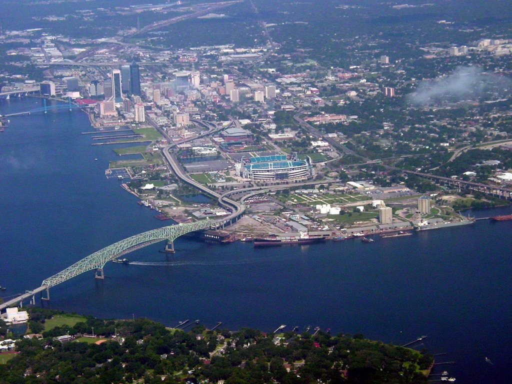
From time to time I bring my camera with me to snap aerial photos. I took this shot of Alltel Stadium on September 2, 2006. The Hart bridge is in the left foreground with Alltel Stadium in the center. Downtown Jacksonville's northbank is in the upper left. We are looking west north west from about 2000'. That's the St. Johns River.

Monday, October 30, 2006

Vegas at Night

I took this shot as we flew from the East towards the Stratosphere. Kind of hard to fly the plane AND take pictures, so the blurriness is to be expected. You can see the Wynn on the far right and the single bright light on the far left is on top of the Luxor pyramid. In between you've got Caesars, The Venetian, Bally's, Bellagio, Monte Carlo, Paris, New York New York, Excalibur and many others. What a great city!

Night flight over Las Vegas

Daylight faded quickly into neon as the sun fell behind the mountains to the west of Las Vegas. Having completed my checkout with the local instructor, I ran through a quick pre-flight of N975TA, a four year old Cessna Skyhawk with about 1400 hours on the clock.

Cessna outfitted this aircraft with the NAVII option - dual nav/coms with a glideslope on the nav 1 and the Garmin 430/530 moving map GPS system. A two axis autopilot rounded out the equipment.

Remembering the instructor's words about flooding this particular plane, I tried unsuccessfully to start the engine without using the priming procedure. Mixture at ICO, throttle at 1/2 (which seems a bit aggressive to me), I turned the key to start. After about two blades, the engine caught and I pushed the mixture, but the engine didn't start. I tried several more times with a variety of throttle and mixture positions. Finally, I pushed the throttle to full, mixture at ICO and tried again. This time the engine caught, revved quickly and I increased the mixture. With RPMs ridiculously high, I pulled the throttle back to idle and things came back to some semblance of order.

I asked Matt to be my flight crew - navigator and handed him the Las Vegas sectional. I tuned the ATIS and got the numbers.

Contacting North Vegas ground, I called, "North Vegas ground, Skyhawk niner seven five tango alpha at west air with uniform, VFR to Hoover Dam and Grand Canyon at five thousand five hundred feet."

The controller replied, "Skyhawk niner seven five tango alpha, squawk 4251, taxi to and hold short of runway 7."

I read back the instructions and the controller told me the readback was correct.

As we started our taxi, ground advised that there was a Baron that would be passing on my right and I should keep an eye out. I asked if he would like me to stay put - but he said I should see the baron momentarily off to my right.

The Baron approache the runup area ahead of me, but he parked right in the middle and did not angle his propwash away from the rest of the area...brilliant. I pulled up to his right and ran through the runup checklist. I then flipped on my strobes, nav lights and taxi lights and after checking to see that the Baron was staying put, I pulled forward to the hold short on taxiway golf short of 7.

I switched the radio to the tower frequency and called, "North Vegas Tower, skyhawk niner seven five tango alpha, on golf holding short of 7."

Immediately, the tower called, "five tango alpha, cross runway seven and hold short of runway one two. Number three for departure."

I repeated the call and did as I was told.

The plane on the runway departed and the number two plane was cleared to position and hold. Shortly, he was cleared, but we had to wait for an arriving aircraft who landed long. This plane was told to taxi back on runway 12 - "Hey, we're waiting here!" I thought to myself. Finally, I was cleared for departure and assigned a heading of 220 on the climbout.

Lights, Camera, Action, Showtime - Landing lights on, transponder to ALT, off we go - time 6pm.

The sun set about 5 minutes before our departure, but Las Vegas was lit! We climbed out and I made my turn to 220. The tower quickly handed me off to Las Vegas departure. As soon as I switched to the new frequency, I heard, "Skyhawk niner seven five tango alpha, Las Vegas Departure, you up?"

Wow! that was quick. Usually, I have to switch, then wait for a break and then make my call. These guys are good.

I replied, "Approach, five tango alpha is through three thousand two hundred for five thousand five hundred".

The controller then told me to identify and I complied.

ATC then announced contact and asked me what route I wanted to the dam and the canyon. I replied that I had never flown in this area and would be happy with whatever he chose to assign to me.

He immediately told me to turn left to 080 and expedite a climb to five thousand six hundred. He cleared me through the Bravo airspace. I repeated the instructions and said I would give her everything she's got. I pitched for Vy (74 knots) and made my turn.

Our course put us right along the Las Vegas strip. I was busy flying the plane, but I'm sure that Matt had a great view of the sights below.

We leveled off at 5,600. As we traversed the bravo airspace, we received quite a few traffic calls and could see the planes loaded with gamblers. As we headed east, it became clear that we wouldn't be able to see much of the canyon in the dark.

Just prior to clearing the class bravo airspace, the tower told us we were clear, squawk VFR and fly a normal VFR altitude. I repeated the instruction, advised that I would descend to 5,500 feet and thanked the controller for the nice tour.

I plugged in the CROWE intersection into the GPS. This was the second point on my plan -we were already nearing the MEADS intersection and were high enough that the peaks below would not be a concern. As we got closer to CROWE, we really couldn't see much of anything. There was a small airport below according to the chart, but we could only see a few lights. Ahead in the distance I could see a few other lights in the area where the Grand Canyon West airport was situated - but I saw no beacon. I could make out the shapes of the mountains below and ahead of us, but they were only shadows.

I got the feeling that Matt was becoming nervous and since it was clear that we wouldn't be able to see a thing, I started thinking about turning back. I started to think about landing at an unfamiliar airport at night in the mountains - when I've never flown in the mountains. I had a choice to make - would I like to do my gambling in the air, or on the ground? Being a conservative pilot, I told Matt that we would turn around, but I wanted to check the chart to determine the height of the mountains near us, just in case a mountain would be too close to our turning path. With our flashlights and the overhead light glowing, we determined that we could turn above the nearby airport without any trouble and I made a leisurely right turn.

I turned back to the CROWE intersection and listened to the ATIS. I then called Las Vegas approach and advised that we were over CROWE at 5,500 with victor at north vegas and would like vectors for a full stop at north vegas. The controller gave me a squawk and advised me to ident when I tuned the squawk. Before I could punch in the squawk, the transponder reset to 1200...don't know why that happened. Finally I had the code input and I idented. ATC announced my position as 4 miles west of CROWE - cleared through the class bravo, fly heading 270.

We received several other vectors to avoid traffic and the lights of Las Vegas grew closer. We were advised to descend to 4,200 feet - and I double checked the mountain tops on the chart. As we passed our last mountain, Matt told me to look back if I could - I'm sure the mountain looked closer than it really was, but the vegas lights sure made it look imposing - good thing we were already past it. ATC vectored me directly to the Stratosphere tower, but it was impossible to make it out from the clutter below. The controller asked me if I could see the tower and I reluctantly admitted that I could not see it amoungst all the other lights. He told me to continue my course.

As we got closer to the strip, I finally could determine which building was the stratosphere - and I told the tower I had it in sight. He told me to fly directly to it and to descend to 3,500. There was the famous Las Vegas Strip out our left window. What a great sight. I managed to snap a few shots as we got closer - only one is usable - too much shaking with a slow shutter speed.

As we passed directly over the tower, ATC told me to turn right to 320 and advise when the north vegas airport was in sight. About 7 miles out, I spotted the airport and was about to tell ATC, when the controller asked me if I had North Vegas in sight. When I said that I did, he told me to contact the North Vegas tower and the handoff was complete.

North Vegas told us to enter a right downwind for runway seven. We were number two behind another aircraft who appeared to be wandering west of the airport. The tower questioned the other plane and made him verify that he was lining up on seven and not one-two. We saw the other plane and made our turns, but by following him, we were not exactly lined up properly - good thing we extended our downwind. We were cleared to land and touched down smoothly. I followed the other aircraft on the ground as he requested a progressive taxi to the terminal. Since I remembered that our hangar was right below the control tower, I looked for the fuel depot, found it, and with ground's permission, taxied to the hanger.

This was an exciting flight for me and Matt seemed to enjoy himself, too. It was good having a co-pilot, even if he isn't technically a pilot. Having some help with the charts takes some of the burden away from the pilot. I love flying at night, but usually my flights are in Florida where the world is flat and the coastline makes a nice line to follow. Flying in the mountains was a new experience for me. I'm looking forward to going back to 'Vegas and repeating the journey in daylight hours. Most of my tower flying is done in class C and D airspace. In fact, it is a rare situation that causes me to enter the Tampa or Orlando Class B airspace. Flying in the Las Vegas bravo was a real treat. The controllers are extremely professional and always polite. Even though I heard some other pilots blunder, the controllers never reacted in any way other than with strict professionalism. The controllers at CRG could learn a few things here. So there it was, new city, 'Vegas, night, class B - truly a special flight.

1.3 hours of night flight with 1 night landing. David West

Saturday, October 28, 2006

Vegas Baby!

I had to go to Las Vegas this week for a company-sponsored convention, Better Management Live. Since I knew I'd be arriving in town around 1pm, I made arrangements with West Air Aviation at the North Las Vegas Airport for a check ride and a rental of a 2002 Cessna 172SP.

The earliest that I could get the check out was at 4pm and they told me I would need to do a 2 hour checkout. Nevertheless, I planned to fly to the West Grand Canyon airport (1G4).

Don Ford was assigned as my instructor. He's a young guy from upstate New York. He took a quick look at my logbook and I told him about the planes that I've been flying. Since I fly nearly every weekend, he wasn't too concerned about my skills and he didn't ask me any questions about the FARs and such.

I had invited my colleague, Matt Flynn, to come along. Matt's dad flies gliders in Michigan and Matt was looking forward to the flight.

We preflighted and discussed the radio calls that we would need to make. North Vegas (KVGT) is a class D airport that is situated under the Las Vegas Class B airspace. There are special VFR transition routes that are documented on the TAC and the airspace is very busy.

Don warned me about flooding the plane as apparently this plane has a tendency to do just that. The plane was still warm from the prior flight although it had been refueled. It took a few tries for the starter to engage the flywheel, but once it grabbed, the engine started ok.

At North Vegas, the ATIS said clearance was delivered by ground control. The local controllers do not want a courtesy call and I was warned that they would be annoyed if I gave them one. Just the facts - who you are, where you are and what do you want. I called the ground controller and said, "North Vegas Ground, Skyhawk niner-seven-five-tango-alpha, at West Air with tango, taxi for northwest VFR." The controller immediately gave me a squawk and cleared me to taxi to and hold short of runway 7. Don then explained that North Vegas with its crossing runways had one of the highest incidents of runway incursions in the US last year...not good.

The runup area was to the left of the Golf taxiway, so we pulled over and went through the runup. Finding no problems, I taxiied to Golf, then advised the tower that we were holding short of 7. The tower then advised me to taxi across 7 and hold short of runway 12. He said we were number 3 for departure. I read back the instructions as we began to roll. There was a light twin waiting to depart ahead of us and another plane that had been told to position and hold. Don then explained that at North Vegas, we do not need to call the tower to say we are ready to go.

Once the twin departed, we were cleared for takeoff and told to make a right downwind departure. Departing from a density altitude of around 3400' is something I've never done in Florida. I had expected some decreased performance, but with three people in the plane, I got much more than I expected. The plane began the take off roll and as the airspeed indicator showed 55 knots, I pulled back on the yoke slightly. The nose came up, but the plane kept rolling on the runway. At about 60 knots, the plane lifted off and we began our climbout at about 600 fpm. At home in Florida, when you pull the nose up, the plane jumps into the air. This was a very different experience.

Don told me I could begin my crosswind turn at 2500' - which was only 300' AGL - a bit low by my standards, but that's the local procedure, so I didn't argue. I concentrated on making a nice smooth climbing right turn at standard rate. He instructed me to level off at 4000'. ATC called traffic for us which we both had spotted off to our left. Once we cleared the airspace, Don switched frequencies to a local practice area frequency and we spotted two other planes coming at us at our altitude. I asked him if he would like to monitor 121.5 on the COM2, but he said no. He had me make a few turns, and a climb. He seemed convinced that I could fly the plane, so he asked me to descend and fly back to the airport by following the localizer that he had just tuned for us. We were heading around 090 and the localizer was for the 12 left approach, so I waited for about 2 to 3 dots of deviation before beginning my turn to 120 - lined it up nicely.

Prior to entering the class D, we listened to the ATIS - same as when we departed. I then called the ATCT for North Vegas and requested touch-and-go. The tower advised me that they could not comply and that I was to remain outside of the class D as well - That's a first for me. I've never had a class D tower tell me not to enter his airspace...technically, two way radio com is all that is required. We made a turn back to the right and circled in the area. We were finally permitted to enter the airspace, but could not get the option. I would have once chance to show the instructor that I could land the plane.

As we approached, ATCT told me to make some S turns to maintain separation or slow it up - I was already going pretty slowly - about 80 knots. I could see another Cessna in front of me on final, but he had wandered way off to the left of the runway. His landing was very abrupt - from my vantage point, it looked like he had just dropped onto the runway and had stopped very short. I even asked Don if he thought they were ok. It looked like an impossibly short landing and I thought they had landed short - but I was apparently wrong.

I maintained 65 knots on the approach with about a 500 fpm descent rate. Before crossing the threshold, I pulled the power and let the speed bleed off. My roundout and flare were just above the numbers, but I could tell that I made Don nervous because he started to reach for the yoke. Nevertheless, the touchdown was smooth and we were never in any danger of a prop strike or anything like that. It was a good landing.

We taxied back to the hanger and chocked the wheels. Don signed me off with only 0.7 hours of flying time. His record was 0.6 which we might have beaten if we had received clearance sooner.

While we flew, we had a good view of the mountains nearby and of the desert below. Looks like a bunch of sand and cactus to me.

After filling out a little paperwork, Matt and I went back to the plane for our flight to the Grand Canyon...more on that in the next post.

Thursday, October 19, 2006

Night IFR, or METARs don't always tell the story

Last night I flew night IFR in real IFR conditions. I wanted to maintain night currency which requires three night landings to a full stop in order to take passengers at night. I'm going to Las Vegas next week and want to fly over the Grand Canyon. Since I'll be arriving late in the afternoon, I'll want the freedom to come back after dark, so currency is important.

My plan was to depart around 1900 local (2300 zulu) and fly a few approaches at St. Augustine with stop and go landings. Unfortunately, the NOTAMs showed that the ILS was out of service at St. Augustine and at Craig the glideslope was out. At least there was the localizer. Consequently, I opted to plan my flight to make two approaches at Jacksonville International and request stop and goes. The short runway at JAX is 7000 feet, so there would be no problem assuming that traffic was not too intense.

Several hours before the flight, the weather had deteriorated significantly. Visibility was only 2 miles at both CRG and JAX. The Navy Jax tower was reporting even worse - 1/2 mile. Ceilings weren't too bad with Craig reporting a few clouds at 600 feet and a broken ceiling at 1,200 feet. JAX was better with layers at 1500, 4500 and a ceiling at 8000. The winds were fairly light from the southeast around 7 or 8 knots, but they had shifted from the southwest.

Arriving at the airport I noticed that my new favorite plane was still tied down - maybe I could switch from the old Warrior II with its poor lighting and no autopilot to the brand new Skyhawk SP with its G1000 glass panel instrumentation. Sure enough, the fellow who had reserved this plane canceled it. He had switched to the Diamond DA40.

After calling the FSS to switch the flight plan to the new plane, I pre-flighted and was ready to go. ATC was being staffed by one person. I knew this since there was the same voice on the clearance delivery, ground and tower frequencies.

My clearance came as "November 1463 Foxtrot, cleared to Craig as filed; climb 2000 expect 3000 in 10 minutes; departure frequency is 118.0; squawk 4222; Taxi to 14; What is you intention at JAX?"

What a mouthful! I responded, "six three Foxtrot would like to get an instrument approach to the active runway at JAX with a stop and go, if possible".

The controller responded, "Roger. I'll let 'em know."

Knowing that I hadn't yet read back my clearance, I read it back and the controller responded with a "Read back correct".

I flipped on my taxi light, eased the throttle and started my taxi run all the way around the airport to runway 14. On the roll, I ran through the preflight checklist and completed my runup. I tuned the tower on the standby frequency, and entered the approach frequency on my COM2 radio. I also punched 4222 on the transponder.

While taxiing, I heard the controller tell another departing aircraft that departure was now on 127.5, so I wrote that down expecting to get the same change.

Reaching the runup area, I parked just so I could go over my departure, pick up the METAR on the NEXRAD weather display and took a good guess as to the active approach that was in use at JAX. I pulled out the approach plate for the ILS25 approach and noticed that the clip on the yoke was busted. Good thing I have a lapboard.

I then pulled up to the hold short and announced that I was ready to go at 14.

After telling me to "standby for release" (odd because we "HOLD" for release, not standby), I was issued the following instruction:
"Six-Three-Foxtrot, cleared for takeoff on 14, left turn to 010, new departure frequency is 127.5"

This meant I needed to change the departure frequency on my radio - and this is best done before you get busy on climbout - so I immediately made the switch. I also adjusted the heading bug to 010 as a reminder. I then repeated my takeoff clearance and taxied onto the runway. Lights on, strobes on, nav lights on, note the time - 7:20 PM, the transponder is automatic in this plane, so no worries. Off I went down the dark runway lined with bright lights.

Between 300' and 400' I encountered an unreported layer of clouds that lit up like daylight when my landing lights hit them. So much glare in my eyes!

At 700', I began my turn to the left. As I made my turn, the tower handed me off to the approach controller who found me on radar as I passed through 1400 feet. He cleared me to 3000' and gave me a new vector. I leveled off and decided it would be best to use the autopilot while I briefed the approach. The autopilot makes flying so much more precise. I've reviewed my GPS track from last night and it is amazing how precise all of my turns were - even those that I flew by hand.

My first approach was great until I got down to around 1500', at which point the radios were so filled with static that I could not hear anything. The indicator showed that I was transmitting - but I knew that wasn't true. I could hear the tower sporadically. Thinking that I was having a problem with a single radio, I tuned the other radio to what I thought was the same frequency and I switched radios. The problem was that I had tuned the new radio to the approach frequency, but I had already been handed off to the tower. I was still getting static anyway. I realized my mistake when I heard someone call JAX approach on the frequency. I immediately double checked the frequency on my approach plate - 118.3! And I switched back to the proper frequency. As soon as I did, I heard the tower controller calling my sign with a radio check! I responded that I heard him loud and clear, but I had been experiencing quite a bit of static - which was true. He cleared me for my stop and go and then asked me what my intentions - I told him I wanted to do the same approach all over again, if possible, with another stop and go.

The landing was uneventful, but once on the ground, the tower asked me if I could make my climbout turn before crossing runway 13. That would give me about 9000 feet to climb and turn - so no problem. I responded that I would comply. He told me I had 757 traffic approaching 13, and I told him I had the traffic in sight. I climbed out smoothly, but I was a bit nervous making my right turn to 360 so early over pitch black pine forest. I glanced at the approach plate and didn't see anything to worry about, though.

ATC vectored me for the new approach and I heard them talking with a learjet that had some sort of emergency. The controller told me to expect to get waived off at one mile as they might not have time to clear the runway before I got there. Knowing that, I slowed down to about 90 knots hoping to buy some time for a stop and go landing. Once again, I started to get static while on final approach. I was cleared for the approach, and told to execute a low approach prior to crossing runway 13 - the missed approach point. I heard the tower talking with the emergency personnel and it sounded to me like the runway was clear. I was expecting to be cleared for a stop and go, but the static started to drown out all transmissions. Through the noise, I heard the tower call "Radio Check" and I keyed the mic saying, "JAX tower, 63Foxtrot is experiencing considerable static. I cannot clearly receive your transmission. Executing missed approach." And I began my right turn to a heading of 130 as instructed. As soon as I hit the throttle and started climbing, the static went away! The tower handed me off to departure and I got vectors for the localizer approach at Craig. I thanked the tower controller - he was very patient with my radio problems.

I'm sure the radio was being affected by the weather. Most of the flight I was in the clouds or in very hazy, foggy cloud-like conditions. Perhaps the slower moving prop and extended flaps were causing an excessive static charge on the plane and as this constantly bled off, the radio signal was completely blocked.

I proceded back to Craig via radar vectors and punched in the ILS32 approach on the GPS. I also retrieved the plate from my book of approaches. I know this one by heart, but I briefed it anyway.

The controller vectored me quite a few times - turn 130, 140, 150, then 220 then 270. Finally, I was told I was x miles from ADERR, cleared for the approach and handed off to the tower. I had pulled the METAR prior to getting to this point, so I called the tower saying, "CRAIG tower, Skyhawk 1463Foxtrot, 8 miles out on the Localizer 32 Circle to 14 approach with Sierra; Stop and Go". He told me to continue and circle to the south entering a left downwind for 14.

I flew the localizer down to 1000' then leveled off. At 3 miles out, I made a course adjustment to the right and announced that I was 3 miles out and entering the downwind. As there was no other traffic at that point, I was cleared for stop and go.

I slowed the plane, progressive extended the flaps and made my base turn. Dropped another notch of flaps and contined my descent. Then the turn to final and the final notch. Wind was reported at 150 @ 7 knots - almost straight down the runway. I maintained a steady approach speed of about 65 knots on short final and touched down at around 50 knots. It was a smooth landing, but a little long. I could have made the first taxiway - A5, I believe. I stopped, retracted the flaps and was told to stay put while another aircraft landed on runway 5. I had canceled IFR when I entered the pattern, so I double checked the transponder for 1200. Yup - I had remembered. About this point, I noticed that the altimeter was reading -40 feet. Hmmm...that's just outside of the parameters which mandate a reading within 75 feet. I checked the standby (traditional) altimeter and it reported correct altitude, so I made a mental note of the problem.

CLeared for takeoff and instructed to make left traffic, I climbed out and leveled off at 1000 feet. I concentrated on maintaining a stabilized approach and using the proper airspeed. Although I knew I could use the entire runway to save some taxi time, I wanted to prove to myself I could land this plane in minimal space. This time, I set it down quite smoothly right on the numbers, pulled the flaps, held the nose up as long as possible while applying the brakes - this was one seriously short landing! I made the first turnoff and called for taxi clearance.

Although I never went over 3000 feet on this flight, I was in the clouds amost the entire time. Where the METARs said I should have few or broken, I had solid. The METAR did not report the clouds that I encountered around 300 feet on my first take off from CRAIG, nor did the report the clouds that were solid at 500 feet on my first climb out from JAX. Checking my log, I saw that I had not flown for almost three weeks - the last time being when I took Jim, Jimmy and Paige up on a nice VFR flight. This was a real challenging flight - single pilot IFR in the soup with weather-related radio issues. I probably could have done some things differently - like making sure I had the first approach on the GPS as part of my checklist...there's an idea - Change the AMICEATM so that I plug the approach in the GPS properly.

This flight involved three full stop landings, three IFR approaches, one VFR approache, with 1 hour of NIGHT IFR and 1.6 hours total. I sure love this stuff!

Sunday, October 15, 2006

VFR Around Manhattan

The news has been full of talk about Cory Lidle's crash earlier this week into a Manhattan appartment building. I've examined the VFR sectional charts for New York and I am now convinced that it is technically impossible to conduct a VFR flight without entering the Class B airspace. Therefore, Lidle's flight, for the most part was an illegal operation.

The FARs state that the minimum safe altitude for any aircraft... (b) Over congested areas. Over any congested area of a city, town, or settlement, or over any open air assembly of persons, an altitude of 1,000 feet above the highest obstacle within a horizontal radius of 2,000 feet of the aircraft.
(c) Over other than congested areas. An altitude of 500 feet above the surface, except over open water or sparsely populated areas. In those cases, the aircraft may not be operated closer than 500 feet to any person, vessel, vehicle, or structure.

Although the FARs do not define the term, "congested area", I think the metropolitan area of New York City would certainly qualify. The VFR corridor that exists over the East River has a Ceiling of 1100'. It is approximately 2000' wide. There are numerouse buildings along the east coast of Manhattan that are well over 600' tall. So, in order to comply with the FARs, I must remain 1000' above the highest obstacle within a horizontal radius of 2000'. This means that I must remain at least 1000' above all of the buildings in Manhattan that dot the banks of the East River. If the tallest building was 100' tall, I would have to fly higher than 1,100' MSL, which puts me squarely in the Class B airspace. If I fly in the VFR corridor, then I'm flying too close to the buildings as per the FARs.

I just don't see how one could fly VFR over the East River legally without entering class B airspace. Lidle never received clearance to enter the Class B space.

Thursday, October 12, 2006

Cory Lidle - Another Wealthy Athlete Dies Senselessly

Last night as I watched ESPN in my local sports bar, the topic of the day was the crash of Cory Lidle's Cirrus SR20 into a 50 story condominium in New York City. As more news has become available, we now know that his passenger was a flight instructor, Tyler Stanger. According to the FAA's certificate search, Cory obtained his private pilot certificate in February of this year (2006). Tyler held a Commercial ASEL, MSEL, Instrument, CFI-I, and was an A&P mechanic.

Although the plane was Lidle's and he was supposedly at the controls, we cannot attribute this crash to inexperience.

I've reviewed the METARs for both LGA and TEB and although ceilings were low, they weren't completely unflyable. Lidle departed TEB at around 18:21z. The weather at 1751z at TEB was overcast at 1700'. Pressure was dropping and the temperature/dewpoint spread was narrowing. However, at at 1851z the ceiling had risen to 1900'. One hour later visibility had dropped from 7 miles to 3 miles in drizzle. By then, he had already crashed, though.

LaGuardia airport is closer to the accident scene, so I also looked at its METARs. At 1751, they were reporting visibility of 9 miles, an overcast ceiling of 1800' and a stable temperature/dewpoint spread. At 1951z, they reported light rain and visibility dropped to 8 miles.

Clearly, the weather was not a beautiful fall day, but it wasn't so bad that they should have been flying so low as to strike a 50 story building. According to the CNN photos, he struck the building about 12 stories from the top. This would put him very low indeed, and much lower than the FARs allow.

Some have speculated that wind may have been a factor. Wind was easterly at a maximum of 13 knots during the time in question. Wind tends to swirl around buildings, but he was upwind of the buildings.

The path of the flight appears to have been a sightseeing tour. Although his altitude was not reported, he departed Teterboro at 1821z, made a right turn and flew down the Hudson River until he reached the statue of liberty which he circled. They then proceded north up the East River. At some point he made a left turn, possibly 180 degrees and then struck the tower from the North. He narrowly missed a taller building about 2 blocks north of the impact building.

The airspace around the NYC area is very complex, however, there is a portion of airspace below the Class B that covers the area that is cut out for VFR below 1100'. This basically gives the pilot 100 feet to work with. One must remain 1000' above obstacles, an the water is full of boats, ships, bridges, etc. If you go above 1100', you are in Class B airspace. While it is possible to get clearance to enter the Class B, I would think the controllers would have been reluctant to give clearance to a VFR sightseer. The airspace cutout ends due east of LGA, and the crash was around 72nd Street - very close to the edge. I suspect he was trying to turn around. However, the airspace covers most of Manhattan from the Ground to 7000'. He struck the building while in Class B airspace.

He did not report an emergency.

Was he instructed by ATC to turn around?
Did he have unreported engine trouble?
I've seen the Coast Guard video of the initial impact and I think we can rule out running out of fuel.

Why, then, was he illegally low?

He was very near LaGuardia. With Easterly winds, landing aircraft would have been passing somewhat near his position. The ILS-13 approach would bring aircraft in on a course of 134 with the glide slope intercept at 1900 right about where they begin to cross the East River. The approach plate shows a 600+' structure along the flight path. Could a landing aircraft have been near enough to spook him or to cause ATC to tell him to expedite a left turn?

Although Cory's pilot certificate lists a Polk County, Florida address, he is originally from California. The flight instructor's address on his certificate is also California. Was he just taking a buddy on a sightseeing trip? Was he showing off - buzzing through buildings? Who does he know in the building and the other residential buildings in the vicinity?

This is truly a shame that two pilots died in this manner. Only after we see the full report will we have some idea of what caused him to crash. Even in an emergency, crashing in the river would have been preferred to crashing into a building.

Folks, there are well defined procedures for everything that is related to aviation. The airspace around NYC is complex, but tightly controlled. Cirrus makes a very good aircraft. The weather was not pretty, but not really a factor - the coast guard video backs that up. This leaves two possibilities, pilot error and pilot intention. Time will help narrow the causes. The end result will be the same.

Tuesday, September 26, 2006

Garmin G1000 - Multi-function display

In the last post, I talked about the replacement of traditional instruments with the primary flight display, now, I'll talk about the multifunction display - the panel on the right.

The MFD contains a plethora of engine instruments, an incredible moving map GPS, weather information, terrain detail, and best of all, TRAFFIC.

The Garmin controls are very easy to use. I've been flying a Skyhawk with the Bendix/King GPS coupled to a KLN94 Autopilot and the Garmin GPS is significantly more intuitive and easier to use. Entering a flight plan is very similar to entering one on my old Garmin GPS Pilot III. It is a bit easier with the G1000 because of the use of knobs that don't exist on my portable. An identical set of controls is found on both the PFD and the MFD. In fact, you can enter a flight plan on either display. On the PFD, you get a small window in the lower right of the display for the flight plan. From the pilot's seat, accessing the controls of the MFD is a bit difficult because the knobs are on the far right side of the display and you have to maneuver around the co-pilot's yoke. If I had any complaints, that would be the only one. If I was a Cessna/Garmin designer, I'd move the communications controls from the narrow vertical stack between the two displays down below the two right above the autopilot, then move the co-pilot's MFD control from the right to the left between the two panels. Maybe just switching the Nav and Com controls on the MFD would do the trick. There would rarely be a case where the pilot would need to tune radios from the MFD, but there is often the need to use to controls to access weather, maps, airport info, flight plans, etc. While this would make the basic controls on the MFD exact opposites of the PFD, so what? The push-to-talk button is already reversed on most of the planes I've flown.

Anyway, the MFD shows a large moving map that contains varying levels of detail depending on what declutter setting has been applied. In addition to the map info, Approaches can be overlayed once they are selected as part of a flight plan. Nexrad weather can be selected and this can be very useful in Florida. When we left Saturday night, we immediately saw a large rainstorm approaching from the east...it hit the airport about 30 minutes after we left. The weather was good to the north, and I could verify this by zooming out until I saw the huge line of storms running from Louisiana through Pennsylvania.

The MFD also has the ability to display traffic information provided that the controller's radar shares the information with the system...or so I suppose. South of Vero Beach, no traffic info was available going and coming. The rest of the way, we used the information to our advantage. It is not always easy to spot other aircraft. If they are lower than you, they can easily blend in with the ground. If they are higher, they can be obscured by a cloudy background. The farther away they are, the smaller they get. Even when ATC announces traffic, the direction is usually very general and I usually don't see traffic unless it is at my altitude and within a half mile. But, with the traffic system on the G1000, I usually saw traffic long before ATC called it out. The display shows the direction of the other aircraft and it's relative altitude. If it gets within 34 seconds, bitchin' betty calls "Traffic! Traffic!" in a calm but authorotative voice. It was very useful when flying home at night. Although most traffic can be spotted miles away at night due to the use of strobes, there was one Bonanza that only had a beacon - no nav lights, no strobes and worse, he was flying 500 feet below me, so the lights on the ground easily obscured him. The traffic display told me where to look, and I eventually spotted him. ATC had called the traffic at 7 miles (!), but it still took a while to spot him.

Traffic, terrain, map, etc. can also be displayed on the PFD in an inset box about 1.5 inches square on the lower left of the PFD. It is a bit small to be truly useful for traffic, but for moving map, it isn't bad.

There is a definite temptation to keep one's head inside the cockpit when flying with this remarkable equipment. With the easily programmed GPS and a very convenient auto pilot, safety is greatly enhanced. Set it and then let the equipment fly the plane while you monitor the situation inside and out. It will even get you set up on your approaches. I punched up the ILS 32 at CRG and switched the autopilot to HDG mode while ATC gave me vectors. Passing St. Augustine, I was given a course of 020, which I dialed on the heading bug, then switched the autopilot from NAV mode to HDG mode. Meanwhile, I activated the approach on the GPS. ATC told me to turn to 350 and cleared me for the approach. I turned the bug to 350 and the plane made a nice, smooth turn to the heading. Once I was established on that heading, I put the autopilot back in NAV mode and it made the turn to the approach course perfectly. After it established the approach, I killed the autopilot and flew the HSI until I intercepted the glideslope. I dropped the first notch of flaps, flew down to 700' and made my circling approach to runway 5. The high intensity beam of the halogen landing light illuminated the runway nicely. We touched down smoothly - which can be a challenge at night with many pilots flaring too high, but this one was perfect.

I loved flying the 2003 Skyhawk with the Bendix King GPS and the traditional gauges, but what an experience flying the 2005 'hawk and the incredible G1000. It was definitely worth the extra $116. I can't wait to fly again this weekend!

This was a great weekend for flying - I had 2.0 hours for the checkout, followed by 2.3 for the flight down to F45. Coming home we got an unexpected tailwind - even throttling back, I was still getting 120 knots of groundspeed and buring only 7.2 gallons per hour! The return took 2.2 hours with about .2 of actual instrument.

Flying Life is Good!

Garmin G1000 Glass panel

In the early 1980s Microsoft released Flight Simulator. This computer program was intended to make a personal computer's display resemble the instrument panel of an airplane. In the early 21st century, Garmin created the G1000 instrument panel which uses a computer display to present flight information. We've come full circle.

I flew N1464F for the first time last Friday. This 2005 Cessna Skyhawk SP is equipped with the NavIII option that replaces the traditional six-pack of instruments instruments inlcuding airspeed, turn coordinator, altimeter, heading indicator, vertical speed indicator, and attitude indicator with a computer panel. But, it does much more than that. Instead of a heading indicator, there is a horizontal situation indicator that can be linked to the integrated GPS and the two NAV radios. The gyro for this device is a solid state gyro - which means that there really isn't a spinning gyro at all, therefore there's no precession. No more matching the heading to the compass and the inherent inaccuracy of doing so. There are still back ups for the altimeter, attitude indicator and airspeed indicator, but they are mounted low on the panel beneath the autopilot and between the yokes.

Airspeed and altitude are represented by moving tapes with indicators showing the changes. For the altitude, a bug can be set to a target altitude with the setting appearing above the tape on the right side of the display. To the right of the tape is a pointer that represents the VSI. The actual vertical speed is shown inside the pointer in 50 fpm increments, but the pointer also moves up or down depending on the direction of the change. To the immediate left of the altimeter is an indicator for the glideslope for ILS approaches. There's much more space between the high and low of the glideslope and I think this will lead to more precise control of altitude during approaches.

The attitude indicator takes up the majority of the central portion of the screen and it truly resembles something from a video game. The pitch angle scrolls up and down and the bank is shown with notches across the top. This is the easiest part of the transition, in my opinion. There is no specific turn coordinator with the bank angle and ball of the traditional gauge. Instead, coordination is shown by a small bar that moves left or right at the top of the attitude indicator. It is synched with the pointer and replaces the ball. The rate of turn is shown by a magenta line that appears on the compass heading of the HSI. Two notches shows a 2 minute turn.

One of the best things about the panel is the HSI. Three separate indicators can be superimposed on the compass card to show three different navigation devices. During my flight to F45 - North Palm Beach County - I used the primary to show the GPS course, and used the two additional indicators to back up the GPS with VORs and to triangulate my position with VORs that were not on my course. Since there's a GPs involved, the boxes that appeared next to the HSI also showed the distance to the selected position. With this much navigation information, anyone who gets lost in a G1000 aircraft has absolutely no business flying.

Flying an ILS is a little different and requires a different scan. But, without the traditional six pack to scan, and a well-conceived interface, you get the same information with less mental digestion. With the traditional ILS approach, you have a single gauge that shows your position relative to a horizontal course and a vertical path. Keep the two needles centered, and you are perfectly on course. However, the other information you need, such as attitude, heading, airspeed and rate of descent are on different gauges, so you have to break your concentration momentarily to glance at the other gauges. With the G1000, the display is very different. Your horizontal course is displayed on the HSI. At a glance you get both the heading, the course and your relative position to the course from a single indicator. Now glance up and to the right slightly and you've got your altitude, rate of descent, and your glideslope from a single composite indicator. Attitude is right in the center and airspeed to the left of that. You could just keep looking in a circle and everything would be there.

I flew the ILS 32 at Craig in daylight -or at least part of it until the tower said we had to break off due to traffic. I also flew the ILS 31 at St Augustine up to 3 miles also broken off due to traffic. At Palm Beach, I flew the ILS 8R to a full stop. Coming home, I flew the ILS32 Circle to 5 at Craig at 10pm. I never deviated more than half a ball from the VSI and hardly that on the HSI. I believe these instruments will make for a much more precise flying situation.

I've spent all this time talking about the primary flight display...in my next post, I'll talk about the multi-function display.

Glass Panel Skyhawk with the Garmin G1000

I didn't realize so much time had passed since my last entry. Since the last entry I've been to Germany, Rhode Island, Ohio, Homossassa, Tallahassee, and a few other places that I've forgotten about. I flew myself and my golf partner to Myrtle Beach for the first time in August. It was a challenge figuring out how to load two sets of clubs in the cargo area of a Skyhawk, but we managed. Having a travel bag around the clubs makes a huge difference.

Now for the subject of this post...Maureen and I wanted to go to Palm Beach for the weekend to visit her parents, but all of the planes I would consider flying cross-country were booked. I want something with modern avionics, decent airspeed, a reliable engine, and I prefer an autopilot or at least a wing leveler to ensure the smoothest flight possible. Maureen tends to get motion sickness in all but the smoothest air. Sterling recently added a brand new Cessna 172SP to its fleet. This one has the Garmin G1000 glass panel - aka the Cessna NavIII option. To fly this aircraft, an additional 2 hour checkout is mandatory.

I did a little research and discovered a number of articles that discussed the difficulties associated with transitioning from traditional panels to the PFD/MFD (Primary flight display/multi-function display). Not being one to cut corners, I purchased Garmin's G1000 simulator from their website and printed out their entire manual. I then spent my evenings reading through the manual and flying the simulator to ensure that I was comfortable with it before my checkout ride.

I had never flown with the instructor before. He joined Sterling after I completed my instrument training. Chase Rider is a great guy to fly with. He knew a great deal about the panel and showed me several things that I didn't remember from looking over the book including the METAR page that will show the latest METAR for the selected airport. I think there was only one thing that I knew that he didn't. When using the Direct-to option on the GPS, you can specify a course for the destination and the direct-to button will plot a course to intercept the desired approach course. This could be very useful for lining up with a runway that doesn't have an instrument plate.

Anyway, we flew down to Flagler and flew the GPS approach ending in a landing and taxi-back due to the ridiculous rules against touch and goes. Then we tried to request an approach at St. Augustine, but they asked us to break off at 3 miles - - not much of an approach, but it gave me a chance to at least intercept the localizer and fly the glideslope. We then went on to Craig where we requested the ILS 32 approach, but the tower had too much traffic going the opposite direction and due to time constraints, we had to land VFR.

The next post will have details about the equipment, etc. For now, the flight was enjoyable and amounted to 2.0 hours of dual cross-country with 0.2 simulated instrument. The two hours were enough to get me signed off so I could take the plane down to F45 for the weekend.

Monday, August 07, 2006

VFR & the need to practice

I've been very busy for the past few months and have not been able to fly every weekend as I would like. Even skipping only one week, I find that rust tend to accumulate on my skills. The last few times that I've flown, I've missed steps in my preflight check and my landings were not nice stable approaches other than a few full instrument approaches. Therefore, I decided to knock the rust off a bit by practicing some landings and making sure I caught everything on the preflight checklist.

Sunday I flew N51313 a fairly new Skyhawk with just over 1000 hours on the tach. It's the plane that I prefer to fly for cross country flights as it is reasonably roomy, has a nice 180 hp fuel injected engine, a great Bendix-King moving map GPS and autopilot.

I took my time with the preflight and found that the plane had about 30 gallons of fuel on board. The pilot who flew it before me must have been a student who has not been properly trained on securing the aircraft, though. He used slipknots on both wings which are a major pain in the ass to untie. He also did not switch the fuel selector away from the "Both" setting. This is required to prevent fuel from shifting from one tank to the other due to sloping ground or the inbalance caused when the plane is being refueled. It's not a big deal, but I'm pretty particular about flying and it bugs me when things are not done to the letter.

Anyway, the plane had about 30 gallons of fuel on board which was more than enough for the hour or so that I planned to fly. The engine started after a few turns of the prop - a few more than usual, but it ran fine and all gauges checked out. I turned on the avionics stack and the radios came to life. The first thing I checked was the push-to-talk button on the pilot's yoke. The last time I flew this plane, it did not work and it was a real pain to have to switch my headset cord to the far side of the aircraft and use the co-pilot's controls. There's always something going wrong with these planes, it seems. This time, the GPS could not receive any satellites. I've seen notams recently that warned about temporary outages, but I hooked up my portable GPS and it worked fine. The biggest drawback is that the lack of the GPS results in having no DME and DME is required for many of the approaches that I do. It is also critical for situational awareness. Triangulation simply takes too much time and is not all that accurate. DME and a VOR will put your position within a few tenths of a mile. Without DME, you're lucky to get within a half mile.

The winds were favoring runway 14 - the farthest from Sterling. After starting and taxiing to the boundary of the controlled area, I called ground control.

"Good afternoon Craig Ground, Skyhawk 51313", I called.

"Skyhawk 51313, Craig Ground, Good afternoon", she replied.

I responded, "Skyhawk 313 is on Delta holding short of Bravo, VFR southbound, with November."

To which she replied, "Skywawk 313, Taxi to one-four".

Since I had so much distance to cover - that's about 2 miles to get to 14 - the length of runway 5 plus most of the length of 14 - I completed the runup on the roll. Everything was working but the GPS. When I got to the runup area, I fiddled with the GPS - restarted it. Nothing worked, so I turned the brightness down so I wouldn't be tempted to look at it.

I saw a plane approaching for landing on short final, so I pulled up to the hold short and waited until he passed and called the tower for my clearance. I was told to hold short of 14.

The landing plane was doing a touch and go, and as soon as he was airborn again, the tower called back, "Skyhawk 313, cleared for take off on one-four, right turn southbound approved, the aircraft ahead of you is making left traffic."

I turned the transponder to ALT, noted the time, turned on the landing lights and taxiied onto the runway. Full power, feet off the brakes and we were rolling. At 50 knots, I pulled slightly back on the yoke and the plane lifted. I released the pressure and held the plane in ground effect as the speed continued to rise. At 75 knots, I pulled the nose up and she began her climb out. At 700', I made a smooth right turn to 180. I leveled off at 2700' - just 300' below the altitude at which I needed to worry more about direction and altitude and just above the controlled airspace at St. Augustine and JAX NAS. I ran through the cruise checklist and was pleased to see that the EGT gauge had been repaired since the last time I flew - the taxi light had not.

I engaged the autopilot to hold altitude and heading while I pulled out my portable GPS and bolted it to the co-pilot's yoke. This would at least give me DME.

I flew south for a short while, then pulled out a VFR sectional chart to get the ATIS frequency at St. Augustine. I made a 235 degree turn to the right to keep me away from St. Augustine as I flew over World Golf Village. I then shook hands with the St. Augustine Tower who told me to continue NE, then make a teardrop turn to the left to join an 8 mile straight in for runway 13. He also told me I would be following a Navy T-34 which he assumed that I had probably alreay saw. I had not. As it turns out, he was already 1200 feet below me and not a factor. I made my turn and heard the tower talking to a Piper in the pattern. I spotted the T-34 well below me and several miles ahead. The tower had told me the T-34 was flying the VOR-13 approach which should have had him on the 318 radial, but I was lined up with the runway and he was way off to the right.

When the tower cleared me to touch and go, I acknowledged and then told him I would be departing to the north.

I made a beautiful, stable approach and concentrated on landing smoothly. I went just a little long, but touched down softly on the centerline. I retracted the flaps, gave full power and was quickly on my way back to the north.

I then tuned the ILS at Craig and flew along the beach at 2000'. I was making very good groundspeed of around 130 knots and I reached the localizer sooner than I expected. I tuned the ATIS for Craig and had just written down the figures when I noticed the localizer centering. I made a steep turn to the left after checking for traffic and lined up on the localizer. At 8 miles out, I called the tower and was told to enter a right downwind for 14. I reduced speed to 90 knots and flew the localizer until I intercepted the glideslope, then popped the first notch of flaps and flew the ILS to 4 miles out. I then angled over to the left to enter the downwind an halted my descent at 1000'. I announced midfield and as I passed the numbers, I reduced power to 1700 RPM and pushed the nose down for a 500 FPM descent. As the runway passed behind the right window pillar, I made a steady descending turn to the right and dropped the second notch. I turned about 100 degrees because the wind was down the runway and this would give me a fairly square pattern. I then lined up on the runway and dropped the final notch of flaps. I was on the glideslope and descending at about 500 fpm. I started to drop below the slope because of the headwind, so I gave a bit more power. I was maintaining 75 knots on the approach and as I got closer, I reduced power to idle and continued the descent. I flared the plane and it seemed to want to climb, so I reduced the nose and let it drop closer to the runway. I nosed up again with the stall warning in continuous squeel. The mains touched down with a chirp and I concentrated on keeping the nose wheel off the ground. I released the back pressure and the nosewheel made its own chirp.

Back on the power and one more time around the pattern - this time in left traffic. Another smooth landing, but this time I was getting lots of gusts just before I reached the runway. I gave the plane a little extra power to compensate for the gusts. This made me land a little longer, but still in about 1000 feet.

Today, I flew VFR for the first time in a while. I concentrated on a few skills which I long ago mastered. Three landings and 1.1 hours of PIC.

Sunday, July 23, 2006

Typical Florida Summer Weather

The weather forecast called for isolated thunderstorms throughout the state with tops exceeding 45,000 feet. Welcome to Florida in July.

I gave the plane a very thorough checkout and I called North County unicom to see what runway was in use. 26 Left came the reply...the same runway I landed on yesterday. I began to taxi towards the runway and saw another Skyhawk coming towards me looking a little lost. I could see that there were planes on both sides of the oncoming plane, so I stopped and turned off my landing lights as a signal to the other aircraft that I was stopping. He made a slight turn to his right and we passed each other without incident. He made some comment on the radio like "That'll work" and I thanked him.

I went through the runup as we taxied to the runway. Reaching the runup area, I called clearance delivery and received my clearance. I was given an amended clearance - to VRB via radar vectors, then as filed. Climb 2000, expect 7000 in 10. Squawks and freqs. Upon entering controlled airspace, fly heading 360. She then asked me to say what runway I would be using and when I would be ready. I readback the clearance and told her I was ready to depart 26 Left. She cleared me and I switch to the CTAF and off we went.

After contacting ATC, I was told to fly a heading of 330, no 340...then 330 and then was told to join V3. After turning to 330, I looked at the GPS display to see where V3 was. I also tuned the VOR to the VRB vortac. It was clear that the airway was to my right, but a course of 330 was not going to intercept it at all. I cheated and turned to 350 which would have me intercept the airway about 20 miles south of Vero.

ATC was busy calling traffic for everyone except me. I was in touch with Miami center when I saw a twin engine pass directly beneath me about 500 feet below. I just caught a glimpse of him to my left when he zipped under me. This traffic should have been called. We were way too close.

I could see some towering cumulous and cumulonimbus clouds ahead and to my left. These would later become the scattered thunderstorms that were forecast. I heard several aircraft request deviations to go around these clouds. ATC actually told one pilot that most planes were flying right through without any problem. I was really hoping that we would get down before these clouds reached the airport.

The rest of the flight was fairly uneventful although we got a fair amount of weather flying. Nearing Ormond Beach, ATC instructed me to descend to 5000 feet. That would put me directly in the clouds and I should have asked the controller if he could keep me at 7000 a while longer. The clouds weren't too bumpy and Maureen didn't seem to bothered by the ride. South of St. Augustine, I was told to fly 360. This vectored me over the ocean. Daytona approach then handed me off to JAX. We got further and further off shore. I had tuned the ILS and the VOR and I could tell we were getting close to intercepting the localizer, so I called ATC. "Standby" was the reply. Shortly, she called back and asked for my request. I said, "I would like the ILS 32 circle 23 to Craig and I was wondering how long you wanted me to fly 360?"

She replied, "continue flying 360, you are number 3 for the approach". I was flying at 3000 feet now and was probably barely within glide distance of the beach if something went wrong. I then noticed that we had flown past the localizer. Eventually, she turned me to 230 which would be perpindicular to the approach course. I'd be making a steep right turn. She also advised me to maintain 2000 until established on the ILS, "Cleared for the ILS 32 approach to Craig". I turned the plane and descended using the autopilot. As I got closer to the approach course, I canceled the autopilot and began to handfly the plane. I was flying the needles very well and intercepted the localizer, then the glideslope. About 10 miles out, I was told to contact Craig tower.

I called the tower and was asked to report ADERR which is 5.4 miles out from the airport. Reaching ADERR which is also the point at which I started my timer, I called the tower and received clearance to land. I flew the needles to about 300 feet, then looked up and there was the runway straight ahead. Crossing the airport property, I got quite an updraft. I managed to land fairly smoothly and was immediately cleared to taxi to parking.

About 20 minutes after we got home, the skies unleashed a tremendous thunderstorm. If we had left only 30 minutes later, we would have caught this mess. Timing is everything.

Another 2.3 of cross-country and 0.5 of actual instrument plus one instrument approach. Good day.

Craig to North Palm Beach

We flew from Jacksonville Craig Municipal (KCRG) to North Palm Beach County (F45) for the weekend. As seems to be the norm these days, the plane was not fueled and had more squawks than I prefer when we arrived Saturday morning. The log suggested that about 3 hours of fuel had been burned since it was last refueled and that would not have allowed me the required 45 minutes reserve for an IFR flight. I started the engine and motored over to the fuel depot. I was very happy to see that one of the line crew had shown up for work early. The fuel is not self-service and I have no idea how to turn the pumps on.

I was rushed and went through my preflight a little faster than usual. I found that the taxi light did not work. No big deal. Everything else seemed to work fine. When I checked the ATIS, I clicked the push-to-talk and nothing happened. I had to really push hard on the button to get the mic to transmit. Not good.

Because I had rushed throught the preflight, we were able to depart within a few minutes of our scheduled departure of 9:15. I went through the runup checklist and the engine checked out fine. I taxied to the split between taxiway C and F in case the tower wanted me to hold for release, that way I could get out of the way of waiting aircraft if needed. I heard the tower clear another aircraft for landing and then I called for take-off clearance. The tower cleared me, but didn't give me a departure heading. As I taxied onto the runway, I asked the controller if he had a departure heading for me. He responded as though I had asked the dumbest question ever. He said, "Do you mean a departure frequency?" with lots of attitude in his voice. I calmly replied, "I'm departing IFR, an usually the tower assigned a departure heading". Now he understood and replied, "Position and hold".

He then asked the flight in the pattern to extend his downwind by a half mile.

Momentarily, he re-cleared me to takeoff and fly heading 160, climb 2000. An odd way to do it, but it worked.

Throughout the conversation, I was having fits with the PTT. Half of my calls were broken up because the mic cut in and out. Getting frustrated with the unreliable button, I pulled the cord from my headset and swapped it to the other side of the plane. The PTT on the co-pilot's yoke worked fine, but it meant that I would have to reach across the plane every time I wanted to talk.

As I approached Daytona, the Daytona Approach Controller gave me several traffic alerts. The first one was at 5500', five hundred below me headed in the opposite direction. I saw this aircraft about 15 seconds before he passed beneath me. Next the tower called for another plane behind me that was overtaking me. He was also at 5,500' flying on the V-3 airway, same direction. I looked behind me, but couldn't see the airplane. As he passed beneath just below the right wing, Maureen pointed it out. I couldn't see him until he got way in front of me. He was not in contact with ATC and was flying VFR only about 1000' above the clouds below him. I was just about to call ATC to announce "Tally-ho", but the controller called me first and said the plane was no longer a factor and had begun descending. I watched as this VFR flight descended into the clouds along the airway.

This kind of crap really pisses me off. The regulations are very clear and anyone flying a twin engine plane should have plenty of flying time to be extremely familiar with the regulations. We were on the airway which is Class E airspace. He was not on an instrument flight plan or ATC would have been in contact. Nevertheless he flew into the clouds. This is so friggin' dangerous. So what if you are instrument rated. If you aren't in the system, chances are you will not receive any traffic calls...heck it's just illegal and dangerous.

The rest of the fight was fairly uneventful and we arrived on schedule. I canceled IFR about 8 miles out because ATC was going to have me hold for a student flying the ILS 8R. Winds were favoring 26L and I didn't want to hold. At 2000 feet, we were below the cloud layer at 3000'. I could see the plane flying the ILS as well as one aircraft in the pattern. I opted to overfly the airport at 1500' then make a descending teardrop entry into the midfield downwind for 26L. I was a bit impatient and didn't fly past the airport far enough, so my pattern was very close to the runway. This meant that my descent would be steep and hot. As I turned final, I pulled power to idle, dropped full flaps and executed a forward slip until I was about 40 feet AGL. I kicked out the slip and lined up the runway. I was still a bit hot, but made a smooth touchdown.

I really love flying and days like this give just enough challenges to be interesting without being too dangerous. 2.3 hours of x-country with 0.3 of actual instrument.