I checked the weather for CRG and noted that my destination was currently IFR. The temperature and dewpoint were close and wind was light and variable, signalling little change. The ceiling was reported a 800 and broken and the METARs showed several special issues in the prior hour showing different RVRs. The TAF called for scattered thunderstorms and rain. This was going to be interesting. On the way down the GDL69A - the NEXRAD weather radio had malfunctioned. I had hoped that it would magically fix itself.
There was haze at North Palm Beach County airport as we loaded the plane, but the ceiling was high and I probably could have departed VFR. My preference is to fly in the system, though, so VFR was out of the question. This proved to be the right decision as I would later discover.
"Good Morning, Palm Beach clearance delivery, Skyhawk 1-4-6-3-foxtrot is at foxtrot 4-5, ready to copy IFR to Charlie-Romeo-Golf", I called.
A reply came quickly, Skyhawk 1-4-6-3-foxtrot, cleared to Vero via radar vectors, then as filed, climb 2000 expect 7000 in 10 minutes, contact palm beach departure on 123.8 before entering controlled airspace, squawk 4415, How soon before you are ready to depart?"
I responded, "Clearance, Skyhawk 6-3-foxtrot is number one at 2-6-Left and ready to go" and I repeated the clearance.
The controller cleared my departure and instructed me to head 340 on departure and switch to advisory. I eased the throttle and taxied on to the runway. The plane accelerated down the runway and lifted off smoothly. I announced, "north county traffic, skyhawk 6-3 foxtrot upwind on 2-6-left departing IFR turning to 340, last call, north county".
I turned to 340 and switched the radio to palm beach departure's frequency. I was progressively cleared to 3000', then 5000 and finally 7000. I encountered solid IMC about the time I passed through 1500'. We flew in smooth, but obscured conditions until somewhere around Daytona.
Passing Ormond, the air took on a distinct smoky smell.
I noted several bogeys on the traffic information system and ATC advized me to head 360. About five minutes later, he advised me to descend to 5000'. I was nearing 6000' when the controller called back and advised me to climb back to 7000 and said he thought I was landing at St. Augustine. He also cleared me direct CRG.
Throughout the flight, I checked the METAR for CRG using the weather data interface - the GDL69A had miraculously repaired itself. The weather was still reporting an 800' ceiling with 3sm visibility. I pulled out the plate for the ILS32 and briefed it as I've done many times before. ATC authorized a descent to 2000' and gave me vectors for the ILS. We found ourselves in and out of clouds with a broken layer below us. I was cleared for the approach and handed off to Craig tower. I announced that I was 10 miles out on the ILS32 with Hotel, full stop. The controller asked me to report 2 mile final. I flew the beam and we broke out of the clouds at 1200'. Not quite minimums, but it was still fun. There was another plane in the pattern - flying VFR, illegally in my opinion as he was flying the pattern at 1000' and the ceiling was clearly less than 500 ' above him. The tower advised me that I was number two following a skyhawk turning final and asked if I had him in sight. I replied that I had him, but he looked rather high - he was turning final, but was still at pattern altitude through his base leg. I continued my approach and watched as the other pilot dove down and eventually touched down about halfway down the 4000' runway. He completed his touch and go and I continued down, slowing the aircraft gradually touching down near the numbers and turned off on the A4 taxiway.
The flight took a bit longer for the return due to headwinds and my more conservative use of power. I logged 2.2 hours with one full hour in actual instrument. Another Great Weekend for Flying!
Wednesday, May 16, 2007


Florida on Fire - Mother's Day Weekend 2007
Friday was my last day at SAS. I spent most of the day tieing up loose ends and packing up my office. I bolted for home at 3:30 in the hope that we could leave immediately for the airport and make the 4:00 IFR slot that I had filed.
We almost made it, but the plane wasn't ready. A photog from the Times-Union had hired one of the Sterling pilots to take him up for shots of the fires that are plaguing North Florida these days. Unfortunately, the pilot paid no attention to the time and returned the plane 30 minutes late. I was not pleased and probably was a bit harsher to the nice people at Sterling than I should have been...but this was the second time in a row that the plane was returned late by an inconsiderate pilot who blamed his tardiness on ATC.
We finally took off and headed south. Almost immediately, we found ourselves enveloped in haze as the ground disappeared beneath us. I departed runway 5 and was given a heading of 100 for departure. The plane's climb performance was miserable - I was only getting about 600 fpm. The air was hot, hazy and smoky, so I think there must have been lower O2 content. ATC turned me to a southeast heading, but shortly after, he asked me to expedite my climb. I replied that I was givin' it all she had. The controller turned me back to the east - probably to avoid the blimp that was orbiting the TPC Sawgrass for the big golf tournament. Once I had reached 5000', I was cleared direct to Ormond then on course.
We found ourselves in and out of IMC throughout the flight. Passing Melbourne, I was handed off to Miami Center who changed my clearance to Pahokee, as I had expected. I punched in PHK in the flight plan and turned to the southwest. I could see some large dark clouds ahead and I warned Maureen that it might get bumpy. I even dug out my plastic garbage bags just in case her Bonine didn't do the trick. The ceiling was barely VFR, so when I was asked if I wanted the ILS 8R, I replied in the affirmative.
There was no traffic in the pattern when ATC handed me over to advisory. I called, "North County traffic, Skyhawk 6-3-foxtrot, 4 mile final for 8 right, north county." Another voice asked if I was flying straight in, so I replied, "I'm straight in on the ILS 8 right, full stop."
Coming in, I slowed the plane to 65 knots and made a very nice touch down on the runway. I braked and turned off to the left at the first taxiway, then proceded to the ramp. The flight had taken a scant 2.0 hours and I logged .5 hours of actual instrument.
We almost made it, but the plane wasn't ready. A photog from the Times-Union had hired one of the Sterling pilots to take him up for shots of the fires that are plaguing North Florida these days. Unfortunately, the pilot paid no attention to the time and returned the plane 30 minutes late. I was not pleased and probably was a bit harsher to the nice people at Sterling than I should have been...but this was the second time in a row that the plane was returned late by an inconsiderate pilot who blamed his tardiness on ATC.
We finally took off and headed south. Almost immediately, we found ourselves enveloped in haze as the ground disappeared beneath us. I departed runway 5 and was given a heading of 100 for departure. The plane's climb performance was miserable - I was only getting about 600 fpm. The air was hot, hazy and smoky, so I think there must have been lower O2 content. ATC turned me to a southeast heading, but shortly after, he asked me to expedite my climb. I replied that I was givin' it all she had. The controller turned me back to the east - probably to avoid the blimp that was orbiting the TPC Sawgrass for the big golf tournament. Once I had reached 5000', I was cleared direct to Ormond then on course.
We found ourselves in and out of IMC throughout the flight. Passing Melbourne, I was handed off to Miami Center who changed my clearance to Pahokee, as I had expected. I punched in PHK in the flight plan and turned to the southwest. I could see some large dark clouds ahead and I warned Maureen that it might get bumpy. I even dug out my plastic garbage bags just in case her Bonine didn't do the trick. The ceiling was barely VFR, so when I was asked if I wanted the ILS 8R, I replied in the affirmative.
There was no traffic in the pattern when ATC handed me over to advisory. I called, "North County traffic, Skyhawk 6-3-foxtrot, 4 mile final for 8 right, north county." Another voice asked if I was flying straight in, so I replied, "I'm straight in on the ILS 8 right, full stop."
Coming in, I slowed the plane to 65 knots and made a very nice touch down on the runway. I braked and turned off to the left at the first taxiway, then proceded to the ramp. The flight had taken a scant 2.0 hours and I logged .5 hours of actual instrument.
Monday, April 23, 2007
Sun-n-fun 2007...or Read the Friggin' NOTAM First!
 I made the trek to Lakeland for the EAA's annual fly-in for the third time this year. Each year, this event brings thousands of aircraft from all over the US to a single place for a week or so of air shows, parts swaps, sunshine and good clean fun. (It has to be clean fun if you expect to meet the 8 hours bottle to throttle requirements of the FAA!)
 Here's a nice shot of one of the P-51 Mustangs that flew in the show.
This year, I brought a fellow pilot from Sterling with me and we flew a G1000 equipped Skyhawk. I'm really falling in love with this aircraft. The glass panel instrumentation provides much clearer information and the combination of an outstanding GPS with a highly effective autopilot make this an excellent plane for instrument conditions.
I reserved an instrument arrival slot several days before the flight and scheduled a 10:30 arrival. We expected a wheels-up time of 9:00. I arrived at the airport around 8:15 and Matt was already there making sure the aircraft was completely fueled.
With our pre-flight completed, I started the engine and called for my instrument clearance. Although I had filed for CRG-ORL-LAL, a route that would take us through the Orlando Class B airspace, ATC wasn't cooperative. They cleared me to OCF (Ocala) via radar vectors, then direct LAL. This was the route that I've flown many times before and the leg to Ocala is the same that I fly when going to either Tampa or to Crystal River.
There were a few low clouds on climbout, but nothing that warranted logging instrument time. Our cruising altitude was 5000' as assigned by ATC. Above the clouds we found considerable haze from the forest fires in north Florida and south Georgia. There was plenty of air traffic around us, too and this made me appreciate the Traffic Avoidance System that is integrated with the moving map GPS. We usually found traffic before ATC announced it to us...but not always.
As we neared Lakeland, ATC descended us to 3000 directly in front of another aircraft that was flying the same basic route, but who was flying VFR without flight following and was not in contact with ATC. I saw the plane flying along our path about the same speed, so I increased power a bit to give us a little distance. When ATC finally called the traffic, I could see them behind my left wing about a quarter mile away at most. I could tell that it was a v-tail Bonanza and he was now at my altitude and approximate airspeed. He finally pushed his throttle and passed us on the left while ATC advised us to follow.
Throughout the flight so far it was clear that ATC was getting very frustrated with many of the pilots. We heard so many blunders from pilots who clearly don't fly very often. It was almost comical to hear the Tampa approach controller tell one of the pilots that he "didn't need his life story - just tell me who you are and what you want".
ATC asked us if we were familiar with the Lake Parker arrival procedure and he was pleased when I advised him that I had done it before. The controller asked me to advise when I had the lake in sight. I had to wait quite a while for a break in the calls to announce that I had the lake in sight and as soon as I did, ATC asked if I would like to cancel IFR, which I quickly did. We headed to lake from the northwest and expected to make a right turn then back to the west over the power plant. As I headed closer to the lake, I saw another Skyhawk moving eastward almost directly over the powerplant and that gave me pause. Thinking that I might have missed something in the ATIS about a change in the pattern direction around the lake, I opted to remain a few miles out while listening to the ATIS a second time. This gave the other plane time to straighten himself out - he was much too close to the lake to be heading east.
I found a gap in the pattern and joined the flow behind a yellow Piper Cub.
The NOTAM states that the pattern altitude is 1200 feet around lake Parker and the airspeed in the pattern should be 100 knots. After flying over the power plant we were to proceed westward until reaching I-4, then follow I-4 to the two unique water towers. Then, proceed due south between the water towers towards the terminal building at which point we would turn east or west depending on which way we were landing. This is a pretty simple procedure and it really aggravates me when pilots cannot follow simple instructions.
The first problem came with the five or six aircraft in front of me who decided that 1200 feet was too high and decided to fly around 1000'. The second problem came from the pilot of the Cub who must have thought that 100 knots was just too fast for a Cub. I slowed to 75 knots and made S-turns to avoid overtaking him without any luck. There I was at 1200 feet making dangerous S-turns only slightly above stall speed to avoid overtaking this yahoo in his wannabe airplane going much too slowly. To further compound the problem, this dummy was not following I-4 - he was about a quarter mile south of the highway. His last mistake actually helped me as I finally gave up on the S-turns and passed him on the right - but never had to fly outside of the proper pattern since he was so far off course.
By now, the four aircraft ahead of the Cub were about a mile away and I could see them in the distance...but they were beyond the turning point. Like lemmings, the were following each other - duplicating each other's errors. I slowed the plane and dropped a notch of flaps while the over shooting planes finally made their turns back to towards the terminal building. ATC called our turns to base and to final one after the other. As I approached my turn to final, my co-pilot urgently pointed out a bi-plane that was heading straight for us. I wasn't worried since I knew the grass runway on which he would be landing was parallel to the taxiway on which we would land and he would be turning his final soon - but I still kept a close eye on him. Sure enough, he turned and dropped in on the grass while we were told to fly long to the orange dot that was painted on the taxiway cum runway. I kept the speed up and flew straight along the taxiway finally pulling power in time to touchdown across the big dot.
The day was filled with aircraft and airshow. At the end of the airshow, there was a mad dash for the runway as hundreds of aircraft rushed to depart. It was madness - like a regular traffic jam, but with spinning propellers instead of bumpers.
The walk to the plane was long across what seemed like miles of grass. But, this worked in our favor as we walked past numerous aircraft with engines running and I'm certain that we took off long before most of them did.  We preflighted and fired up the mill. Taxiing required that we make a hard right turn in the grass and this was made more difficult by the weak dampers in the nose gear - there was no way to make the plane turn without using differential braking and that's a no-no in soft field situations. I had no choice. When I hit the taxiway, there were only five or six planes in the line ahead of me - but there were hundreds waiting in other lines.
 We preflighted and fired up the mill. Taxiing required that we make a hard right turn in the grass and this was made more difficult by the weak dampers in the nose gear - there was no way to make the plane turn without using differential braking and that's a no-no in soft field situations. I had no choice. When I hit the taxiway, there were only five or six planes in the line ahead of me - but there were hundreds waiting in other lines.
 The weather was looking a bit cloudy and I wondered if I would make it to the HYZER intersection in VFR conditions. We took off and flew according to the NOTAM - due west until at least 3 miles beyond the airport before turning. At this point, I took the transponder off of standby and keyed direct HYZER into the GPS.
About 20 miles south of HYZER, we began to receive pilots calling ATC trying to pick up their instrument clearances. We were at 3,500 feet headed towards some clouds when we finally started to hear ATC responding to these calls. The controller said he had about 16 pilots waiting on clearances and he would get to us one at a time. He then asked us to give our full call signs and nothing more. After listing to five or six planes who announced their call signs, I heard a short gap, so I announced mine as well. Even though I had not previously called, I figured this was just as good a time as any. A few minutes later, ATC started giving clearances or asking for clarifications. When it came to me, the controller asked for my position which I initially reported as 10 miles north of HYZER...upon reflection, I corrected myself and annouced that I was 10 miles south of HYZER. The controller told me to call back when I was at HYZER as he could not see me on radar.
I figured it would be easier for him to see me if I climbed, so I changed my altitude to 5,500. Before reaching HYZER, ATC gave me a squawk code and told me to ident. He then advised me to climb to 6000' and cleared me direct to CRG once I reached 6000.
We were above a solid layer of clouds and smoke and I looked forward to getting some actual instrument time. As we neared Palatka, ATC descended me to 4000 through the clouds. We were in and out of clouds for much of the rest of the flight and were advised to expect the ILS32 circling to 5 approach at CRG as other pilots had had some difficulty. Fine with me.
I was then descended to 3000', but could go no further due to another plane below that appeared to be maneuvering. We couldn't see the actual plane, but we could see him on the TAS. He appeared to be maneuvering because he really was. It turns out that he was the other Skyhawk pilot from Sterling who was trying hard to remain VFR. He was not an instrument rated pilot and he later told me they had to fly below 2000 feet in windy, bumpy conditions the entire way home. He also described the problems he had landing with the wind gusts - wind was reported at 14 knots with gusts to 24 knots, but it was fairly close to blowing straight down the runway. I asked him if he was able to make the Bravo 2 taxiway and he said he used the entire runway. (This actually made me feel great since I was able to land the plane softly before Bravo 2...much less than 1000').
We flew the approach and circled to land on runway 5. I noted the windsock sticking straight out and brought the plane in straight over the numbers.
What a great day! 3.9 hours of cross-country time with .5 actual instrument.
Lastly, today I learned that someone besides me actually reads these entries - so Hi to Felissa! The next time you're in Jacksonville or you find yourself at the same conference, let me know and we'll go flying!
Wednesday, April 04, 2007
Future of Democracy in America
Sir Alex Fraser Tytler theorized that "a democracy cannot exist as a permanent form of government. It can only exist until the voters discover that they can vote themselves largess of the public treasury. From that time on the majority always votes for the candidates promising the most benefits from the public treasury, with the results that a democracy always collapses over loose fiscal policy, always followed by a dictatorship. The average age of the world's great civilizations has been 200 years. These nations have progressed through this sequence: from bondage to spiritual faith; from spiritual faith to great courage; from courage to liberty; from liberty to abundance; from abundance to selfishness; from selfishness to complacency; from complacency to apathy; from apathy to dependency; from dependency back again to bondage."
He lived between 1742 and 1813. The U.S. has existed as a sovereign nation for a little over 200 years, so should we be happy that our government has outlived its life expectancy? That would make us complacent.
I agree with Sir Alex's hypothesis, however, I do not believe that society as a whole progresses smoothly from each of his nine steps. In the case of the U.S., Canada, and much of twenty first century western civilization, I think that certain segments of the population reach the various stages differently and therefore the overall population my have elements of some if not all of the phases simultaneously.
It is quite clear from the voting patterns in the U.S. that a significant portion of the population is either complacent or apathetic since such a large portion of the population fails to vote. Of those who do vote, their re-election of pork-barrell politicians for decades suggests that they are adhering to Sir Alex's initial hypothesis - they are voting themselves largess of the public treasury.
Early in our nation's history, we were a devout, god-fearing society with strong spiritual faith. Indeed, one of the major principals of our government is the freedom to worship whichever god we choose in the manner we desire. With our belief in God and the help of the French, we fought the tyranny of George III and created a nation of liberty.
Over the decades, our liberty brought prosperity that was marred only briefly by our Civil War. That which does not kill us makes us stronger, and we emerged from the war as a strong nation. The industrial revolution brought abundance which we enjoyed even as most of Europe was embroiled in a horrible war. The selfishness of isolationists in our government blocked our entry into World War I until very late. We continue to show signs of this selfishness unless our economic interests are threatened. Somalia, Serbia-Croatia, Palestine/Israel, and Taiwan are all examples where we failed to take a visible and active role in serving the common good until very late. Yet we deposed the dictators of Panama and Iraq quickly and with great force due to their impact on our economy.
The government is a reflection of the ugliest parts of the society that it governs. Our people have grown complacent in their selection of elected officials and we sit idly by while our leaders lie, cheat and steal...and possibly worse. We remained largely apathetic when our President molested a 21 year old office worker - in the White House, then lied about it. Whether one believes that two adults have the right to do what they want behind closed doors is immaterial. By engaging in these activities, Bill Clinton put himself in a position where he could easily have been blackmailed. This lapse in judgement and more importantly his bold-faced lies about it and his feeble attempt to mince words should have resulted in his immediate dismissal. Imagine if ANY of our corporate leaders had been caught getting a blow job from a 21 year old secretary in their office...how long do you think they would keep their jobs? The same standard should have been applied to Clinton. The apathy and complacency of the governed allowed him to remain in office.
A significant portion of our population is completely dependent on the government - and the taxes I pay - for their very survival. Their dependence knows no bounds. The flooding from Hurricane Katrina nearly destroyed New Orleans. Yet the locals resorted to thievery and murder while holding out their hands DEMANDING that the rest of the nation help them. These people have been dependent on the government for so long that they were incapable of escaping a storm that everyone knew was headed their way. The flooding took three days to destroy New Orleans. It was neither sudden nor unexpected. Yet these people sat by waiting for the government to help them instead of helping themselves and each other. Even worse, their local government proved their incompetence by also showing their dependence on the Federal Government. There are those who would say that the response to the problem in New Orleans was a result of the race of the people most affected by the disaster. Hogwash! If the majority of the population had been some other race that sat idly by - demanding help, the response would have been no different. Self-reliance is key and the people of New Orleans who stayed behind had absolutely no self-reliance whatsoever. They have placed their entire existence in the hands of the government. It is precisely this type of dependence that will return us to bondage and dictatorship. Some of us are already there.
David West
He lived between 1742 and 1813. The U.S. has existed as a sovereign nation for a little over 200 years, so should we be happy that our government has outlived its life expectancy? That would make us complacent.
I agree with Sir Alex's hypothesis, however, I do not believe that society as a whole progresses smoothly from each of his nine steps. In the case of the U.S., Canada, and much of twenty first century western civilization, I think that certain segments of the population reach the various stages differently and therefore the overall population my have elements of some if not all of the phases simultaneously.
It is quite clear from the voting patterns in the U.S. that a significant portion of the population is either complacent or apathetic since such a large portion of the population fails to vote. Of those who do vote, their re-election of pork-barrell politicians for decades suggests that they are adhering to Sir Alex's initial hypothesis - they are voting themselves largess of the public treasury.
Early in our nation's history, we were a devout, god-fearing society with strong spiritual faith. Indeed, one of the major principals of our government is the freedom to worship whichever god we choose in the manner we desire. With our belief in God and the help of the French, we fought the tyranny of George III and created a nation of liberty.
Over the decades, our liberty brought prosperity that was marred only briefly by our Civil War. That which does not kill us makes us stronger, and we emerged from the war as a strong nation. The industrial revolution brought abundance which we enjoyed even as most of Europe was embroiled in a horrible war. The selfishness of isolationists in our government blocked our entry into World War I until very late. We continue to show signs of this selfishness unless our economic interests are threatened. Somalia, Serbia-Croatia, Palestine/Israel, and Taiwan are all examples where we failed to take a visible and active role in serving the common good until very late. Yet we deposed the dictators of Panama and Iraq quickly and with great force due to their impact on our economy.
The government is a reflection of the ugliest parts of the society that it governs. Our people have grown complacent in their selection of elected officials and we sit idly by while our leaders lie, cheat and steal...and possibly worse. We remained largely apathetic when our President molested a 21 year old office worker - in the White House, then lied about it. Whether one believes that two adults have the right to do what they want behind closed doors is immaterial. By engaging in these activities, Bill Clinton put himself in a position where he could easily have been blackmailed. This lapse in judgement and more importantly his bold-faced lies about it and his feeble attempt to mince words should have resulted in his immediate dismissal. Imagine if ANY of our corporate leaders had been caught getting a blow job from a 21 year old secretary in their office...how long do you think they would keep their jobs? The same standard should have been applied to Clinton. The apathy and complacency of the governed allowed him to remain in office.
A significant portion of our population is completely dependent on the government - and the taxes I pay - for their very survival. Their dependence knows no bounds. The flooding from Hurricane Katrina nearly destroyed New Orleans. Yet the locals resorted to thievery and murder while holding out their hands DEMANDING that the rest of the nation help them. These people have been dependent on the government for so long that they were incapable of escaping a storm that everyone knew was headed their way. The flooding took three days to destroy New Orleans. It was neither sudden nor unexpected. Yet these people sat by waiting for the government to help them instead of helping themselves and each other. Even worse, their local government proved their incompetence by also showing their dependence on the Federal Government. There are those who would say that the response to the problem in New Orleans was a result of the race of the people most affected by the disaster. Hogwash! If the majority of the population had been some other race that sat idly by - demanding help, the response would have been no different. Self-reliance is key and the people of New Orleans who stayed behind had absolutely no self-reliance whatsoever. They have placed their entire existence in the hands of the government. It is precisely this type of dependence that will return us to bondage and dictatorship. Some of us are already there.
David West
Monday, February 19, 2007
Which slows a flight more? ATC or Headwinds???
...or what happens when you experience both?!
This weekend I flew to F45 (North Palm Beach County, aka North County) from Craig (CRG). With a cruise speed of 120 knots TAS, the no-wind time for such a flight should be 1.75 hours. The forecast for Saturday called for a slight tailwind component that should add 5 knots to our cruise speed. But, as anyone who has ever flown can tell you, the winds never obey predictions. Once I climbed to my crusing altitude of 6000 feet for the flight down, the GPS was clearly showing some strong winds off of the right wing with about a 3 or 4 knot reduction in ground speed.
Nevertheless, the sky was clear and the flight was smooth. I had a great view of the Cape as we flew past the shuttle landing area, the assembly building and all of the rocket launchers.
I was a bit disappointed in ATC because they did not clear me as filed, instead, once I reached MLB I was to depart the V3 airway and join the V492 airway which would take me a few miles off shore before turning back towards PBI - which was farther south than I needed to go.
Before passing MLB, I had plugged in the ANGEE intersection which would define the V492 route. As we passed the VOR, the plane made its turn towards the southeast and we continued merrily along for about 10 miles when ATC called, "November 6-3-Foxtrot, cleared to Pahokee, then direct Foxtrot 45". That provided marginal relief as Pahokee was not farther south than our destination - just quite a bit farther west. I quickly punched in the modification and the plane headed in the right direction. About 25 miles from PHK, I was cleared direct to F45, so that shaved a little time off of the clock.
The end result for this trip was a total time of 2.1 hours. Figure .2 for ground work and the net result of the wind and routing was about a .4 hour increase in flying time.
The trip home was much worse.
First, the winds a 3000, 6000, and 9000 were not conducive to a northerly flight path. At 9000, the forecast called for winds in the 45 to 50 knot range. At 6000, they were in the 28 knot range, but at 3000, they were in the 35 knot range and would be dead in my face. I opted to file for 5000 feet and planned the flight based on interpolated winds at that altitude. This would cause our planned time to require 2h30m wheels up to wheels down at 120 knots. Not good.
The winds at PBI were reported at 300 at 20 with gusts to 30. Challenging conditions - to say the least. I flew in some tough winds a few weeks ago when I went to X39, so I was somewhat comfortable. Still, I spent some time reviewing crosswind procedures, high wind landing procedures, etc. before heading out to the airport. The local, unofficial, weather radio was reporting diminishing winds - first call had them at 300 at 18 and they dropped to 13 by the time I stopped listening. As we walked to the plane, I watched as another 172 climbed and it didn't appear to be tossed around at all, so that made me a bit more relieved.
I had filed IFR, but figured that it would be better to take off VFR and pick up my clearance once airborne. This would prevent the ATC from having to keep the airspace over F45 clear while they waited for me to take off. It would also avoid my having to sit on the ground waiting for release.
So, I departed on Runway 31 and made left turns in the pattern as I climbed steadily. I had plugged in the MORGA intersection as my first waypoint as this would keep me out of the Gwinn airspace. I flew over the airport and headed for MORGA as I leveled off at 2,500 feet. I contacted Palm Beach Approach and requested my clearance. The controller gave me a squawk and handed me to a different controller for the clearance. I was cleared via vectors to VRB, then as filed - That's a surprise! ATC advised me to climb to 5000 feet and procede direct VRB, which I did.
Leveling off at 5000 feet, the GPS clearly showed that the wind was greater than forecast - about 34 knots and directly in our face. As I passed Ft. Pierce, I called Miami Flightwatch on 122.0 and filed a pirep noting the clear skies, higher than forecast wind and smoother than forecast conditions.
Shortly after passing Vero, Orlando approach advised me that due to the procedures in effect for the Daytona 500, I could expect to be routed over Orlando International, then Ocala, then Gainesville. That should add some time to the trip, but I replied to the controller that this sounded like fun.
I plugged MCO, OCF and GNV into the flightplan in place of MLB and OMN. This would add about 15 minutes to the flying time if we flew the entire route.
As expected, ATC advised me to descend to 4000 feet and turn to a heading of 290. I made the necessary adjustments by switching the autopilot from Nav to Heading mode and dialed the heading on the HSI. I made a 1000 FPM descent to 4000 and was pleased to note a 5 knot increase in our groundspeed once I leveled off - we were no longer flying directly into the wind.
As we neared the Orlando Class B airspace, the controller gave me more and more heading changes. Usually no more than 10 degrees right or left, but I made sure that I flew these headings precisely. I was surprised by how many different course changes he gave me. Ultimately, I flew just past the Orlando International Airport over the southern end of the multiple runways. Of course, I took some photos.
On the west side of Orlando, ATC vectored me to OCF and cleared me direct to OCF. He then asked if I was landing at OCF, which worried me - OCF was not even on my flight plan, so landing there was not my intention at all. I responded, "Negative, Our destination is Craig - Charlie-Romeo-Golf, 6-3-Foxtrot."
Passing out of the Class B, we flew directly over Leesburg. I double checked my map and saw that a direct line from Leesburg to Craig would put us well outside of the Daytona airspace. Orlando Approach handed me off to Jacksonville Approach. I called, "Jax Approach, Skyhawk 1463Foxtrot level at 4000, with request." The controller asked me for my request and I asked for Direct Craig. He told me that once I was clear of the Orlando airspace, he would give me direct. (I was already outside of the technical Class B airspace.) A few minutes later, I was cleared direct and I headed home.
I got a great view of the sunset from the air and took quite a few photos. As I neared Jacksonville, another plane joined me 500 feet above - a VFR flight in an Aztec a Piper twin engine plane. I was surprised that he was not catching up to me very quickly, but I may have been pushing it a bit, too. I was told to descend to 3000, then was handed off to Jax Approach on 118.0. Unfortunately, at 3000 southwest of the river and 30 miles from CRG, I could not hear the controller, but I could hear other pilots calling him. I waited five or six miles and called in again and asked how he heard me. All was OK, we could hear each other now. The Aztec was only about 2 miles behind me and was still at 4500 feet. He radioed that he had Craig in sight and ATC advised that he had another aircraft in front. (that was me!) He said he no longer had me in sight, but had me on his TCAS. I seriously doubt that he has a TCAS - probably just a TIS, big difference as a TCAS will actually issue instructions for avoiding other aircraft and a TIS is just traffic information based on radar downlink data. Nevertheless, he had me on his scope and I had him on mine.
I announced that I also had Craig in sight and that I had the Aztec on my display as well.
ATC cleared me for the visual 32 and then shortly handed me off to the tower. The Aztec joined the tower shortly afterwards and was immediately told to turn 10 degrees to the right as he was getting too close to me. The piper pilot had a choice to make. He could slow up and land behind me - which was the smart thing to do, or he could fly fast and try to get around me - a bit more dangerous and obnoxious, but if I was in a faster twin-engine plane, I probably would have done the same.
I was told to follow a Citation jet in the pattern and the Aztec was told to follow me by the tower controller. I advised the controller, that I would be happy to slow down and let the Aztec pass since he was a faster aircraft. The controller thanked me and vectored me to 090 as I slowed down. He then asked if I saw the other aircraft and of course I did. I followed behind the Aztec and made an awful landing. The approach lights were out and I bounced the plane as I tried to land. There was a fair amount of wind, but a bad landing is still the pilot's fault. It wasn't a bad bounce, but it wasn't my usual smooth flare.
Anyway all of this flying around did not add appreciably to the calculated time of 2.5 hours. All told this flight required 2.8 hours and none of the time was spent in cloud.
I've recalculated the no-wind times for the original flight plan, the expected modification and the actual course and found that my original plan would have been 1h52 minutes without wind. The rerouting over Orlando to OCF to GNV to CRG would have increased the flying time to 2:17 - an increase of 25 minutes. The actual route flown (an approximation due to the numerous heading changes) is estimated at 2:04. It still took us 2:30 wheels up to wheels down - so the combination of wind and ATC resulted in an additional 38 minutes of flying time. ATC only accounted for 12 minutes of that, so the severe headwinds produced a whopping 26 minutes of delay.
David West
This weekend I flew to F45 (North Palm Beach County, aka North County) from Craig (CRG). With a cruise speed of 120 knots TAS, the no-wind time for such a flight should be 1.75 hours. The forecast for Saturday called for a slight tailwind component that should add 5 knots to our cruise speed. But, as anyone who has ever flown can tell you, the winds never obey predictions. Once I climbed to my crusing altitude of 6000 feet for the flight down, the GPS was clearly showing some strong winds off of the right wing with about a 3 or 4 knot reduction in ground speed.
Nevertheless, the sky was clear and the flight was smooth. I had a great view of the Cape as we flew past the shuttle landing area, the assembly building and all of the rocket launchers.
I was a bit disappointed in ATC because they did not clear me as filed, instead, once I reached MLB I was to depart the V3 airway and join the V492 airway which would take me a few miles off shore before turning back towards PBI - which was farther south than I needed to go.
Before passing MLB, I had plugged in the ANGEE intersection which would define the V492 route. As we passed the VOR, the plane made its turn towards the southeast and we continued merrily along for about 10 miles when ATC called, "November 6-3-Foxtrot, cleared to Pahokee, then direct Foxtrot 45". That provided marginal relief as Pahokee was not farther south than our destination - just quite a bit farther west. I quickly punched in the modification and the plane headed in the right direction. About 25 miles from PHK, I was cleared direct to F45, so that shaved a little time off of the clock.
The end result for this trip was a total time of 2.1 hours. Figure .2 for ground work and the net result of the wind and routing was about a .4 hour increase in flying time.
The trip home was much worse.
First, the winds a 3000, 6000, and 9000 were not conducive to a northerly flight path. At 9000, the forecast called for winds in the 45 to 50 knot range. At 6000, they were in the 28 knot range, but at 3000, they were in the 35 knot range and would be dead in my face. I opted to file for 5000 feet and planned the flight based on interpolated winds at that altitude. This would cause our planned time to require 2h30m wheels up to wheels down at 120 knots. Not good.
The winds at PBI were reported at 300 at 20 with gusts to 30. Challenging conditions - to say the least. I flew in some tough winds a few weeks ago when I went to X39, so I was somewhat comfortable. Still, I spent some time reviewing crosswind procedures, high wind landing procedures, etc. before heading out to the airport. The local, unofficial, weather radio was reporting diminishing winds - first call had them at 300 at 18 and they dropped to 13 by the time I stopped listening. As we walked to the plane, I watched as another 172 climbed and it didn't appear to be tossed around at all, so that made me a bit more relieved.
I had filed IFR, but figured that it would be better to take off VFR and pick up my clearance once airborne. This would prevent the ATC from having to keep the airspace over F45 clear while they waited for me to take off. It would also avoid my having to sit on the ground waiting for release.
So, I departed on Runway 31 and made left turns in the pattern as I climbed steadily. I had plugged in the MORGA intersection as my first waypoint as this would keep me out of the Gwinn airspace. I flew over the airport and headed for MORGA as I leveled off at 2,500 feet. I contacted Palm Beach Approach and requested my clearance. The controller gave me a squawk and handed me to a different controller for the clearance. I was cleared via vectors to VRB, then as filed - That's a surprise! ATC advised me to climb to 5000 feet and procede direct VRB, which I did.
Leveling off at 5000 feet, the GPS clearly showed that the wind was greater than forecast - about 34 knots and directly in our face. As I passed Ft. Pierce, I called Miami Flightwatch on 122.0 and filed a pirep noting the clear skies, higher than forecast wind and smoother than forecast conditions.
Shortly after passing Vero, Orlando approach advised me that due to the procedures in effect for the Daytona 500, I could expect to be routed over Orlando International, then Ocala, then Gainesville. That should add some time to the trip, but I replied to the controller that this sounded like fun.
I plugged MCO, OCF and GNV into the flightplan in place of MLB and OMN. This would add about 15 minutes to the flying time if we flew the entire route.
As expected, ATC advised me to descend to 4000 feet and turn to a heading of 290. I made the necessary adjustments by switching the autopilot from Nav to Heading mode and dialed the heading on the HSI. I made a 1000 FPM descent to 4000 and was pleased to note a 5 knot increase in our groundspeed once I leveled off - we were no longer flying directly into the wind.
As we neared the Orlando Class B airspace, the controller gave me more and more heading changes. Usually no more than 10 degrees right or left, but I made sure that I flew these headings precisely. I was surprised by how many different course changes he gave me. Ultimately, I flew just past the Orlando International Airport over the southern end of the multiple runways. Of course, I took some photos.
On the west side of Orlando, ATC vectored me to OCF and cleared me direct to OCF. He then asked if I was landing at OCF, which worried me - OCF was not even on my flight plan, so landing there was not my intention at all. I responded, "Negative, Our destination is Craig - Charlie-Romeo-Golf, 6-3-Foxtrot."
Passing out of the Class B, we flew directly over Leesburg. I double checked my map and saw that a direct line from Leesburg to Craig would put us well outside of the Daytona airspace. Orlando Approach handed me off to Jacksonville Approach. I called, "Jax Approach, Skyhawk 1463Foxtrot level at 4000, with request." The controller asked me for my request and I asked for Direct Craig. He told me that once I was clear of the Orlando airspace, he would give me direct. (I was already outside of the technical Class B airspace.) A few minutes later, I was cleared direct and I headed home.
I got a great view of the sunset from the air and took quite a few photos. As I neared Jacksonville, another plane joined me 500 feet above - a VFR flight in an Aztec a Piper twin engine plane. I was surprised that he was not catching up to me very quickly, but I may have been pushing it a bit, too. I was told to descend to 3000, then was handed off to Jax Approach on 118.0. Unfortunately, at 3000 southwest of the river and 30 miles from CRG, I could not hear the controller, but I could hear other pilots calling him. I waited five or six miles and called in again and asked how he heard me. All was OK, we could hear each other now. The Aztec was only about 2 miles behind me and was still at 4500 feet. He radioed that he had Craig in sight and ATC advised that he had another aircraft in front. (that was me!) He said he no longer had me in sight, but had me on his TCAS. I seriously doubt that he has a TCAS - probably just a TIS, big difference as a TCAS will actually issue instructions for avoiding other aircraft and a TIS is just traffic information based on radar downlink data. Nevertheless, he had me on his scope and I had him on mine.
I announced that I also had Craig in sight and that I had the Aztec on my display as well.
ATC cleared me for the visual 32 and then shortly handed me off to the tower. The Aztec joined the tower shortly afterwards and was immediately told to turn 10 degrees to the right as he was getting too close to me. The piper pilot had a choice to make. He could slow up and land behind me - which was the smart thing to do, or he could fly fast and try to get around me - a bit more dangerous and obnoxious, but if I was in a faster twin-engine plane, I probably would have done the same.
I was told to follow a Citation jet in the pattern and the Aztec was told to follow me by the tower controller. I advised the controller, that I would be happy to slow down and let the Aztec pass since he was a faster aircraft. The controller thanked me and vectored me to 090 as I slowed down. He then asked if I saw the other aircraft and of course I did. I followed behind the Aztec and made an awful landing. The approach lights were out and I bounced the plane as I tried to land. There was a fair amount of wind, but a bad landing is still the pilot's fault. It wasn't a bad bounce, but it wasn't my usual smooth flare.
Anyway all of this flying around did not add appreciably to the calculated time of 2.5 hours. All told this flight required 2.8 hours and none of the time was spent in cloud.
I've recalculated the no-wind times for the original flight plan, the expected modification and the actual course and found that my original plan would have been 1h52 minutes without wind. The rerouting over Orlando to OCF to GNV to CRG would have increased the flying time to 2:17 - an increase of 25 minutes. The actual route flown (an approximation due to the numerous heading changes) is estimated at 2:04. It still took us 2:30 wheels up to wheels down - so the combination of wind and ATC resulted in an additional 38 minutes of flying time. ATC only accounted for 12 minutes of that, so the severe headwinds produced a whopping 26 minutes of delay.
David West
Thursday, February 01, 2007
To Go Around or Not Go Around
Christmas was over a month ago and I still had presents for my sister's family and my mother sitting at home in Jacksonville. Since I had a free Sunday, I made plans to fly over to Tampa to play Santa.
The forecast called for a front to push through bringing gusty conditions during the mid-day period. The worst part would be during the afternoon after I had already landed in Tampa, so I wasn't too worried. The winds aloft were forecast from the west-northwest at anywhere from 35 to 49 knots. This would give me a bit of a headwind for the first part of my flight with a slight tailwind after I passed Ocala.
During preflight, I discovered that some yahoo had removed the checklist from the aircraft, so I had to go back to the hanger to get another. I think this is the third time in just a few months that the checklist has gone missing. It's a bit aggravating, but I know I made the mistake once when I was a student.
During the preflight, the plane was shaking quite a bit in the wind. I made a mental note to pay close attention to the wind direction and yoke position lest the wind flip the plane. When taxiing to the controlled ground area, the plane kept trying to weathervane into the wind. There was a very steady 15 knot wind from my right rear quarter.
I called for my IFR clearance and went through the runup without incident. The wind was from 280 at 14 knots according to the ATIS and I would be departing runway 32. This would give me a fair amount of crosswind to contend with. The weather was chilly, too, so the engine performance should be good.
On climbout, I saw around 1100 fpm climb rate, which is much better than the POH calls for at STP at sea level. With only me in the plane, I was well below max weight. This fact combined with the favorable temperature and pressure accounted for the excellent performance.
The flight to X39 was fairly uneventful. I flew over at 5000' as instructed by ATC - even though I was flying southwest and the AIM calls for even altitudes. ATC does things differently in Florida since most traffic runs north and south rather than east-west. There was a cloud layer at 4000' that I flew through, but the air was surprisingly smooth. For much of the flight, the GPS showed a 45 knot wind blowing from my right. Fortunately, it was such that my ground speed matched my TAS, so the wind wasn't really slowing me down. I was showing 128 knots TAS.
About 20 miles out, ATC called, "November 6-3-Foxtrot, traffic 11 o'clock 7 miles, two-thousand-three-hundred-feet, maneuvering, type unknown."
I replied, "6-3-Foxtrot, negative contact, and I don't see it on my display yet either. I'm looking".
ATC then descended me to 1600 feet. This struck me as kind of odd since the MEA for the airway I was on was 2000 feet. It was a relatively clear day, so 1600 did not pose any problems.
A few minutes later, ATC announced, "November 6-3-foxtrot, traffic now at your 10 o'clock, seven miles".
I answered, "Approach, 6-3-foxtrot, I do not have the traffic in sight, but I have three bogeys on my scope. I'll keep my eyes out."
The traffic display showed that the traffic was now only two aircraft and it was now heading straight for me 500 feet higher and only a few miles away. ATC called the traffic again at 1 mile and I told the controller that I had the traffic in sight. Meanwhile, I was monitoring the frequency for X39 and heard no one announcing any positions. We were close enought to that airport that I had expected to hear this other pilot on the air, but I had no such luck.
I kept my eye on the other aircraft as he flew directly over head - I never knew if he actually saw me or not.
As I got closer to the airport, I listened to the weather at Vandenberg and Brooksville and a few other airports along the way. My destination airport does not have an ATIS or AWOS. The wind was generally from the Northwest at around 10 or 12 knots and I expected this airport to show the same. With the airport in sight, I canceled my IFR clearance and thanked the controller.
I announced my intentions and flew directly over the field noting that the windsock next to the runway was fully extended and pointing roughly straight down runway 32. The sock on top of the hanger, though was pointing about 30 degrees off indicating that the wind may either be swirling or I would be getting some cross wind from the left as I landed on 32. Crossing over the runway, I descended to 1000' and made a right teardrop turn to enter the left downwind for 32. There was no traffic around at all.
Since the wind was so stiff - the GPS was now showing 23 knots at pattern altitude, I expected some shear and possibly gusts, so I decided that I would only use 2 notches of flaps and would keep my speed up a bit to compensate for any sudden changes in the wind. What happened next was not what I had expected.
I lined up on final and as I reached the runway, I pulled the power and let the plane settle before flaring. The mains touched down and I traveled about 100 feet down the center of the runway when a gust of wind lifted the plane about 10 or 15 feet into the air. I immediately gave the plane a little bit of throttle and let it stabilize. The plane started to drift right, so I banked slightly to the left and realigned with the center of the narrow runway. Back in the center, I reduced power and let the plane settle to the runway and immediately retracted the flaps. I stopped and announced my intention to taxi back on the runway. I carefully taxied with full nose down elevators and found a parking spot.
I've never had a plane lifted into the air in the past, but maybe I've never had such gusts. I once had a Cessna 152 fall out of the sky due to a sudden windshift when I was still a student, but even that didn't bounce...it just caused my instructor to say something about charging me for her chiropractor bills.
Maybe next time, I would use only one notch of flaps in such gusty conditions, but the problem is that I just didn't know there were gusts - the two closest airports were not reporting gusts. I could have opted to give the plane full power and execute a go-around, but I didn't feel like I had let the situation deteriorate to the point that I couldn't land the plane safely. I still had the plane under control, I had 15 feet of altitude and enough speed to maintain the altitude - and several thousand feet of runway remaining. All in all, I think I made a good decision. I'm just glad I didn't have any passengers or witnesses on the ground to comment on the poor first attempt.
Anyway, I got 1.6 hours of cross-country with about 0.2 of actual instrument time. Another fun flight. I returned that night - that flight will be the subject of my next post.
David West
The forecast called for a front to push through bringing gusty conditions during the mid-day period. The worst part would be during the afternoon after I had already landed in Tampa, so I wasn't too worried. The winds aloft were forecast from the west-northwest at anywhere from 35 to 49 knots. This would give me a bit of a headwind for the first part of my flight with a slight tailwind after I passed Ocala.
During preflight, I discovered that some yahoo had removed the checklist from the aircraft, so I had to go back to the hanger to get another. I think this is the third time in just a few months that the checklist has gone missing. It's a bit aggravating, but I know I made the mistake once when I was a student.
During the preflight, the plane was shaking quite a bit in the wind. I made a mental note to pay close attention to the wind direction and yoke position lest the wind flip the plane. When taxiing to the controlled ground area, the plane kept trying to weathervane into the wind. There was a very steady 15 knot wind from my right rear quarter.
I called for my IFR clearance and went through the runup without incident. The wind was from 280 at 14 knots according to the ATIS and I would be departing runway 32. This would give me a fair amount of crosswind to contend with. The weather was chilly, too, so the engine performance should be good.
On climbout, I saw around 1100 fpm climb rate, which is much better than the POH calls for at STP at sea level. With only me in the plane, I was well below max weight. This fact combined with the favorable temperature and pressure accounted for the excellent performance.
The flight to X39 was fairly uneventful. I flew over at 5000' as instructed by ATC - even though I was flying southwest and the AIM calls for even altitudes. ATC does things differently in Florida since most traffic runs north and south rather than east-west. There was a cloud layer at 4000' that I flew through, but the air was surprisingly smooth. For much of the flight, the GPS showed a 45 knot wind blowing from my right. Fortunately, it was such that my ground speed matched my TAS, so the wind wasn't really slowing me down. I was showing 128 knots TAS.
About 20 miles out, ATC called, "November 6-3-Foxtrot, traffic 11 o'clock 7 miles, two-thousand-three-hundred-feet, maneuvering, type unknown."
I replied, "6-3-Foxtrot, negative contact, and I don't see it on my display yet either. I'm looking".
ATC then descended me to 1600 feet. This struck me as kind of odd since the MEA for the airway I was on was 2000 feet. It was a relatively clear day, so 1600 did not pose any problems.
A few minutes later, ATC announced, "November 6-3-foxtrot, traffic now at your 10 o'clock, seven miles".
I answered, "Approach, 6-3-foxtrot, I do not have the traffic in sight, but I have three bogeys on my scope. I'll keep my eyes out."
The traffic display showed that the traffic was now only two aircraft and it was now heading straight for me 500 feet higher and only a few miles away. ATC called the traffic again at 1 mile and I told the controller that I had the traffic in sight. Meanwhile, I was monitoring the frequency for X39 and heard no one announcing any positions. We were close enought to that airport that I had expected to hear this other pilot on the air, but I had no such luck.
I kept my eye on the other aircraft as he flew directly over head - I never knew if he actually saw me or not.
As I got closer to the airport, I listened to the weather at Vandenberg and Brooksville and a few other airports along the way. My destination airport does not have an ATIS or AWOS. The wind was generally from the Northwest at around 10 or 12 knots and I expected this airport to show the same. With the airport in sight, I canceled my IFR clearance and thanked the controller.
I announced my intentions and flew directly over the field noting that the windsock next to the runway was fully extended and pointing roughly straight down runway 32. The sock on top of the hanger, though was pointing about 30 degrees off indicating that the wind may either be swirling or I would be getting some cross wind from the left as I landed on 32. Crossing over the runway, I descended to 1000' and made a right teardrop turn to enter the left downwind for 32. There was no traffic around at all.
Since the wind was so stiff - the GPS was now showing 23 knots at pattern altitude, I expected some shear and possibly gusts, so I decided that I would only use 2 notches of flaps and would keep my speed up a bit to compensate for any sudden changes in the wind. What happened next was not what I had expected.
I lined up on final and as I reached the runway, I pulled the power and let the plane settle before flaring. The mains touched down and I traveled about 100 feet down the center of the runway when a gust of wind lifted the plane about 10 or 15 feet into the air. I immediately gave the plane a little bit of throttle and let it stabilize. The plane started to drift right, so I banked slightly to the left and realigned with the center of the narrow runway. Back in the center, I reduced power and let the plane settle to the runway and immediately retracted the flaps. I stopped and announced my intention to taxi back on the runway. I carefully taxied with full nose down elevators and found a parking spot.
I've never had a plane lifted into the air in the past, but maybe I've never had such gusts. I once had a Cessna 152 fall out of the sky due to a sudden windshift when I was still a student, but even that didn't bounce...it just caused my instructor to say something about charging me for her chiropractor bills.
Maybe next time, I would use only one notch of flaps in such gusty conditions, but the problem is that I just didn't know there were gusts - the two closest airports were not reporting gusts. I could have opted to give the plane full power and execute a go-around, but I didn't feel like I had let the situation deteriorate to the point that I couldn't land the plane safely. I still had the plane under control, I had 15 feet of altitude and enough speed to maintain the altitude - and several thousand feet of runway remaining. All in all, I think I made a good decision. I'm just glad I didn't have any passengers or witnesses on the ground to comment on the poor first attempt.
Anyway, I got 1.6 hours of cross-country with about 0.2 of actual instrument time. Another fun flight. I returned that night - that flight will be the subject of my next post.
David West
Monday, January 15, 2007
ALTITUDE ALERT!!!
"November 363 Bravo Lima! Altitude Alert! St. Augustine altimeter 30.23. Watch your altitude!", called the tower controller at St. Augustine municipal airport.
I was on final approach to runway 13 using the VOR 13 instrument approach. The ceiling over the airport was around 1800 feet, but to the West, the ceiling was around 1000'. I had been in IMC almost from my departure from Craig Municipal in Jacksonville. So what did I do to generate an altitude alert from ATC?
The weather was forecast to have scattered ceilings around 4000 to 5000 feet, but a quick glance at the sky before I jumped in the shower suggested that the forecasters had made a mistake. The sky was overcast at my house 8 miles south of the airport. I couldn't reliably estimate the height of the ceiling, but it sure looked to me to be much lower than 4000. I had originally planned to make this a VFR flight since there wouldn't be much actual instrument time to be accumulated, but when I saw the sky, I filed an IFR plan for CRG-SGJ-CRG with PLA in the notes. (PLA is "practice low approaches").
The ATIS report for CRG did not match the conditions that I saw. I also overheard the controller telling another pilot that they didn't have weather info in the tower that weekend.
When I departed runway 5, I encountered clouds around 900 feet as I was turning towards my assigned heading of 100. The controller didn't hand me off as early as he usually did and I was through 1500 feet before I was given to JAX departure. On my initial contact, Departure asked me for my intentions and I requested vectors for the VOR 13 approach at St. Augustine, since the forecast called for winds that would favor this runway. ATC turned me to 180 and asked me to advise when I had the ATIS at St. Augustine. Meanwhile, I was encountering rain and clouds and when I was out of the clouds, I could see lots of low clouds and rain to the south and west of me. Meanwhile, I heard a Piper pilot (PA32) call JAX and requested an instrument clearance so he could fly VFR on top. His request was improperly made and it confused the controller. He had stated that he would be entering IMC shortly and asked for clearance. The controller took his info and advised him to remain VFR and he would have his clearance shortly. The pilot had departed SGJ and was Westbound. There was no way he could have remained VFR and flown a safe distance above the ground...not with the clouds that I saw. Nevertheless, he called back and canceled his request saying that it was just a rain squall and he would be able to fly VFR all the way to Pensacola. A few minutes later, he requested a touch-and-go at Cecil (VQQ).
Some pilots really irritate me...especially those who do not do a proper job of planning and don't make use of the tools available to them. This pilot in particular was bad news. With the weather that was apparent, why would anyone try to fly VFR? Why not file IFR and get in the system? It's safer, better organized and it only requires a little bit of planning (and an instrument rating). Clearly this pilot did not plan his flight and had no flight plan on file for a cross-country flight that would take a couple of hours. Frankly, I think he is an accident waiting to happen.
Anyway, I was in solid IMC at 2000' and I had briefed the approach which was clipped to my yoke. ATC had asked me for my intentions and gave me a missed procedure of 360, 2000' and their current frequency. I was now cleared for the approach and told to fly a heading of 160 until established on the approach. The approach vector for final was 128 degrees, so this was about a 30 degree intercept, the problem was I was already fairly close to the fix. A glance at the GPS told me that I would be well past the FAF before I intercepted the radial. I was advised to remain at 2000' until established. Now that I was within 10 miles and the needle was coming alive, I descended to 1600'. My next descent would be to the MDA - 460'. I was now about 3.4 miles out and had been handed off to the tower who had requested that I report 2 miles. I was still at 1600 and had just intercepted the radial, so now I could descend to 460, but I didn't have much time to do it. So much for a stabilized approach. I reduced power and dropped the flaps. As the speed bled off, I executed a forward slip that resulted in a rate of descent between 1500 and 2000 feet per minute. I broke out of the clouds somewhere around 1000 feet. At 2 miles out I advised the tower of my position. At about 700 feet, I pointed the nose where it belonged and gave the throttle a push until I had 1700 rpm. I leveled off at 500' and a few seconds later, the tower controller contacted me with the ALTITUDE ALERT.
I responded, "I'm level at 500 feet and have the runway in sight...what generated the alert?" The controller responded by explaining that my descent path according to their computers was going to put me below the proper descent path and alarms go off in the JAX center and in the tower. They have to alert me and to alert the center.
I replied, "Thanks for the alert, I had to drop down pretty quickly, so I didn't make a nice smooth descent. Sorry to wake everybody up!"
The controller chuckled and said it was not a problem.
So that's how you generate an altitude alert!
I lined the plane up with the runway and made a very nice smooth landing...not technically a low approach, but since I was cleared for the option, I opted for a touch and go.
The return to Craig was interesting and in IMC the entire time. I'll write more about that later.
David West
I was on final approach to runway 13 using the VOR 13 instrument approach. The ceiling over the airport was around 1800 feet, but to the West, the ceiling was around 1000'. I had been in IMC almost from my departure from Craig Municipal in Jacksonville. So what did I do to generate an altitude alert from ATC?
The weather was forecast to have scattered ceilings around 4000 to 5000 feet, but a quick glance at the sky before I jumped in the shower suggested that the forecasters had made a mistake. The sky was overcast at my house 8 miles south of the airport. I couldn't reliably estimate the height of the ceiling, but it sure looked to me to be much lower than 4000. I had originally planned to make this a VFR flight since there wouldn't be much actual instrument time to be accumulated, but when I saw the sky, I filed an IFR plan for CRG-SGJ-CRG with PLA in the notes. (PLA is "practice low approaches").
The ATIS report for CRG did not match the conditions that I saw. I also overheard the controller telling another pilot that they didn't have weather info in the tower that weekend.
When I departed runway 5, I encountered clouds around 900 feet as I was turning towards my assigned heading of 100. The controller didn't hand me off as early as he usually did and I was through 1500 feet before I was given to JAX departure. On my initial contact, Departure asked me for my intentions and I requested vectors for the VOR 13 approach at St. Augustine, since the forecast called for winds that would favor this runway. ATC turned me to 180 and asked me to advise when I had the ATIS at St. Augustine. Meanwhile, I was encountering rain and clouds and when I was out of the clouds, I could see lots of low clouds and rain to the south and west of me. Meanwhile, I heard a Piper pilot (PA32) call JAX and requested an instrument clearance so he could fly VFR on top. His request was improperly made and it confused the controller. He had stated that he would be entering IMC shortly and asked for clearance. The controller took his info and advised him to remain VFR and he would have his clearance shortly. The pilot had departed SGJ and was Westbound. There was no way he could have remained VFR and flown a safe distance above the ground...not with the clouds that I saw. Nevertheless, he called back and canceled his request saying that it was just a rain squall and he would be able to fly VFR all the way to Pensacola. A few minutes later, he requested a touch-and-go at Cecil (VQQ).
Some pilots really irritate me...especially those who do not do a proper job of planning and don't make use of the tools available to them. This pilot in particular was bad news. With the weather that was apparent, why would anyone try to fly VFR? Why not file IFR and get in the system? It's safer, better organized and it only requires a little bit of planning (and an instrument rating). Clearly this pilot did not plan his flight and had no flight plan on file for a cross-country flight that would take a couple of hours. Frankly, I think he is an accident waiting to happen.
Anyway, I was in solid IMC at 2000' and I had briefed the approach which was clipped to my yoke. ATC had asked me for my intentions and gave me a missed procedure of 360, 2000' and their current frequency. I was now cleared for the approach and told to fly a heading of 160 until established on the approach. The approach vector for final was 128 degrees, so this was about a 30 degree intercept, the problem was I was already fairly close to the fix. A glance at the GPS told me that I would be well past the FAF before I intercepted the radial. I was advised to remain at 2000' until established. Now that I was within 10 miles and the needle was coming alive, I descended to 1600'. My next descent would be to the MDA - 460'. I was now about 3.4 miles out and had been handed off to the tower who had requested that I report 2 miles. I was still at 1600 and had just intercepted the radial, so now I could descend to 460, but I didn't have much time to do it. So much for a stabilized approach. I reduced power and dropped the flaps. As the speed bled off, I executed a forward slip that resulted in a rate of descent between 1500 and 2000 feet per minute. I broke out of the clouds somewhere around 1000 feet. At 2 miles out I advised the tower of my position. At about 700 feet, I pointed the nose where it belonged and gave the throttle a push until I had 1700 rpm. I leveled off at 500' and a few seconds later, the tower controller contacted me with the ALTITUDE ALERT.
I responded, "I'm level at 500 feet and have the runway in sight...what generated the alert?" The controller responded by explaining that my descent path according to their computers was going to put me below the proper descent path and alarms go off in the JAX center and in the tower. They have to alert me and to alert the center.
I replied, "Thanks for the alert, I had to drop down pretty quickly, so I didn't make a nice smooth descent. Sorry to wake everybody up!"
The controller chuckled and said it was not a problem.
So that's how you generate an altitude alert!
I lined the plane up with the runway and made a very nice smooth landing...not technically a low approach, but since I was cleared for the option, I opted for a touch and go.
The return to Craig was interesting and in IMC the entire time. I'll write more about that later.
David West
Sunday, December 17, 2006
Florida Winter Weather
Having lived in Florida for around 40 years, I think I've seen about every type of weather in December. I've seen the city shut down on Christmas Eve (1987) due to snow - a inch was enough to close every bridge in town. I've been water skiing or golfing throughout the winter. You never know what it will be like.
Today, I checked DUAT for the local TAF and METAR information and saw IFR or marginal VFR conditions throughout most of Northeast Florida. The current information showed 6 miles visibility and mist at Craig, but JAX and St. Augustine were much worse. At 9am, JAX was reporting 1/2 mile in mist, but at 10:10, they were at 3 miles with a scattered cover. At 9am, it was 3 miles and mist at St. Augustine. I had planned a 10 am departure, so with iffy weather, I opted to file IFR.
The drive to the airport was covered by blue skies with an increasing cloud cover as I neared the airport - but nothing as bad as the earlier METARs had indicated. I grabbed the flight bag and prepped the plane. Today, I would be flying a Cessna 172SP with the NAVII package. I've been flying one with a glass cockpit lately, so this would be different flying with the traditional six-pack of gauges.
The plane checked out although it's tanks were only half full and the previous pilot had not secured the controls. Since my flight was only going to take about an hour, 2.5 hours of fuel would be more than enough.
The engine started easily and I ran through the usual checklists. Clearance delivery cleared me as filed and told me to climb to 2000 expect 3000 in 10 minutes and she gave me my squawk and the ATC frequency. While in the runup, I double checked the VORs against each other and they were perfect.
With the wind running down runway 5, I would have just a short taxi before takeoff. I taxied out of the parking area at Sterling and stopped on taxiway Golf short of the controlled space before contacting ground control and requesting taxi to runway 5.
There was a single, older 172 in the runup area and he was turned 90 degrees to the wind for his runup - a bizarre way of doing things. I passed him and parked myself into the wind as close to the hold short as possible. The engine ran just fine in the runup. I plugged in the frequencies and the transponder code, then pulled forward and requested takeoff clearance. Although I pulled out of my parking space, I remained clear of the taxiway thinking that ATC would make me hold for clearance - I was right. The wait wasn't long, though and I was cleared for take off quickly. I was given 100 as my departure heading. I put 100 on the heading bug on the heading indicator, turned the transponder to ALT, turned on my lights and noted the time.
On thing that the glass panel aircraft does that the traditional gauges won't do is to compensate for precession on the heading indicator - you simply never have to make an adjustment, whereas with the traditional gauges, you have to stay on top of things. Therefore, once I lined up on the runway, I double checked the heading on the HI and started my takeoff roll.
I noted that I was airborne before I passed the B2 intersection - that's less than 1000' for a takeoff - and I didn't even start my roll at the very end of the runway.
Reaching 700' I turned to 100 and ATC handed me off to Departure. The departure controller had asked me what I wanted at St. Augustine, so I requested vectors for the VOR31 approach. The NOTAMS said that the ILS glideslope was still out of commission, so a VOR approach would be fine. I've been flying ILS and localizer approaches lately anyway, so a VOR approach would be a good thing to do.
On the downwind leg at 3000', I took a few shots of the St. Augustine airport with my new lens. The shots at least show some of the haze that we had, but conditions were definitely VFR.
I made a very nice touch-and-go at SGJ then headed back to Craig. Due to the good weather, I decided to cancel IFR and putter around a bit. I took a few more shots of my house, the beach, other aircraft, etc.
I then headed back to Craig flying straight up highway 9A. I listened to the ATIS that reported winds at 4 knots at 070 - light and only 20 degrees off of the runway. Craig tower advised me to enter a right base to runway 5 and report 2 miles. I followed the highway for a while, then adjusted my course to enter the assigned pattern while descending to 1000'. I slowed the plane and maintained 65 knots of airspeed for the approach. I wanted to be able to exit the runway at taxiway B2. There was a seminole holding short and I hate to make people wait for me almost as much as I hate to wait for people. B2 was the quickest way off the runway provided that I could stop the plane in time.
This time, the plane was much lighter than usual due to the reduced fuel load. I had about 20 gallons of fuel versus a full load of 56 gallons - so I was over 200 pounds lighter with no passengers or cargo. Although my approach speed was steady at 65 knots, the plane floated and just did not want to stay on the ground. The tires chirped a few times too many - I hoped that no one was watching. Nevertheless, I stopped right at the B2 turnoff and was able to clear the runway quickly for the seminole.
It was fun day to fly, but I logged no actual instrument time...passing through a few whispy clouds just doesn't count in my book. I did log an instrument approach, though. I flew 0.7 on an instrument flight plan and the remaining 0.3 hours was pure VFR. Total time for the day was 1.0 with two landings.
David West
Today, I checked DUAT for the local TAF and METAR information and saw IFR or marginal VFR conditions throughout most of Northeast Florida. The current information showed 6 miles visibility and mist at Craig, but JAX and St. Augustine were much worse. At 9am, JAX was reporting 1/2 mile in mist, but at 10:10, they were at 3 miles with a scattered cover. At 9am, it was 3 miles and mist at St. Augustine. I had planned a 10 am departure, so with iffy weather, I opted to file IFR.
The drive to the airport was covered by blue skies with an increasing cloud cover as I neared the airport - but nothing as bad as the earlier METARs had indicated. I grabbed the flight bag and prepped the plane. Today, I would be flying a Cessna 172SP with the NAVII package. I've been flying one with a glass cockpit lately, so this would be different flying with the traditional six-pack of gauges.
The plane checked out although it's tanks were only half full and the previous pilot had not secured the controls. Since my flight was only going to take about an hour, 2.5 hours of fuel would be more than enough.
The engine started easily and I ran through the usual checklists. Clearance delivery cleared me as filed and told me to climb to 2000 expect 3000 in 10 minutes and she gave me my squawk and the ATC frequency. While in the runup, I double checked the VORs against each other and they were perfect.
With the wind running down runway 5, I would have just a short taxi before takeoff. I taxied out of the parking area at Sterling and stopped on taxiway Golf short of the controlled space before contacting ground control and requesting taxi to runway 5.
There was a single, older 172 in the runup area and he was turned 90 degrees to the wind for his runup - a bizarre way of doing things. I passed him and parked myself into the wind as close to the hold short as possible. The engine ran just fine in the runup. I plugged in the frequencies and the transponder code, then pulled forward and requested takeoff clearance. Although I pulled out of my parking space, I remained clear of the taxiway thinking that ATC would make me hold for clearance - I was right. The wait wasn't long, though and I was cleared for take off quickly. I was given 100 as my departure heading. I put 100 on the heading bug on the heading indicator, turned the transponder to ALT, turned on my lights and noted the time.
On thing that the glass panel aircraft does that the traditional gauges won't do is to compensate for precession on the heading indicator - you simply never have to make an adjustment, whereas with the traditional gauges, you have to stay on top of things. Therefore, once I lined up on the runway, I double checked the heading on the HI and started my takeoff roll.
I noted that I was airborne before I passed the B2 intersection - that's less than 1000' for a takeoff - and I didn't even start my roll at the very end of the runway.
Reaching 700' I turned to 100 and ATC handed me off to Departure. The departure controller had asked me what I wanted at St. Augustine, so I requested vectors for the VOR31 approach. The NOTAMS said that the ILS glideslope was still out of commission, so a VOR approach would be fine. I've been flying ILS and localizer approaches lately anyway, so a VOR approach would be a good thing to do.
On the downwind leg at 3000', I took a few shots of the St. Augustine airport with my new lens. The shots at least show some of the haze that we had, but conditions were definitely VFR.
I made a very nice touch-and-go at SGJ then headed back to Craig. Due to the good weather, I decided to cancel IFR and putter around a bit. I took a few more shots of my house, the beach, other aircraft, etc.
I then headed back to Craig flying straight up highway 9A. I listened to the ATIS that reported winds at 4 knots at 070 - light and only 20 degrees off of the runway. Craig tower advised me to enter a right base to runway 5 and report 2 miles. I followed the highway for a while, then adjusted my course to enter the assigned pattern while descending to 1000'. I slowed the plane and maintained 65 knots of airspeed for the approach. I wanted to be able to exit the runway at taxiway B2. There was a seminole holding short and I hate to make people wait for me almost as much as I hate to wait for people. B2 was the quickest way off the runway provided that I could stop the plane in time.
This time, the plane was much lighter than usual due to the reduced fuel load. I had about 20 gallons of fuel versus a full load of 56 gallons - so I was over 200 pounds lighter with no passengers or cargo. Although my approach speed was steady at 65 knots, the plane floated and just did not want to stay on the ground. The tires chirped a few times too many - I hoped that no one was watching. Nevertheless, I stopped right at the B2 turnoff and was able to clear the runway quickly for the seminole.
It was fun day to fly, but I logged no actual instrument time...passing through a few whispy clouds just doesn't count in my book. I did log an instrument approach, though. I flew 0.7 on an instrument flight plan and the remaining 0.3 hours was pure VFR. Total time for the day was 1.0 with two landings.
David West
Monday, December 04, 2006
RADAR for PDAs, Blackberries and Smartphones

When I was preparing to fly home from North Palm Beach after Thanksgiving, I thought it really would have been nice to have one last glance at the radar before hopping in the plane. Wouldn't it be nice to have been able to view current radar images on my Blackberry's display?!
When I got home, I created a website that is designed to provide a menu on the blackberry's browser that will provide quick connections to the latest National Weather Service radar and satellite images.
The link is: http://home.comcast.net/~davidwest007/radar.html.
Currently, there are three menu items in a table - the first two provide links in order of the ICAO radar station name for long range base reflectivity and the long range base reflectivity loop. The third link provides a listing by State and City of all of the ICAO radar stations and will connect the user to the current long range base reflectivity snapshot.
I'll be adding the visible, infrared and watervapor satellite images soon. I will probably rewrite the page in cHTML (compact-html) so that it will work on most handheld browsers. This means that I cannot use any jpegs or tables.
In the event that anyone sees this post and actually tries my radar site, I would really like feedback. There is no charge for the website other than what your cell provider charges for the connection.
I hope folks find this site useful. I think I'll add a METARs and TAF site soon.
David West
Sunday, December 03, 2006
Low Clouds Aren't Always All That Low
This entry will probably be a bit long. It covers approaches and landings at three airports in the Jacksonville area when the TAFs predicted IFR conditions and METARs showed marginal VFR conditions. Overall the conditions would have been nice for a sightseeing flight - the ceiling was higher than forecast and the IFR conditions really didn't materialize. Because of the forecast, I didn't bring my camera - which I now regret.
With TAFs predicting IFR conditions for much of the local area, I thought today would be a good day to get some actual instrument time and shoot a few approaches. However, from a flying perspective, the weather was better than forecast - from a not flying viewpoint, it was just a blustery, ugly, overcast day...at least for those on the ground.
I filed IFR for CRG-VQQ-SGJ-CRG. All three airports forecast either IFR or marginal VFR conditions. My plan remarks included "PLA" for practice low approaches. I don't like low approoaches. I would much rather drag the wheels across the runway and log an actual landing. Today, I was going to focus on landing in as little distance as possible.
After listening to the ATIS, I tuned clearance delivery and heard the controller pulling double duty. He was giving clearances and filling ground control duties simultaneously. I waited for the airwaves to clear and requested my clearance.
The controller said, "November 1463Foxtrot, cleared to Craig as filed, climb 2000, expect 4000 in ten minutes, departure on 118.0, squawk 5515."
I correctly repeated my clearance and taxied on Golf until I was on the boundary of the controlled taxiway and contacted the ground controller with a courtesy call.
After his response, I radioed, "63 Foxtrot is on Golf short of Bravo request taxi for IFR departure to the west."
Since I neglected to tell the tower that I had information echo, he cleared me to taxi to runway 5 and asked if I had information echo.
During the runup, I programmed VQQ, Cecil Field, as a direct-to in the GPS and made sure that the CRG VOR was programmed in the NAV radio. I had previously entered my squawk code and entered the approach control frequency in the standby on COM1.
Following a thorough runup, I switched to the tower frequency and requested takeoff clearance.
After being held for release, the tower announced, "November 63-Foxtrot, cleared for takeoff runway 5, left turn 280."
I acknowledged and taxied on to the runway, lined up in the center and gave it the gas.
At 55 knots, I pulled back on the yoke and the plane bounced a few times and then began a steady climb out. With only one person in the plane, I think that the trim should be set a bit higher than the takeoff position. This would cause me to use less backpressure on initial takeoff and I would be less likely to exceed the optimal climbout speed. I'll keep that in mind for future flights.
I adjusted the pitch for a steady 74 knots on the climb and after passing 700', I began my turn back to 280. During the turn, the tower handed me off to approach who cleared me to 4000'.
During my climb, I pulled the instrument approach plates for VQQ and tuned the ATIS on the second COM. The ATIS announced that winds were light and variable and runway 31R was in use.
Jax approach asked my intentions at Cecil and since 31 was in use, I requested the ILS31 approach followed by vectors to St. Augustine.
The controller gave me my climbout instructions, "November 63foxtrot, following your low approach or touch-and-go, fly heading 270, climb to 2000 feet, departure on this frequency."
I double checked the frequency and replied, "climbout on 270 to 2000 and 123.8, six-three-foxtrot."
He then gave me a heading of 230 which took me directly over JAX NAS. I leveled off and adjusted my speed for 110 knots TAS since this is what I had filed. This required a throttle setting around 2340 RPM. With the headwinds coming from the southeast, I was only making around 90 knots of ground speed.
I double checked the ATIS, adjusted the altimeter and briefed the plate for 36R. I set the autopilot to heading mode, and activated the approach in the GPS.
The controller vectored me for my downwind, then descended me to 2000'. He then gave me my base leg heading of 270, and I was starting to wonder if he had forgotten me because the localizer was starting to come alive - the needle was starting to move away from full deflection on the HSI. Just as the needle moved to 4 dots, the controller gave me a heading of 330 and advised me to maintain 2000 until established on the ILS. I immediately turned the heading bug to 330, reduced power to 2100 RPM to drop my speed down to 90 knots, and then switched the autopilot to NAV mode. This would make the autopilot intercept the localizer and get me nicely established on a proper approach course.
I watched the glideslope diamond start to descend and when it was one dot above the middle, I dropped the first notch of flaps, disengaged the autopilot and trimmed a little nose down to maintain a 500 fpm rate of descent. I had to reduce the throttle to about 1800 RPM to keep the airspeed at 90 and the descent at 500fpm. I was pleased with the way that I was maintaining my track and glideslope, but noticed that it was much easier to stay on the localizer if I used the GPS display on the multi-function display zoomed in to just a few miles. The track indicator clearly showed where I would be heading and if it ventured too far to the left or right, then I knew I would soon be off course. This was a much more responsive indicator than the localizer needle shown on the HSI.
I kept my head in the cockpit - with the traffic display, I wasn't too worried about other aircraft in the area. If decided to look up at 500' and saw the runway dead ahead. The rest of the aproach, I completed visually. I reduced speed to 65 knots - with a fully loaded plane, the approach speed for a short field landing would be 68 knots - with just me on board, I reasoned that 65 knots would be just fine. When it was clear that I would reach the runway, I reduced power to idle and kept my hand on the throttle just in case I needed a push. I flared the plane just before the numbers and then dragged rubber right across the big 36. I probably could have had the plane stopped completely within 700'. I was very pleased with this landing.
Ok, time to retract the flaps, push the throttle to full and give it some rudder to maintain the centerline. Nose up at 55, then climb out at 74. With somewhere around 11,000 feet of runway left, I had lots of room to climb. I reached 700 feet and made my left turn to 270 - I still had not reached the crossing runway! The tower controller handed me back to departure and I called, "Jax Departure, Skyhawk 1463Foxtrot out of 1,100 for 2000."
"November 1463Foxtrot, radar contact 1 mile west of Cecil, climb to 3000, after passing 2000, left turn to 130", the controller advised.
I leveled off and entered SGJ as the direct-to in the GPS. My current heading of 130 was perfect. I would go straight to St. Augustine. I set the autopilot to follow my heading bug and maintain 3000'.
When I was almost south of NAS JAX, I heard the controller talking to a Navy pilot - couldn't hear the pilot, just the controller. The controller advised the pilot that he should maintain 4000' due to skyhawk traffic four miles south of the airport heading southeast. That had to be me. ATC then told me to alter my course to 090 - there was a navy jet inbound from the south on an attack pattern. I looked all over to the south for this plane, but he must have been above the cloud layer that was right around 4000'. As I passed the river, ATC vectored me to 130 again and I never saw the Navy fighter.
I tuned the ATIS for St. Augustine and heard that they were landing on runway 31 - and also that the ILS was unmonitored and the glideslope was out of service. Visibility was 5 miles in mist and the sky was 5500 scattered with 8000 overcast. This was much higher than Craig or Cecil. The problem with the ILs has been that way for quite a while. I don't get it. The St. Augustine VOR was out of service for over a year without any explanation. Now the glideslope is OTS. With Florida weather, a fully functioning ILS is a very good thing for an airport to have.
ATC then asked for my intentions following St. Augustine and I replied that I would like to go back to Craig and get the ILS 32 approach. The controller advised me to fly 360 and climb to 2000, approach on 120.75, which I acknowledged.
Like before, I received vectors for my downwind leg. I heard ATC talking to another aircraft that reported 10 miles out on the ILS 31, but I never saw it...never even saw it on my traffic indicator. Although I was only 5 miles from the airport, he gave the other aircraft priority - he must have been much faster. He canceled his IFR clearance at 10 miles saying that the airport was in sight - I guess the 5 miles of visibility wasn't really 5 miles after all. Since it was clear to me that I was being sequenced, I reduced my speed to 85 knots - no sense in flying miles out of the way if I didn't have to.
Finally, I was given vectors to intercept - "...Fly heading 270, maintain 2000 until established on the localizer, glideslope is out of service, cleared for the ILS 31 approach."
I acknowledged saying, "63Foxtrot, 270 and 2000 until established, I understand that the glideslope is out of service and will make this a localizer approach, cleared for the ILS31."
As I turned to intercept the localizer, ATC handed me off to the tower who told me to report reaching the coastline. I began descending to 1600 as this was the minimum altitude at the FAF. Crossing the FAF at 1600, I established a 500 fpm descent at 90 knots with one notch of flaps. I reported the coastline and was cleared for the option. When I was down to 1000', I looked up and noted that even though the localizer said I was dead on and my heading was exactly what was prescribed in the plate, the runway was slightly off to the right. It was at this point that I payed more attention to the GPS display on my right and noted any deviations. At 500', I slowed the plane to 65 knots and pointed the nose at the bottom of the numbers. There are a few hundred feet of runway overrun area before the threshold, so I've got a nice concrete buffer if I land short. I progressively added the rest of the flaps and pulled power to idle. I nailed the landing on the numbers and could easily have made a very short landing. Flaps up, trim to T/O, full power and I was cruising down the runway again.
I payed careful attention to the GPS display on climb out and made sure I was perfectly lined up with the runway - the localizer was showing full deflection - which clearly told me that it is not a straight-in localizer otherwise the back course would have showed me dead on as well.
I was paying so much attention to my heading that I almost forgot to make my turn to 360. At 1000' I made my turn and the tower handed me back to departure control.
Since St. Augustine is only about 25 miles from Craig and I would be flying the ILS32 approach, I would not have much time to brief the plate and get my stuff together. ATC told me to climb to 2000and kept me on my 360 heading. I entered and identified the ILS on 111.7, punched up KCRG and selected the approach on the GPS, and then listened to ATIS information Foxtrot on COM2. Wind was 040 at 5 with 5 miles visibility, skies OVC at 060. I was told to expect the ILS32-circle to 5. So I clipped that plate to the yoke and read it over.
In no time I was very near the approach course, so I activated the approach on the GPS and set the autopilot to NAV mode. ATC cleared me for the approach when I was about 4 miles from ADERR and told me to turn left to 350 and maintain 2000 until established on the ILS. Once I was established, he handed me off to Craig tower who advised me to circle to runway 5 and turn southwest for a right base - report circling.
I followed the ILS down to 600 feet, leveled off and at 1 mile, I made my left turn. I reported my circle to the tower who cleared me to land. I slowed the plane to 75 knots and turned my base and began descending again. On the base, I dropped the second notch of flaps and then turned final. This happened pretty quickly because I had made my circle fairly close to the runway - I was making a very tight pattern. On my downwind, the GPS had indicated 17 knots of wind, but this had dropped to a 4 knot indication when I was on final. I reduced the throttle to get the speed down to 65 while dropping the last notch of flaps. I pointed the nose at the numbers and as I got closer, I reduced power to idle while pointing the nose short of the numbers. Crossing the threshold about 10 feet above the tarmac, I started pulling the nose up and the wheels made their black marks across the big 5. I kept backpressure on the yoke and then slowly dropped the nose to the ground while applying brakes. I could have stopped this very short - probably in less than 600 feet. I actually gave the plane a little gas to get me to the Bravo-2 turnoff which is right about 1000' from the end of the runway. I coasted through the turnoff and the tower told me to hold short of bravo - contact ground on point 8.
I stopped the plane on the far side of the hold short line and tuned the ground control frequency. This plane automatically turns the transponder on and off, so I didn't have to worry about that. I called ground and requested taxi clearance to Sterling which was given to me right away.
For some this might seem pretty boring or even run of the mill, but I love this stuff. Writing this, I feel like I'm right back in the cockpit - my favorite place to be. Nothing conveys a greater sense of freedom than flying thousands of feet above the earth with complete control over your destination. And nothing builds confidence like being able to stick three short field landings at three different airports in a single session.
I had hoped to encounter a great deal more weather en route than I did. On my initial climb out, I quickly entered the clouds before reaching 2000 feet even though the METAR only reported a few clouds at 600' with an overcast ceiling at 6000'. Heading towards Cecil, there were occasional patches of clouds, and I encountered IMC on my climb to the west. When I was flying Southwest over NAS JAX, I could see a band of clouds that began around Cecil and extended quite a ways to the North. On my climb out from Cecil, I encountered these clouds and hit just a few more bewteen Cecil and St. Augustine. I'm estimating that I was actually in IMC for about half an our out of a total of 1.6 hours of flying time. I flew three instrument approaches and made three short field landings. I had a great time. Single pilot IFR is not all that difficult when the low clouds aren't really that low.
David West
With TAFs predicting IFR conditions for much of the local area, I thought today would be a good day to get some actual instrument time and shoot a few approaches. However, from a flying perspective, the weather was better than forecast - from a not flying viewpoint, it was just a blustery, ugly, overcast day...at least for those on the ground.
I filed IFR for CRG-VQQ-SGJ-CRG. All three airports forecast either IFR or marginal VFR conditions. My plan remarks included "PLA" for practice low approaches. I don't like low approoaches. I would much rather drag the wheels across the runway and log an actual landing. Today, I was going to focus on landing in as little distance as possible.
After listening to the ATIS, I tuned clearance delivery and heard the controller pulling double duty. He was giving clearances and filling ground control duties simultaneously. I waited for the airwaves to clear and requested my clearance.
The controller said, "November 1463Foxtrot, cleared to Craig as filed, climb 2000, expect 4000 in ten minutes, departure on 118.0, squawk 5515."
I correctly repeated my clearance and taxied on Golf until I was on the boundary of the controlled taxiway and contacted the ground controller with a courtesy call.
After his response, I radioed, "63 Foxtrot is on Golf short of Bravo request taxi for IFR departure to the west."
Since I neglected to tell the tower that I had information echo, he cleared me to taxi to runway 5 and asked if I had information echo.
During the runup, I programmed VQQ, Cecil Field, as a direct-to in the GPS and made sure that the CRG VOR was programmed in the NAV radio. I had previously entered my squawk code and entered the approach control frequency in the standby on COM1.
Following a thorough runup, I switched to the tower frequency and requested takeoff clearance.
After being held for release, the tower announced, "November 63-Foxtrot, cleared for takeoff runway 5, left turn 280."
I acknowledged and taxied on to the runway, lined up in the center and gave it the gas.
At 55 knots, I pulled back on the yoke and the plane bounced a few times and then began a steady climb out. With only one person in the plane, I think that the trim should be set a bit higher than the takeoff position. This would cause me to use less backpressure on initial takeoff and I would be less likely to exceed the optimal climbout speed. I'll keep that in mind for future flights.
I adjusted the pitch for a steady 74 knots on the climb and after passing 700', I began my turn back to 280. During the turn, the tower handed me off to approach who cleared me to 4000'.
During my climb, I pulled the instrument approach plates for VQQ and tuned the ATIS on the second COM. The ATIS announced that winds were light and variable and runway 31R was in use.
Jax approach asked my intentions at Cecil and since 31 was in use, I requested the ILS31 approach followed by vectors to St. Augustine.
The controller gave me my climbout instructions, "November 63foxtrot, following your low approach or touch-and-go, fly heading 270, climb to 2000 feet, departure on this frequency."
I double checked the frequency and replied, "climbout on 270 to 2000 and 123.8, six-three-foxtrot."
He then gave me a heading of 230 which took me directly over JAX NAS. I leveled off and adjusted my speed for 110 knots TAS since this is what I had filed. This required a throttle setting around 2340 RPM. With the headwinds coming from the southeast, I was only making around 90 knots of ground speed.
I double checked the ATIS, adjusted the altimeter and briefed the plate for 36R. I set the autopilot to heading mode, and activated the approach in the GPS.
The controller vectored me for my downwind, then descended me to 2000'. He then gave me my base leg heading of 270, and I was starting to wonder if he had forgotten me because the localizer was starting to come alive - the needle was starting to move away from full deflection on the HSI. Just as the needle moved to 4 dots, the controller gave me a heading of 330 and advised me to maintain 2000 until established on the ILS. I immediately turned the heading bug to 330, reduced power to 2100 RPM to drop my speed down to 90 knots, and then switched the autopilot to NAV mode. This would make the autopilot intercept the localizer and get me nicely established on a proper approach course.
I watched the glideslope diamond start to descend and when it was one dot above the middle, I dropped the first notch of flaps, disengaged the autopilot and trimmed a little nose down to maintain a 500 fpm rate of descent. I had to reduce the throttle to about 1800 RPM to keep the airspeed at 90 and the descent at 500fpm. I was pleased with the way that I was maintaining my track and glideslope, but noticed that it was much easier to stay on the localizer if I used the GPS display on the multi-function display zoomed in to just a few miles. The track indicator clearly showed where I would be heading and if it ventured too far to the left or right, then I knew I would soon be off course. This was a much more responsive indicator than the localizer needle shown on the HSI.
I kept my head in the cockpit - with the traffic display, I wasn't too worried about other aircraft in the area. If decided to look up at 500' and saw the runway dead ahead. The rest of the aproach, I completed visually. I reduced speed to 65 knots - with a fully loaded plane, the approach speed for a short field landing would be 68 knots - with just me on board, I reasoned that 65 knots would be just fine. When it was clear that I would reach the runway, I reduced power to idle and kept my hand on the throttle just in case I needed a push. I flared the plane just before the numbers and then dragged rubber right across the big 36. I probably could have had the plane stopped completely within 700'. I was very pleased with this landing.
Ok, time to retract the flaps, push the throttle to full and give it some rudder to maintain the centerline. Nose up at 55, then climb out at 74. With somewhere around 11,000 feet of runway left, I had lots of room to climb. I reached 700 feet and made my left turn to 270 - I still had not reached the crossing runway! The tower controller handed me back to departure and I called, "Jax Departure, Skyhawk 1463Foxtrot out of 1,100 for 2000."
"November 1463Foxtrot, radar contact 1 mile west of Cecil, climb to 3000, after passing 2000, left turn to 130", the controller advised.
I leveled off and entered SGJ as the direct-to in the GPS. My current heading of 130 was perfect. I would go straight to St. Augustine. I set the autopilot to follow my heading bug and maintain 3000'.
When I was almost south of NAS JAX, I heard the controller talking to a Navy pilot - couldn't hear the pilot, just the controller. The controller advised the pilot that he should maintain 4000' due to skyhawk traffic four miles south of the airport heading southeast. That had to be me. ATC then told me to alter my course to 090 - there was a navy jet inbound from the south on an attack pattern. I looked all over to the south for this plane, but he must have been above the cloud layer that was right around 4000'. As I passed the river, ATC vectored me to 130 again and I never saw the Navy fighter.
I tuned the ATIS for St. Augustine and heard that they were landing on runway 31 - and also that the ILS was unmonitored and the glideslope was out of service. Visibility was 5 miles in mist and the sky was 5500 scattered with 8000 overcast. This was much higher than Craig or Cecil. The problem with the ILs has been that way for quite a while. I don't get it. The St. Augustine VOR was out of service for over a year without any explanation. Now the glideslope is OTS. With Florida weather, a fully functioning ILS is a very good thing for an airport to have.
ATC then asked for my intentions following St. Augustine and I replied that I would like to go back to Craig and get the ILS 32 approach. The controller advised me to fly 360 and climb to 2000, approach on 120.75, which I acknowledged.
Like before, I received vectors for my downwind leg. I heard ATC talking to another aircraft that reported 10 miles out on the ILS 31, but I never saw it...never even saw it on my traffic indicator. Although I was only 5 miles from the airport, he gave the other aircraft priority - he must have been much faster. He canceled his IFR clearance at 10 miles saying that the airport was in sight - I guess the 5 miles of visibility wasn't really 5 miles after all. Since it was clear to me that I was being sequenced, I reduced my speed to 85 knots - no sense in flying miles out of the way if I didn't have to.
Finally, I was given vectors to intercept - "...Fly heading 270, maintain 2000 until established on the localizer, glideslope is out of service, cleared for the ILS 31 approach."
I acknowledged saying, "63Foxtrot, 270 and 2000 until established, I understand that the glideslope is out of service and will make this a localizer approach, cleared for the ILS31."
As I turned to intercept the localizer, ATC handed me off to the tower who told me to report reaching the coastline. I began descending to 1600 as this was the minimum altitude at the FAF. Crossing the FAF at 1600, I established a 500 fpm descent at 90 knots with one notch of flaps. I reported the coastline and was cleared for the option. When I was down to 1000', I looked up and noted that even though the localizer said I was dead on and my heading was exactly what was prescribed in the plate, the runway was slightly off to the right. It was at this point that I payed more attention to the GPS display on my right and noted any deviations. At 500', I slowed the plane to 65 knots and pointed the nose at the bottom of the numbers. There are a few hundred feet of runway overrun area before the threshold, so I've got a nice concrete buffer if I land short. I progressively added the rest of the flaps and pulled power to idle. I nailed the landing on the numbers and could easily have made a very short landing. Flaps up, trim to T/O, full power and I was cruising down the runway again.
I payed careful attention to the GPS display on climb out and made sure I was perfectly lined up with the runway - the localizer was showing full deflection - which clearly told me that it is not a straight-in localizer otherwise the back course would have showed me dead on as well.
I was paying so much attention to my heading that I almost forgot to make my turn to 360. At 1000' I made my turn and the tower handed me back to departure control.
Since St. Augustine is only about 25 miles from Craig and I would be flying the ILS32 approach, I would not have much time to brief the plate and get my stuff together. ATC told me to climb to 2000and kept me on my 360 heading. I entered and identified the ILS on 111.7, punched up KCRG and selected the approach on the GPS, and then listened to ATIS information Foxtrot on COM2. Wind was 040 at 5 with 5 miles visibility, skies OVC at 060. I was told to expect the ILS32-circle to 5. So I clipped that plate to the yoke and read it over.
In no time I was very near the approach course, so I activated the approach on the GPS and set the autopilot to NAV mode. ATC cleared me for the approach when I was about 4 miles from ADERR and told me to turn left to 350 and maintain 2000 until established on the ILS. Once I was established, he handed me off to Craig tower who advised me to circle to runway 5 and turn southwest for a right base - report circling.
I followed the ILS down to 600 feet, leveled off and at 1 mile, I made my left turn. I reported my circle to the tower who cleared me to land. I slowed the plane to 75 knots and turned my base and began descending again. On the base, I dropped the second notch of flaps and then turned final. This happened pretty quickly because I had made my circle fairly close to the runway - I was making a very tight pattern. On my downwind, the GPS had indicated 17 knots of wind, but this had dropped to a 4 knot indication when I was on final. I reduced the throttle to get the speed down to 65 while dropping the last notch of flaps. I pointed the nose at the numbers and as I got closer, I reduced power to idle while pointing the nose short of the numbers. Crossing the threshold about 10 feet above the tarmac, I started pulling the nose up and the wheels made their black marks across the big 5. I kept backpressure on the yoke and then slowly dropped the nose to the ground while applying brakes. I could have stopped this very short - probably in less than 600 feet. I actually gave the plane a little gas to get me to the Bravo-2 turnoff which is right about 1000' from the end of the runway. I coasted through the turnoff and the tower told me to hold short of bravo - contact ground on point 8.
I stopped the plane on the far side of the hold short line and tuned the ground control frequency. This plane automatically turns the transponder on and off, so I didn't have to worry about that. I called ground and requested taxi clearance to Sterling which was given to me right away.
For some this might seem pretty boring or even run of the mill, but I love this stuff. Writing this, I feel like I'm right back in the cockpit - my favorite place to be. Nothing conveys a greater sense of freedom than flying thousands of feet above the earth with complete control over your destination. And nothing builds confidence like being able to stick three short field landings at three different airports in a single session.
I had hoped to encounter a great deal more weather en route than I did. On my initial climb out, I quickly entered the clouds before reaching 2000 feet even though the METAR only reported a few clouds at 600' with an overcast ceiling at 6000'. Heading towards Cecil, there were occasional patches of clouds, and I encountered IMC on my climb to the west. When I was flying Southwest over NAS JAX, I could see a band of clouds that began around Cecil and extended quite a ways to the North. On my climb out from Cecil, I encountered these clouds and hit just a few more bewteen Cecil and St. Augustine. I'm estimating that I was actually in IMC for about half an our out of a total of 1.6 hours of flying time. I flew three instrument approaches and made three short field landings. I had a great time. Single pilot IFR is not all that difficult when the low clouds aren't really that low.
David West
Tuesday, November 28, 2006
Night Flight Home
After enjoying a very nice dinner at McCarthy's in Tequesta, it was time for us to fly home. I signed on to the computer, got a weather briefing and filed my instrument flight plan for an 8:30pm departure from F45 to CRG at 7000'. Knowing that my heading would be slightly West of North, the normal procedure would be to file for an even altitude as per the AIM, but having flown this route many times, I knew that ATC would assign odd altitudes to northerly flowing traffic. I didn't want to get stuck down at 5000', so rather than filing for 6000', I filed for 7000.
We loaded up and were ready to go very close to our departure time. I taxied to the runup area and contacted Palm Beach Clearance Delivery.
"Palm Beach Clearance Delivery, Skyhawk 1-4-6-3-Foxtrot, ready to copy IFR to Charlie-Romeo-Golf, holding short of runway 3-1.", I announced.
Nothing.
Oops, wrong frequency. I corrected the frequency and called again.
This time, the response came, "Who's calling clearance delivery?"
I repeated myself and was told that he didn't have anything for me. It seemed strange that he didn't have to spend too much time looking for my plan, so I told him I had filed about 45 minutes ago on line.
"Well, I can give you VFR flight following and you can contact the Miami Flight Service Station at 122.4 or 122.2 and refile with them."
I was sitting with my engine running and I'd have to file over the radio...lovely.
I changed the radio frequency to 122.4 and called, "Miami Radio, Skyhawk 1-4-6-3-Foxtrot."
A garbled crackle was my only response, so I called again. A near perfect duplicate of the original garbled crackle came through my headset.
"Great.", I thought to myself, "I've got an overcast ceiling and I can't file an IFR plan on the ground without shutting down and getting on the phone."
I tuned Palm Beach clearance again and called them up. The controller said he would call when my clearance comes up. This posed a dilemna for me since the only way it would come up would be if my original clearance magically appeared. I decided to avoid clearance delivery and file in the air with the FSS.
I verified that the Vero Beach VOR was my direct to in my GPS and I announced my departure on runway 31. At 500', I began my turn towards VRB and continued my climb towards 2000'. As I climbed, I heard a multi-engine aircraft announce their position to the north of F45 southbound descending for a full stop. I could see his lights in the distance.
I announced my departure to the north on the CTAF and the twin pilot called me, "Traffic departing North County, what's your position? Do you have your landing lights on?".
I responded, "I'm direct Vero out of 1,500 for 2,000. I think I've got your lights in sight. I'll flash mine for you." And I flashed the landing lights.
"Ok, I've got you in sight. I'll turn a little eastward and I'll pass you to the East.", the twin advised.
"Thanks. I see you passing. Have a nice evening", I said.
After this encounter, I called the Miami FSS saying "Miami Center, Skyhawk 1-4-6-3-Foxtrot".
As soon as the words were out of my mouth, I knew I called the target by the wrong name.
"This is the Miami Flight Service Station, can I help you?", announced the FSS contact.
"Sorry. That's what I meant to say. I filed an IFR plan that seems to have been lost. Can I file with you?", I humbly begged.
"Sure. What's your type of aircraft and equipment?", he asked.
We then went back and forth through the full flight plan procedure ultimately culminating with a "You're on file. If you feel like giving a PIREP, please call Flight Watch at 122.0".
I thanked the very patient controller and contacted Palm Beach Approach, "Palm Beach Approach, Skyhawk 1-4-6-3-Foxtrot, with request".
Immediately a very nice sounding lady told me that I was cleared to CRG, squawk 3734 and to climb to 7000'.
I began my climb through the overcast layer. It got a bit bumpy on the climb, but I maintained level flight throughout the climb. We broke out of the clouds around 6600' and there was a very stable layer of clouds only 400' beneath us.
A few minutes later, I was handed off to Miami Center. The center controller told me he had my clearance and I should advise when ready to copy. This seemed odd since I had received clearance from the PB controller, but considering the problems so far, I was not about to argue.
"Cleared direct MLB then Victor 3 to OMN, then V51 to CRG", he announced.
I was already direct VRB, so getting cleared beyond that made life a bit simpler. I repeated my clearance and settled in for a smooth flight.
There was almost no moon to illuminate the cloud layer that undulated below me. At times, towering cumulous clouds jutted into our path tossing the plane with surprising force. At other times, the cloud layer slowly rose in unison above our cruising altitude ever so briefly before retreating to a stable distance about 500' below us. The traffic system was alive now pointing out all traffic within 3500 feet vertically and about 10 miles horizontally. It is always fun when a controller points out traffic and I can reply, I've got him on my scope and in sight.
I tried to take a few pictures of the clouds below, but low light made them very grainy. I'll post one just to show the view...
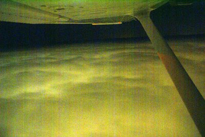
We cruised along making about 110 knots of groundspeed with a decent headwind. True Airspeed was around 118 knots. The traffic system showed a plane 2000' below us heading in roughly the same direction at close to the same speed. He was actually several miles to the West of the airway and weaved left and right quite a bit. At one point, his altitude reported within 1500' of us. Thinking that another aircraft flying at our altitude towards the same destination might cause me some delay getting down, I decided to up the power a bit. I pushed the throttle until the engine was making 2600 RPM and readjusted the mixture. We trimmed out at 122 knots TAS and started making about 116 knots of groundspeed - give or take a knot. Through periodic gaps in the clouds I could see the aircraft below me just to the left of my course. Slowly we passed him until he disappeared from the scope altogether.
During this time, I managed to snap a photo of the lights of Orlando. There's really not much to see. The lights kind of look like lava flows to me.
With a solid layer of overcast below us, we passed over OMN. Shortly afterwards, the Daytona Approach Controller called, "November 6-3-Foxtrot, it is now clear down to 5000, you'll need to be down in about 40 miles, would you like to descend?"
I responded, "6-3-foxtrot, If it isn't a problem, I'd prefer to remain at 7000. We are in smooth air above the clouds and we still have about 65 miles to go."
"November 6-3-Foxtrot, remain at 7000 as requested", he replied.
So on we cruised in smooth air as the cloud layer below us diminished. We were almost clear of clouds when we approached St. Augustine.
Lights of St. Augustine descending from 7000' northbound.
I called Jacksonville Approach and requested lower. The controller cleared me down to 3000' and I began my descent. During the descent, I shot a few photos of St. Augustine - It's amazing what you have time to do when you establish a nice, stable descent. Most of the shots are a bit blurry. The shutter speed had to be fairly slow to get the light, so even the slightest motion resulted in blurred images. Nevertheless, I managed to get one that wasn't totally blurry.
As we approached CRG, I also shot the following picture. You can see the Blount Island lights in the center of the shot as they reflect off of the St. Johns River. The curving line that comes from the bottom left then curls back again to the left is highway 9A. The line with the hump is the Dames Point Bridge.
Craig was landing VFR on runway 5 and when we were about 12 miles out, I advised ATC that I had CRG in sight. I had listened to the ATIS on the second radio and contacted the tower when Jax Approach handed me off. I was advised to make a right base for runway 5 and I set up a steady, slow descent.
Runway 5 is the closest runway to Sterling and if I could stop by the Bravo-2 taxiway, I would cut off a significant part of my taxi time. Therefore, I set up for a short field landing. Winds were calm, so I maintained 65 knots on approach with my hand on the throttle so I could gas it should a gust cause my airspeed to drop. I aimed at the numbers and pulled the power to idle. I flared above the numbers and landed just beyond them. I maintained full backpressure on the yoke and retracted the flaps as soon as I touched down. Confident that we weren't going to bounce, I applied the brakes and we slowed to a crawl in time to make the Bravo-2 cutoff.
Upon seeing me turn off, the tower advised me to taxi to the ramp and monitor ground on "point 8", which means monitor the ground control frequency on 121.8.
I acknowledged and said good night as we taxied to our parking spot. Just before shutting down, the radio announced that the tower was closed and would reopen in the morning....It was now 11PM. Our flight had taken a little over 2 hours due to the extra time on the ground monkeying around with the flight plan. I got a fair amount of instrument time in at the beginning as most of our climbout was spent in the clouds and we popped in and out for the first hour of the ride. Overall the flight was very smooth and enjoyable.
Seven years ago, we made the same trip by car...maybe for Christmas, I don't recall exactly. We had a nearly 4 hour ride to Tampa followed by a similar ride to Palm Beach Gardens and capped off by a nearly 4 hour ride from PBG to Jacksonville. At the end of that trip I remember saying I would never spend that much time on a holiday weekend fighting traffic. Having a pilot's certificate makes a huge difference. We spent much less time in transit. Our time was spent free of traffic relaxing in the air thanks to a terrific autopilot and a wonderful aircraft. Maureen even watched TV on my IPOD during the flight - something she would never dream of doing in a car.
Life is Good!
David West
We loaded up and were ready to go very close to our departure time. I taxied to the runup area and contacted Palm Beach Clearance Delivery.
"Palm Beach Clearance Delivery, Skyhawk 1-4-6-3-Foxtrot, ready to copy IFR to Charlie-Romeo-Golf, holding short of runway 3-1.", I announced.
Nothing.
Oops, wrong frequency. I corrected the frequency and called again.
This time, the response came, "Who's calling clearance delivery?"
I repeated myself and was told that he didn't have anything for me. It seemed strange that he didn't have to spend too much time looking for my plan, so I told him I had filed about 45 minutes ago on line.
"Well, I can give you VFR flight following and you can contact the Miami Flight Service Station at 122.4 or 122.2 and refile with them."
I was sitting with my engine running and I'd have to file over the radio...lovely.
I changed the radio frequency to 122.4 and called, "Miami Radio, Skyhawk 1-4-6-3-Foxtrot."
A garbled crackle was my only response, so I called again. A near perfect duplicate of the original garbled crackle came through my headset.
"Great.", I thought to myself, "I've got an overcast ceiling and I can't file an IFR plan on the ground without shutting down and getting on the phone."
I tuned Palm Beach clearance again and called them up. The controller said he would call when my clearance comes up. This posed a dilemna for me since the only way it would come up would be if my original clearance magically appeared. I decided to avoid clearance delivery and file in the air with the FSS.
I verified that the Vero Beach VOR was my direct to in my GPS and I announced my departure on runway 31. At 500', I began my turn towards VRB and continued my climb towards 2000'. As I climbed, I heard a multi-engine aircraft announce their position to the north of F45 southbound descending for a full stop. I could see his lights in the distance.
I announced my departure to the north on the CTAF and the twin pilot called me, "Traffic departing North County, what's your position? Do you have your landing lights on?".
I responded, "I'm direct Vero out of 1,500 for 2,000. I think I've got your lights in sight. I'll flash mine for you." And I flashed the landing lights.
"Ok, I've got you in sight. I'll turn a little eastward and I'll pass you to the East.", the twin advised.
"Thanks. I see you passing. Have a nice evening", I said.
After this encounter, I called the Miami FSS saying "Miami Center, Skyhawk 1-4-6-3-Foxtrot".
As soon as the words were out of my mouth, I knew I called the target by the wrong name.
"This is the Miami Flight Service Station, can I help you?", announced the FSS contact.
"Sorry. That's what I meant to say. I filed an IFR plan that seems to have been lost. Can I file with you?", I humbly begged.
"Sure. What's your type of aircraft and equipment?", he asked.
We then went back and forth through the full flight plan procedure ultimately culminating with a "You're on file. If you feel like giving a PIREP, please call Flight Watch at 122.0".
I thanked the very patient controller and contacted Palm Beach Approach, "Palm Beach Approach, Skyhawk 1-4-6-3-Foxtrot, with request".
Immediately a very nice sounding lady told me that I was cleared to CRG, squawk 3734 and to climb to 7000'.
I began my climb through the overcast layer. It got a bit bumpy on the climb, but I maintained level flight throughout the climb. We broke out of the clouds around 6600' and there was a very stable layer of clouds only 400' beneath us.
A few minutes later, I was handed off to Miami Center. The center controller told me he had my clearance and I should advise when ready to copy. This seemed odd since I had received clearance from the PB controller, but considering the problems so far, I was not about to argue.
"Cleared direct MLB then Victor 3 to OMN, then V51 to CRG", he announced.
I was already direct VRB, so getting cleared beyond that made life a bit simpler. I repeated my clearance and settled in for a smooth flight.
There was almost no moon to illuminate the cloud layer that undulated below me. At times, towering cumulous clouds jutted into our path tossing the plane with surprising force. At other times, the cloud layer slowly rose in unison above our cruising altitude ever so briefly before retreating to a stable distance about 500' below us. The traffic system was alive now pointing out all traffic within 3500 feet vertically and about 10 miles horizontally. It is always fun when a controller points out traffic and I can reply, I've got him on my scope and in sight.
I tried to take a few pictures of the clouds below, but low light made them very grainy. I'll post one just to show the view...
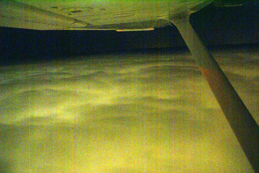
We cruised along making about 110 knots of groundspeed with a decent headwind. True Airspeed was around 118 knots. The traffic system showed a plane 2000' below us heading in roughly the same direction at close to the same speed. He was actually several miles to the West of the airway and weaved left and right quite a bit. At one point, his altitude reported within 1500' of us. Thinking that another aircraft flying at our altitude towards the same destination might cause me some delay getting down, I decided to up the power a bit. I pushed the throttle until the engine was making 2600 RPM and readjusted the mixture. We trimmed out at 122 knots TAS and started making about 116 knots of groundspeed - give or take a knot. Through periodic gaps in the clouds I could see the aircraft below me just to the left of my course. Slowly we passed him until he disappeared from the scope altogether.
During this time, I managed to snap a photo of the lights of Orlando. There's really not much to see. The lights kind of look like lava flows to me.

With a solid layer of overcast below us, we passed over OMN. Shortly afterwards, the Daytona Approach Controller called, "November 6-3-Foxtrot, it is now clear down to 5000, you'll need to be down in about 40 miles, would you like to descend?"
I responded, "6-3-foxtrot, If it isn't a problem, I'd prefer to remain at 7000. We are in smooth air above the clouds and we still have about 65 miles to go."
"November 6-3-Foxtrot, remain at 7000 as requested", he replied.
So on we cruised in smooth air as the cloud layer below us diminished. We were almost clear of clouds when we approached St. Augustine.
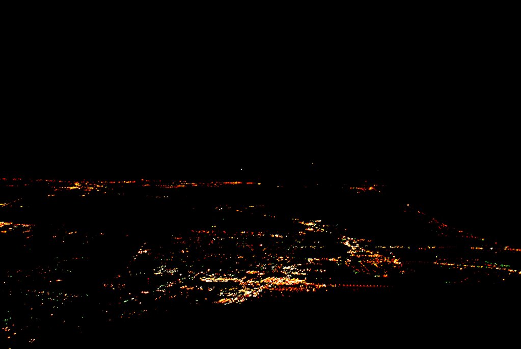
Lights of St. Augustine descending from 7000' northbound.
I called Jacksonville Approach and requested lower. The controller cleared me down to 3000' and I began my descent. During the descent, I shot a few photos of St. Augustine - It's amazing what you have time to do when you establish a nice, stable descent. Most of the shots are a bit blurry. The shutter speed had to be fairly slow to get the light, so even the slightest motion resulted in blurred images. Nevertheless, I managed to get one that wasn't totally blurry.
As we approached CRG, I also shot the following picture. You can see the Blount Island lights in the center of the shot as they reflect off of the St. Johns River. The curving line that comes from the bottom left then curls back again to the left is highway 9A. The line with the hump is the Dames Point Bridge.
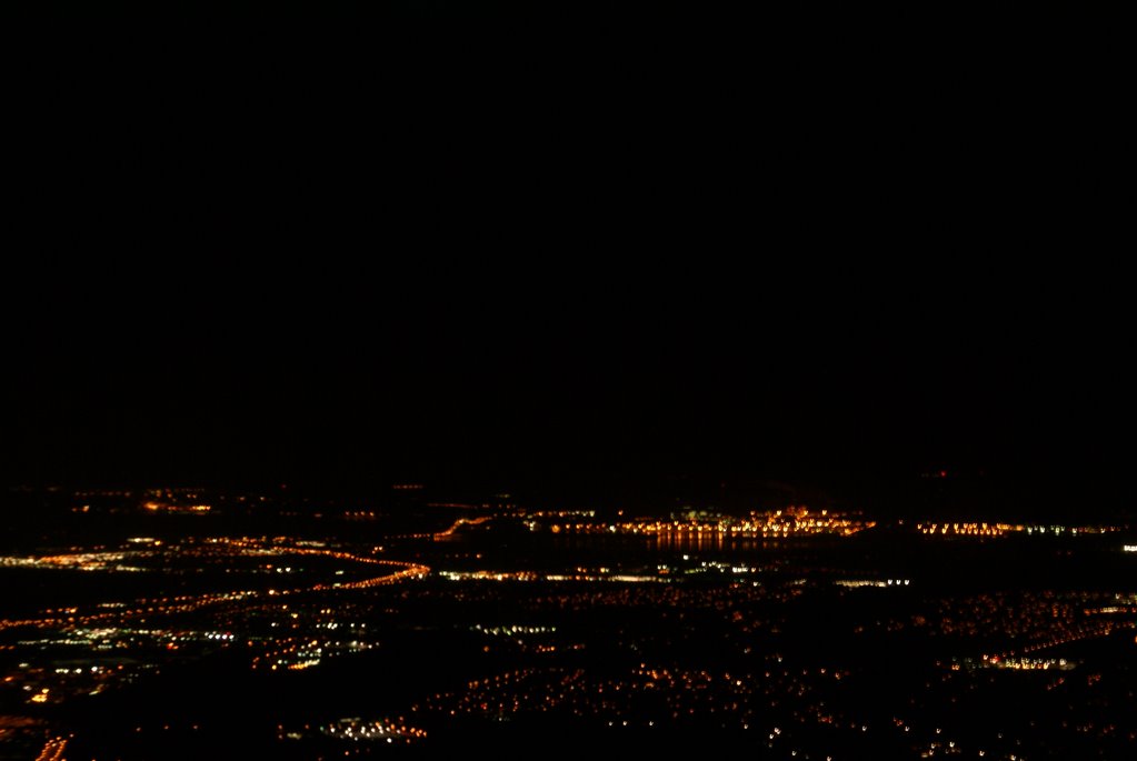
Craig was landing VFR on runway 5 and when we were about 12 miles out, I advised ATC that I had CRG in sight. I had listened to the ATIS on the second radio and contacted the tower when Jax Approach handed me off. I was advised to make a right base for runway 5 and I set up a steady, slow descent.
Runway 5 is the closest runway to Sterling and if I could stop by the Bravo-2 taxiway, I would cut off a significant part of my taxi time. Therefore, I set up for a short field landing. Winds were calm, so I maintained 65 knots on approach with my hand on the throttle so I could gas it should a gust cause my airspeed to drop. I aimed at the numbers and pulled the power to idle. I flared above the numbers and landed just beyond them. I maintained full backpressure on the yoke and retracted the flaps as soon as I touched down. Confident that we weren't going to bounce, I applied the brakes and we slowed to a crawl in time to make the Bravo-2 cutoff.
Upon seeing me turn off, the tower advised me to taxi to the ramp and monitor ground on "point 8", which means monitor the ground control frequency on 121.8.
I acknowledged and said good night as we taxied to our parking spot. Just before shutting down, the radio announced that the tower was closed and would reopen in the morning....It was now 11PM. Our flight had taken a little over 2 hours due to the extra time on the ground monkeying around with the flight plan. I got a fair amount of instrument time in at the beginning as most of our climbout was spent in the clouds and we popped in and out for the first hour of the ride. Overall the flight was very smooth and enjoyable.
Seven years ago, we made the same trip by car...maybe for Christmas, I don't recall exactly. We had a nearly 4 hour ride to Tampa followed by a similar ride to Palm Beach Gardens and capped off by a nearly 4 hour ride from PBG to Jacksonville. At the end of that trip I remember saying I would never spend that much time on a holiday weekend fighting traffic. Having a pilot's certificate makes a huge difference. We spent much less time in transit. Our time was spent free of traffic relaxing in the air thanks to a terrific autopilot and a wonderful aircraft. Maureen even watched TV on my IPOD during the flight - something she would never dream of doing in a car.
Life is Good!
David West
Tampa North to North Palm Beach County
I had never flown this route before although I had flown out of both Tampa North and North Palm Beach County many times in the past. I have also flown to Lakeland Linder for Sun-n-Fun twice before and this airport is along the route. There is a large MOA and Lake Okeechobee to contend with, otherwise, there are many small airports on the route in case of an emergency.
I had filed an instrument flight plan the night before. After making a quick check of the weather on the route and the updated forecast, we were ready to head out. As expected, the engine started easily. I set the altimeter so that the airport's elevation appeared. With a traditional altimeter, the barometer setting is dialed in the "Kohlsman" window. I wonder what they would call the window on this new glass panel aircraft...it's just a box on a computer screen.
Anyway, the winds were light but favored runway 32, so I didn't have far to taxi. There was a skyhawk just ahead of me who announced on the CTAF that he would taxi across the runway for runup. I taxied short of the runway on the near side and angled the prop wash away from the parked aircraft. I set the radios and entered the Lakeland VOR in the GPS as a direct-to. This was my first point on my flight plan and I did not expect any problem getting a clearance once I was airborn. I quickly ran through the checklist and satisfied that all was well, I announced that I would be taking runway 32. The other Skyhawk was still completing his runup while a third airplane had just pulled from his parking spot. Looked like the morning was going to be busy.
Holding the brakes, I ran the engine to full power noting that the RPM had reached 2,400. I released the brakes and we were rolling. The speed came up quickly and I nosed her into the air adjusting my attitude to maintain 74 knots. Since there is a neighborhood in the flight path, I maintained a straight-ahead path until I reached 1000' then I made my left turns which put me on an almost direct path to LAL. I leveled off at 2000' and established a heading of 130 - direct to LAL. After engaging the autopilot and setting it to follow the NAV and maintain altitude, I contacted Tampa Approach and requested my instrument clearance to F45. Approach was busy, so he gave me a transponder code and told me to stand by while he retrieved my clearance.
The controller told me that he had my clearance and asked that I tell him when I was ready to copy. I immediately replied that I was ready.
"Cleared via radar vectors to HALLR, Hotel, alpha, lima, lima, romeo; then direct ULLMN, uniform-lima-lima-mike-november; then direct Palm Beach; then direct Foxtrot-4-5." came the clearance.
I repeated the clearance and was told to fly heading 130 and climb to 5000. I switched the autopilot to heading mode and began my climb to 5000. I also entered HALLR as a direct-to in the GPS and began to enter the rest of the plan.
We passed by the Lakeland Linder airport where I shot these photos out the window.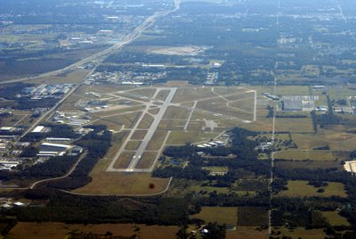
Prior to reaching HALLR, the controller handed me off to Miami and told me I would receive my on course clearance from the Miami controller. About 10 minutes after contacting Miami center, I asked the controller if I could get my on course clearance. The controller said that he thought the prior controller cleared me and apologized. He cleared me direct to ULLMN. I tried hard to find ULLMN on my instrument chart, but it simply wasn't there. It turns out that it REALLY isn't on the L19 chart. I don't know why. Fortunately, the GPS showed me exactly where it was - in the middle of lake Okeechobee.
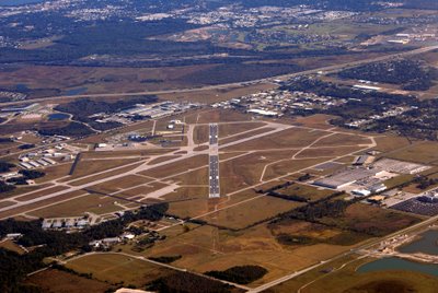
I updated the GPS and adjusted my course slightly to head straight for ULLMN. I was a bit nervous about flying over the big lake. If the engine died, we would be stretching our glide distance to the limit in order to make it to shore. A forced landing in the middle of the lake would satisfy a few alligators' hunger, and surviving would be a challenge if the water was deep enough for the plane to sink. Therefore, I monitored every instrument very carefully to ensure that nothing was about to go wrong. We had clear skies ahead, so weather would not be a problem. I kept a close eye on the GPS which provided an indication of the relative wind. We were getting between 9 and 11 knots of wind from our front left quarter. Knowing this, I reasoned if we were less than 2/3rds of the way across the lake, an engine problem would result in my banking to the right immediately while pitching for 69 knots to make a 120 degree turn to put the wind behind me. This would maximize our distance covered while in best glide configuration. Fortunately, we didn't need to make use of these plans as we made it across the lake safely. I took a couple of shots of the lake, but it just looks like a bunch of blue from the middle. The shots I took as we crossed the west boundary are much more interesting - here's one:
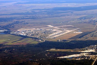
I had filed an instrument flight plan the night before. After making a quick check of the weather on the route and the updated forecast, we were ready to head out. As expected, the engine started easily. I set the altimeter so that the airport's elevation appeared. With a traditional altimeter, the barometer setting is dialed in the "Kohlsman" window. I wonder what they would call the window on this new glass panel aircraft...it's just a box on a computer screen.
Anyway, the winds were light but favored runway 32, so I didn't have far to taxi. There was a skyhawk just ahead of me who announced on the CTAF that he would taxi across the runway for runup. I taxied short of the runway on the near side and angled the prop wash away from the parked aircraft. I set the radios and entered the Lakeland VOR in the GPS as a direct-to. This was my first point on my flight plan and I did not expect any problem getting a clearance once I was airborn. I quickly ran through the checklist and satisfied that all was well, I announced that I would be taking runway 32. The other Skyhawk was still completing his runup while a third airplane had just pulled from his parking spot. Looked like the morning was going to be busy.
Holding the brakes, I ran the engine to full power noting that the RPM had reached 2,400. I released the brakes and we were rolling. The speed came up quickly and I nosed her into the air adjusting my attitude to maintain 74 knots. Since there is a neighborhood in the flight path, I maintained a straight-ahead path until I reached 1000' then I made my left turns which put me on an almost direct path to LAL. I leveled off at 2000' and established a heading of 130 - direct to LAL. After engaging the autopilot and setting it to follow the NAV and maintain altitude, I contacted Tampa Approach and requested my instrument clearance to F45. Approach was busy, so he gave me a transponder code and told me to stand by while he retrieved my clearance.
The controller told me that he had my clearance and asked that I tell him when I was ready to copy. I immediately replied that I was ready.
"Cleared via radar vectors to HALLR, Hotel, alpha, lima, lima, romeo; then direct ULLMN, uniform-lima-lima-mike-november; then direct Palm Beach; then direct Foxtrot-4-5." came the clearance.
I repeated the clearance and was told to fly heading 130 and climb to 5000. I switched the autopilot to heading mode and began my climb to 5000. I also entered HALLR as a direct-to in the GPS and began to enter the rest of the plan.
We passed by the Lakeland Linder airport where I shot these photos out the window.

Prior to reaching HALLR, the controller handed me off to Miami and told me I would receive my on course clearance from the Miami controller. About 10 minutes after contacting Miami center, I asked the controller if I could get my on course clearance. The controller said that he thought the prior controller cleared me and apologized. He cleared me direct to ULLMN. I tried hard to find ULLMN on my instrument chart, but it simply wasn't there. It turns out that it REALLY isn't on the L19 chart. I don't know why. Fortunately, the GPS showed me exactly where it was - in the middle of lake Okeechobee.

I updated the GPS and adjusted my course slightly to head straight for ULLMN. I was a bit nervous about flying over the big lake. If the engine died, we would be stretching our glide distance to the limit in order to make it to shore. A forced landing in the middle of the lake would satisfy a few alligators' hunger, and surviving would be a challenge if the water was deep enough for the plane to sink. Therefore, I monitored every instrument very carefully to ensure that nothing was about to go wrong. We had clear skies ahead, so weather would not be a problem. I kept a close eye on the GPS which provided an indication of the relative wind. We were getting between 9 and 11 knots of wind from our front left quarter. Knowing this, I reasoned if we were less than 2/3rds of the way across the lake, an engine problem would result in my banking to the right immediately while pitching for 69 knots to make a 120 degree turn to put the wind behind me. This would maximize our distance covered while in best glide configuration. Fortunately, we didn't need to make use of these plans as we made it across the lake safely. I took a couple of shots of the lake, but it just looks like a bunch of blue from the middle. The shots I took as we crossed the west boundary are much more interesting - here's one:
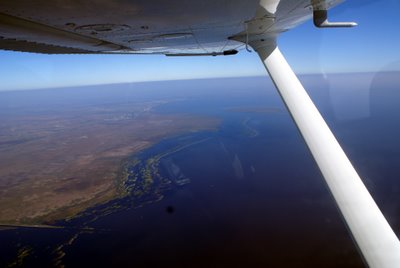 The dark spot near the bottom of the shot is a mote on my camera lens.
Near the eastern end of the lake, ATC instructed me to descend to 3000' and cleared me direct F45. With the airport in sight, I canceled IFR and made a VFR approach to runway 31 which was being used by several other planes. I came in a bit hot and landed longer than I like to, but there would have been little point in landing short as there were no turnoffs near by.
This was a great day for flying and for seeing parts of Florida that I had not seen from the air in the past. I even got a shot of the Sebring airport where they have the 12 hour endurance race every year. Here it is:

So, that gives me another 1.6 hours of cross-country flying with a measly 0.2 hours of actual instrument time. All in all, an outstanding flight.
David West
Sunday, November 26, 2006
Thanksgiving Flying with my Nephew
Tony is my 16 year old nephew who lives in Odessa, Florida. He's an intelligent and artistic young man with great potential. He is an outstanding guitarist and a wonderful big brother to his three younger siblings.
He's flown with me before and has shown himself to be a very calm flyer.
This would be his first flight in a plane with the G1000 cockpit, so I was interested in seeing how he would interface with the new instrumentation. We started the engine and I explained a few things to him. As we were completing our pre-taxi checklist, another aircraft landed and they wanted our parking spot - it was the last one with tiedowns.
"Cessna 63-Foxtrot, are you listening?" came the call from the plane that had taxied up to the small parking area.
"Affirmative. What can I do for you?", I replied.
"If you're getting ready to leave, we'll just park back in that spot", said the local.
Apparently, I had taken his spot. I replied, "We'll get out of your way. Any advice as to where we should park when we return?"
Since the FBO was closed, parking was a free-for-all. The parking areas on the grass were all taken and all of the paved areas appeared to be taken, too. The airport is building numerous new hangars, but they had to tear down some to make room for the new - consequently, parking is at a premium, especially on Thanksgiving.
The other pilot said there was a spot beyond the fuel depot or I could park on the grass anywhere.
Tony and I took off down runway 32 and headed north out from under the Class B airspace at Tampa. I handed over the controls to Tony after explaining the HSI and the altitude read outs. I had toyed with using the reversion mode on the PFD/MFD so he would have the full instrumentation directly in front of him, but this would precluded the traffic display. There were many aircraft in the area and TPA is a busy airport, so I didn't want to take unnecessary chances.
Tony did a remarkable job of flying the plane. He maintained altitude very close to the PTS standard. He was able to turn to specific headings and to maintain level flight very well once I explained the attitude indicator.
I had him turn left to 270 and we flew until we crossed the Veteran's expressway. We were at 2300 feet, well below the Class B shelf which begins at 3000 feet. Crossing the Veteran's, we flew South until we spotted landmarks that identified his neighborhood. We then circled his home and then flew straight back to Tampa North.
As we approached Tampa North, a Comanche radioed his position and intentions and I did the same. I had him on our traffic scope and I was closer to the airport. I descended to pattern altitude and advised that I was entering the left downwind for 32, full stop. The Comanche advised that he would take position behind me...but he was coming from the southeast and I was coming from the west. I could see him coming straight at me as I was on downwind. I called out to him, "Comanche, I've got you in sight. You'll pass directly overhead." It's a good thing that I had already descended below pattern altitude or we would have been on a collision course. I'm not sure why he chose this entry - he could have made a straight-in approach and we would have been safer. Instead, he entered by flying the opposite direction in the downwind - which would have been the Right Downwind for 14, but he was landing on 32.
I suppose that I could have declared that I was going to fly a straight-in for 14 which would have saved taxi time, but with other planes in the pattern, I figured standard approaches would be best. Also, other planes had been using 32 earlier and although there was little wind, what wind there was favored 32.
After touching down, I advised the Comanche that I would taxi to the end of the runway to make room for him to land - he was right behind me in the pattern and taxiing back while he was on final would have forced him to go around. He landed and then taxiied all the way to the end, too. He could have turned around mid way down the runway, but maybe his plane couldn't turn so tightly.
With collisions and crashes averted, we taxiied very rapidly to the other end of the airport and parked in the grass beyond the gas pumps.
Tony did a great job flying - maybe one day, he'll get his certificate.
0.8 hours of sightseeing with my nephew.
David West
He's flown with me before and has shown himself to be a very calm flyer.
This would be his first flight in a plane with the G1000 cockpit, so I was interested in seeing how he would interface with the new instrumentation. We started the engine and I explained a few things to him. As we were completing our pre-taxi checklist, another aircraft landed and they wanted our parking spot - it was the last one with tiedowns.
"Cessna 63-Foxtrot, are you listening?" came the call from the plane that had taxied up to the small parking area.
"Affirmative. What can I do for you?", I replied.
"If you're getting ready to leave, we'll just park back in that spot", said the local.
Apparently, I had taken his spot. I replied, "We'll get out of your way. Any advice as to where we should park when we return?"
Since the FBO was closed, parking was a free-for-all. The parking areas on the grass were all taken and all of the paved areas appeared to be taken, too. The airport is building numerous new hangars, but they had to tear down some to make room for the new - consequently, parking is at a premium, especially on Thanksgiving.
The other pilot said there was a spot beyond the fuel depot or I could park on the grass anywhere.
Tony and I took off down runway 32 and headed north out from under the Class B airspace at Tampa. I handed over the controls to Tony after explaining the HSI and the altitude read outs. I had toyed with using the reversion mode on the PFD/MFD so he would have the full instrumentation directly in front of him, but this would precluded the traffic display. There were many aircraft in the area and TPA is a busy airport, so I didn't want to take unnecessary chances.
Tony did a remarkable job of flying the plane. He maintained altitude very close to the PTS standard. He was able to turn to specific headings and to maintain level flight very well once I explained the attitude indicator.
I had him turn left to 270 and we flew until we crossed the Veteran's expressway. We were at 2300 feet, well below the Class B shelf which begins at 3000 feet. Crossing the Veteran's, we flew South until we spotted landmarks that identified his neighborhood. We then circled his home and then flew straight back to Tampa North.
As we approached Tampa North, a Comanche radioed his position and intentions and I did the same. I had him on our traffic scope and I was closer to the airport. I descended to pattern altitude and advised that I was entering the left downwind for 32, full stop. The Comanche advised that he would take position behind me...but he was coming from the southeast and I was coming from the west. I could see him coming straight at me as I was on downwind. I called out to him, "Comanche, I've got you in sight. You'll pass directly overhead." It's a good thing that I had already descended below pattern altitude or we would have been on a collision course. I'm not sure why he chose this entry - he could have made a straight-in approach and we would have been safer. Instead, he entered by flying the opposite direction in the downwind - which would have been the Right Downwind for 14, but he was landing on 32.
I suppose that I could have declared that I was going to fly a straight-in for 14 which would have saved taxi time, but with other planes in the pattern, I figured standard approaches would be best. Also, other planes had been using 32 earlier and although there was little wind, what wind there was favored 32.
After touching down, I advised the Comanche that I would taxi to the end of the runway to make room for him to land - he was right behind me in the pattern and taxiing back while he was on final would have forced him to go around. He landed and then taxiied all the way to the end, too. He could have turned around mid way down the runway, but maybe his plane couldn't turn so tightly.
With collisions and crashes averted, we taxiied very rapidly to the other end of the airport and parked in the grass beyond the gas pumps.
Tony did a great job flying - maybe one day, he'll get his certificate.
0.8 hours of sightseeing with my nephew.
David West
Thanksgiving Flying
The second flight of the long weekend took me from Jacksonville's Craig Municipal Airport (KCRG) to the Tampa North Aeropark (X39). Mom was picking us up in Tampa and I had offered flights to my neices and nephews. I told her the night before that we would be there by 10:30 am, so a 9AM wheels up time would be the order of the day.
There were three or four other planes who were leaving on instrument plans at 9AM, so clearance delivery told me that my clearance was on request and he'd give it to me in the run-up area at runway 23. He also cleared me to taxi to 23.
I ran through the checklist as I taxied. Reaching the run-up area, I found another skyhawk already there, another single coming up behind me and a Mooney coming from the opposite side of the airport. I parked as close as I could to the Cessna. The controller advised me to tell him when I was ready to copy - I immediately told him I was ready.
I was cleared via radar vectors to OCF then direct DADES then X39--Climb 2000, expect 5000 in 10 given a squawk and the departure frequency. It might come as a surprise that I had filed 5000 as my altitude since this flight was to the West, but in Florida, ATC does things a little differently when dealing with altitudes. If you are in the system - whether flying IFR or using flight following on a VFR flight, ATC looks at things from a NORTH/SOUTH perspective rather than an EAST/WEST perspective in the Florida peninsula. Since we have a long, narrow state, more flying is done north/south than east/west. Traffic separation is more easily accomplished when adjustments are made with this in mind. I've seen this quite a bit on flights down the East coast - When I flew home from North Palm Beach County, I was given 7000' and oncoming Southbound traffic was generally at 6000' or 8000' - even though my heading was North by northwest which according to the AIM should receive an even altitude.
Anyway, my takeoff clearance had me turning to 280 and I was immediately handed off to Jacksonville departure control. The controller advised me to climb to 4000' and to expect on course after 3000'. Usually, I get an on course vector after 2600 - just high enough to clear the NAS JAX airspace. This time, however, the controller was very busy and I received an on course vector when I was passing 3400'. At the same time, I was told to climb to 5000'.
Shortly after that, I was cleared direct to DADES - which was great. This shortened the distance to X39 by taking the bend out of the flight that would have taken me over OCF. It also gave me some practice with the GPS making it skip entries in the flight plan.
It was a beautiful day for flying with only occasional clouds in the distance. Every once in a while, the traffic display reported another aircraft in the vicinity, but we never had a problem. Tailwinds were in abundance with the GPS showing as high as 34 knots of a right rear quartering wind. This was giving us a ground speed in excess of 140 knots and nearly 165 knots on our descent. I was babying the plane to save fuel so I was only getting 114 knots of true airspeed and burning only 7.5 gallons per hour!
There was other traffic in the pattern at Tampa North that I discovered by monitoring the CTAF on the second radio. About 25 miles out, ATC descended me to 2000'. At 12 miles, the told me the airport was 12 o'clock, which I already knew thanks to the incredible technology I had on board...as well as the numerous prior flights I had made to this airport. ATC said I could cancel with them or with the FSS on the ground, so seeing no clouds in the area, I canceled IFR and completed the flight VFR. I overflew the airport at 1,500' and heard other aircraft landing on runway 31. This meant that I would have to land and taxi back. I made a teardrop entry and flew a tight pattern. We touched down near the numbers and I turned the plane around in the width of the narrow runway.
Parking was going to be another story. There must have been quite a few visitors in town for the holiday as I only saw one parking spot available. I pulled in front of it and then pushed back. Mom wasn't there yet, so I called and learned that she was 20 minutes away. She was bringing my 16 year old nephew, Tony, with her so he could take a flight with me.
This flight was 1.5 hours of cross-country, a very small amount of instrument time, and was about as uneventful as they come.
Tony's flight is next.
David West
There were three or four other planes who were leaving on instrument plans at 9AM, so clearance delivery told me that my clearance was on request and he'd give it to me in the run-up area at runway 23. He also cleared me to taxi to 23.
I ran through the checklist as I taxied. Reaching the run-up area, I found another skyhawk already there, another single coming up behind me and a Mooney coming from the opposite side of the airport. I parked as close as I could to the Cessna. The controller advised me to tell him when I was ready to copy - I immediately told him I was ready.
I was cleared via radar vectors to OCF then direct DADES then X39--Climb 2000, expect 5000 in 10 given a squawk and the departure frequency. It might come as a surprise that I had filed 5000 as my altitude since this flight was to the West, but in Florida, ATC does things a little differently when dealing with altitudes. If you are in the system - whether flying IFR or using flight following on a VFR flight, ATC looks at things from a NORTH/SOUTH perspective rather than an EAST/WEST perspective in the Florida peninsula. Since we have a long, narrow state, more flying is done north/south than east/west. Traffic separation is more easily accomplished when adjustments are made with this in mind. I've seen this quite a bit on flights down the East coast - When I flew home from North Palm Beach County, I was given 7000' and oncoming Southbound traffic was generally at 6000' or 8000' - even though my heading was North by northwest which according to the AIM should receive an even altitude.
Anyway, my takeoff clearance had me turning to 280 and I was immediately handed off to Jacksonville departure control. The controller advised me to climb to 4000' and to expect on course after 3000'. Usually, I get an on course vector after 2600 - just high enough to clear the NAS JAX airspace. This time, however, the controller was very busy and I received an on course vector when I was passing 3400'. At the same time, I was told to climb to 5000'.
Shortly after that, I was cleared direct to DADES - which was great. This shortened the distance to X39 by taking the bend out of the flight that would have taken me over OCF. It also gave me some practice with the GPS making it skip entries in the flight plan.
It was a beautiful day for flying with only occasional clouds in the distance. Every once in a while, the traffic display reported another aircraft in the vicinity, but we never had a problem. Tailwinds were in abundance with the GPS showing as high as 34 knots of a right rear quartering wind. This was giving us a ground speed in excess of 140 knots and nearly 165 knots on our descent. I was babying the plane to save fuel so I was only getting 114 knots of true airspeed and burning only 7.5 gallons per hour!
There was other traffic in the pattern at Tampa North that I discovered by monitoring the CTAF on the second radio. About 25 miles out, ATC descended me to 2000'. At 12 miles, the told me the airport was 12 o'clock, which I already knew thanks to the incredible technology I had on board...as well as the numerous prior flights I had made to this airport. ATC said I could cancel with them or with the FSS on the ground, so seeing no clouds in the area, I canceled IFR and completed the flight VFR. I overflew the airport at 1,500' and heard other aircraft landing on runway 31. This meant that I would have to land and taxi back. I made a teardrop entry and flew a tight pattern. We touched down near the numbers and I turned the plane around in the width of the narrow runway.
Parking was going to be another story. There must have been quite a few visitors in town for the holiday as I only saw one parking spot available. I pulled in front of it and then pushed back. Mom wasn't there yet, so I called and learned that she was 20 minutes away. She was bringing my 16 year old nephew, Tony, with her so he could take a flight with me.
This flight was 1.5 hours of cross-country, a very small amount of instrument time, and was about as uneventful as they come.
Tony's flight is next.
David West
Around Florida in Under 6 Hours
or...How I spent my Thanksgiving Vacation
Between Wednesday evening and Friday night, I accumulated 7.3 hours of flying time - 5.5 of that was cross-country. I encountered at least one situation that I had not encountered before and I flew in areas that I had not flown in before.
It all began Wednesday evening when I took N1463F up for a little night flying. I had previously reserved the plane from 5pm Wed through midnight Friday to give me plenty of flexibility to go to my sister's for Thanksgiving. Our plans had changed, so we decided to leave on Thursday morning. I felt bad that someone else wouldn't be using the plane, but I didn't want to take a chance on there not being adequate fuel for my flights from CRG to X39 and then to F45. Refueling would be an issue on Thanksgiving day as most places are closed and we were planning to fly from X39 to F45 first thing on Friday morning.
I filed an instrument plan for a round trip to CRG with a SGJ (St. Augustine) as a stop. The plane was not quite full of fuel, but there would be someone at Sterling to refuel until 7pm, so I should have no problems.
The weather all day at CRG was overcast with a very close temp/dewpoint spread. The engine started easily and I taxied to the departure runway after getting the ATIS and my clearance. The climb out was uneventful. I requested vectors for the ILS31 approach at St. Augustine. I listened to the ATIS at SGJ and learned that the glideslope was out of service and the ILS was unmonitored. The NOTAMs mentioned the unmonitored situation, but not the glideslope - this would have to be a localizer approach. ATC gave me vectors and cleared me for the approach - and told me about the glideslope.
I was handed off to St. Augustine tower and a very nice lady controller cleared me for the option. I had initially planned to make a low approach, but there was no traffic around and since this was night, I opted to make this one a stop and go. I flew the localizer and descended to decision height. When I was a mile out I looked up and saw the runway looming ahead of me. I touched down smoothly and braked to a halt. I then pulled the flaps, pushed the power and I was rolling again.
ATC had previously told me to fly 360 and climb to 2000 following my approach, so at 700 feet I started to make my right turn. The tower handed me back to ATC who asked my intentions at CRG. I requested the ILS32 and was told to expect the ILS 32 circle to 23.
I briefed the approach and tuned the appropriate radios, listened to the ATIS, adjusted the barometer. Since this is a G1000 panel plane, there is no turning the heading indicator to the magnetic compass which is nice - although I suspect it will create some bad habits when I fly aircraft with steam gauges.
I was cleared and handed off to Craig tower. The tower advised me to circle northeast to runway 23 and to advise of the circle. MDA for a circling is 500', so I decided that I would begin my circle at 500. I would imagine that the homes in the area don't care for that so much...but they bought houses next to a very old airport, didn't they!?
I touched down a little long and the controller told me to go all the way to Bravo-2 then taxi to the ramp - this actually saved me a bit of time as I could make an almost straight in taxi to Sterling.
This flight took exactly 1.0 hours with just a little actual instrument time at the beginning of the flight...the skies had cleared pretty quickly.
Flight #2 comes in the next post.
Between Wednesday evening and Friday night, I accumulated 7.3 hours of flying time - 5.5 of that was cross-country. I encountered at least one situation that I had not encountered before and I flew in areas that I had not flown in before.
It all began Wednesday evening when I took N1463F up for a little night flying. I had previously reserved the plane from 5pm Wed through midnight Friday to give me plenty of flexibility to go to my sister's for Thanksgiving. Our plans had changed, so we decided to leave on Thursday morning. I felt bad that someone else wouldn't be using the plane, but I didn't want to take a chance on there not being adequate fuel for my flights from CRG to X39 and then to F45. Refueling would be an issue on Thanksgiving day as most places are closed and we were planning to fly from X39 to F45 first thing on Friday morning.
I filed an instrument plan for a round trip to CRG with a SGJ (St. Augustine) as a stop. The plane was not quite full of fuel, but there would be someone at Sterling to refuel until 7pm, so I should have no problems.
The weather all day at CRG was overcast with a very close temp/dewpoint spread. The engine started easily and I taxied to the departure runway after getting the ATIS and my clearance. The climb out was uneventful. I requested vectors for the ILS31 approach at St. Augustine. I listened to the ATIS at SGJ and learned that the glideslope was out of service and the ILS was unmonitored. The NOTAMs mentioned the unmonitored situation, but not the glideslope - this would have to be a localizer approach. ATC gave me vectors and cleared me for the approach - and told me about the glideslope.
I was handed off to St. Augustine tower and a very nice lady controller cleared me for the option. I had initially planned to make a low approach, but there was no traffic around and since this was night, I opted to make this one a stop and go. I flew the localizer and descended to decision height. When I was a mile out I looked up and saw the runway looming ahead of me. I touched down smoothly and braked to a halt. I then pulled the flaps, pushed the power and I was rolling again.
ATC had previously told me to fly 360 and climb to 2000 following my approach, so at 700 feet I started to make my right turn. The tower handed me back to ATC who asked my intentions at CRG. I requested the ILS32 and was told to expect the ILS 32 circle to 23.
I briefed the approach and tuned the appropriate radios, listened to the ATIS, adjusted the barometer. Since this is a G1000 panel plane, there is no turning the heading indicator to the magnetic compass which is nice - although I suspect it will create some bad habits when I fly aircraft with steam gauges.
I was cleared and handed off to Craig tower. The tower advised me to circle northeast to runway 23 and to advise of the circle. MDA for a circling is 500', so I decided that I would begin my circle at 500. I would imagine that the homes in the area don't care for that so much...but they bought houses next to a very old airport, didn't they!?
I touched down a little long and the controller told me to go all the way to Bravo-2 then taxi to the ramp - this actually saved me a bit of time as I could make an almost straight in taxi to Sterling.
This flight took exactly 1.0 hours with just a little actual instrument time at the beginning of the flight...the skies had cleared pretty quickly.
Flight #2 comes in the next post.
Subscribe to:
Posts (Atom)

